Property Record
4282 Monticello Blvd, Cleveland, OH 44121


NEARBY LISTINGS FOR SALE OR LEASE
Property Detail
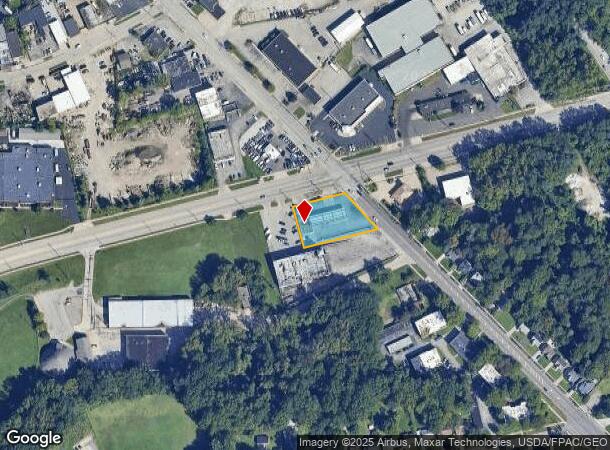
4282 Monticello Blvd
Cleveland
Euclid 06
Cleveland-Elyria, OH
SP OL 27&NP OL 28 SWCMONTICELLO BLVD
701-09-001
Cuyahoga
Servicestation
Ohio
2024
27,28
2024
0.51 AC
185101
East
96 SF
DEMOGRAPHICS near 4282 Monticello Blvd
1 Mile
3 Mile
5 Mile
2024 Total Population
12,286
109,255
288,491
2029 Population
11,955
107,382
284,617
Pop Growth 2024-2029
(2.69%)
(1.71%)
(1.34%)
Average Age
42
42
41
2024 Total Households
5,117
47,856
128,164
HH Growth 2024-2029
(2.95%)
(1.79%)
(1.39%)
Median Household Inc
$63,513
$50,284
$50,106
Avg Household Size
2.30
2.20
2.10
2024 Avg HH Vehicles
2.00
1.00
1.00
Median Home Value
$128,088
$144,587
$160,280
Median Year Built
1953
1953
1953
Nearby Places
Map Layers
Map Styles
 Street
 Aerial
- Restaurants
- Banks
- Shops
- Fitness
- Groceries
PUBLIC TRANSPORTATION
AIRPORT
Cleveland-Hopkins International
DRIVE
WALK
Distance
Cleveland-Hopkins International
40 min
22.8 mi
Nearby Properties
Address
Land Use
TOTAL SIZE
Lot Size
Zoning
Address
Land Use
TOTAL SIZE
Lot Size
Zoning
379,326 SF
43.45 AC
CRG
Address
Land Use
TOTAL SIZE
Lot Size
Zoning
44,577 SF
39.90 AC
SI
Address
Land Use
TOTAL SIZE
Lot Size
Zoning
257,048 SF
17.93 AC
S1
Address
Land Use
TOTAL SIZE
Lot Size
Zoning
106,995 SF
9.62 AC
CRG
Address
Land Use
TOTAL SIZE
Lot Size
Zoning
112,657 SF
19.88 AC
U3
Address
Land Use
TOTAL SIZE
Lot Size
Zoning
252,759 SF
27.66 AC
R-1
Address
Land Use
TOTAL SIZE
Lot Size
Zoning
92,442 SF
159.84 AC
I-1
Address
Land Use
TOTAL SIZE
Lot Size
Zoning
166,392 SF
36.46 AC
RMF-2
Address
Land Use
TOTAL SIZE
Lot Size
Zoning
91,540 SF
14.35 AC
CRG
Address
Land Use
TOTAL SIZE
Lot Size
Zoning
2.53 AC
U6
Address
Land Use
TOTAL SIZE
Lot Size
Zoning
222,426 SF
3.60 AC
U1
Address
Land Use
TOTAL SIZE
Lot Size
Zoning
131,846 SF
5.94 AC
U-9
Address
Land Use
TOTAL SIZE
Lot Size
Zoning
628,514 SF
25.95 AC
B-2
Address
Land Use
TOTAL SIZE
Lot Size
Zoning
100,469 SF
25.96 AC
AA
Address
Land Use
TOTAL SIZE
Lot Size
Zoning
255,964 SF
39.41 AC
R-75
Address
Land Use
TOTAL SIZE
Lot Size
Zoning
275,040 SF
9.07 AC
U3
Address
Land Use
TOTAL SIZE
Lot Size
Zoning
628,514 SF
0.67 AC
B-2
Address
Land Use
TOTAL SIZE
Lot Size
Zoning
27,466 SF
13.39 AC
U6
Address
Land Use
TOTAL SIZE
Lot Size
Zoning
157,761 SF
14.27 AC
R-50
Address
Land Use
TOTAL SIZE
Lot Size
Zoning
89,347 SF
1.10 AC
CRG
Address
Land Use
TOTAL SIZE
Lot Size
Zoning
186,262 SF
5.06 AC
U-4A
Address
Land Use
TOTAL SIZE
Lot Size
Zoning
61,352 SF
10.79 AC
M-I
Address
Land Use
TOTAL SIZE
Lot Size
Zoning
129,593 SF
72.95 AC
P
Address
Land Use
TOTAL SIZE
Lot Size
Zoning
111,800 SF
8 AC
1F-4
Address
Land Use
TOTAL SIZE
Lot Size
Zoning
65,444 SF
7.10 AC
C-C
Address
Land Use
TOTAL SIZE
Lot Size
Zoning
249,374 SF
18.67 AC
1F-4
Address
Land Use
TOTAL SIZE
Lot Size
Zoning
106,995 SF
9.25 AC
CRG
Address
Land Use
TOTAL SIZE
Lot Size
Zoning
162,679 SF
26.07 AC
1F-2
Address
Land Use
TOTAL SIZE
Lot Size
Zoning
97,120 SF
16.61 AC
C-C
Address
Land Use
TOTAL SIZE
Lot Size
Zoning
339,686 SF
5.65 AC
2F
The World's #1 Commercial Real Estate Marketplace
Connect with us
© 2025 CoStar Group
The information above has been obtained from sources believed reliable. While we do not doubt its accuracy we have not verified it and make no guarantee, warranty or representation about it. It is your responsibility to independently confirm its accuracy and completeness. Any projections, opinions, assumptions, or estimates used are for example only and do not represent the current or future performance of the property. The value of this transaction to you depends on tax and other factors which should be evaluated by your tax, financial, and legal advisors. You and your advisors should conduct a careful, independent investigation of the property to determine to your satisfaction the suitability of the property for your needs.