Property Record
4283 Salem Rd, Covington, GA 30016


NEARBY LISTINGS FOR SALE OR LEASE
Property Detail
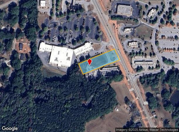
4283 Salem Rd
0013000000123000
Salem Rd Corridor
Commercialacreage
1.252 AC SALEM ROAD
X
Newton
13217C0105D
Georgia
2025
1.25 AC
2025
Newton County
100902
Atlanta
2,358 SF
Atlanta-Sandy Springs-Roswell, GA
DEMOGRAPHICS near 4283 Salem Rd
1 Mile
3 Mile
5 Mile
2024 Total Population
5,313
47,489
92,398
2029 Population
5,846
51,854
99,740
Pop Growth 2024-2029
+ 10.03%
+ 9.19%
+ 7.95%
Average Age
36
37
38
2024 Total Households
1,734
16,328
32,241
HH Growth 2024-2029
+ 10.32%
+ 9.39%
+ 8.12%
Median Household Inc
$71,911
$70,900
$72,968
Avg Household Size
3.00
2.90
2.80
2024 Avg HH Vehicles
2.00
2.00
2.00
Median Home Value
$166,919
$186,971
$191,187
Median Year Built
2002
1997
1995
Nearby Places
Map Layers
Map Styles
 Street
 Aerial
- Restaurants
- Banks
- Shops
- Fitness
- Groceries
PUBLIC TRANSPORTATION
AIRPORT
Hartsfield - Jackson Atlanta International
DRIVE
WALK
Distance
Hartsfield - Jackson Atlanta International
49 min
35.1 mi
SALE & LEASE HISTORY
LISTING DATE
SALE/LEASE

Sep 24, 2016
For Sale
Jun 04, 2019
For Sale
Jan 31, 2017
For Sale
Nearby Properties
Address
Land Use
TOTAL SIZE
Lot Size
Zoning
Address
Land Use
TOTAL SIZE
Lot Size
Zoning
1,158,095 SF
161.26 AC
Address
Land Use
TOTAL SIZE
Lot Size
Zoning
1,158,095 SF
0.01 AC
Address
Land Use
TOTAL SIZE
Lot Size
Zoning
306,886 SF
118.50 AC
R2
Address
Land Use
TOTAL SIZE
Lot Size
Zoning
1,648 SF
25.08 AC
C1
Address
Land Use
TOTAL SIZE
Lot Size
Zoning
175,605 SF
39.99 AC
AR
Address
Land Use
TOTAL SIZE
Lot Size
Zoning
17,056 SF
16.78 AC
C1
Address
Land Use
TOTAL SIZE
Lot Size
Zoning
131,111 SF
22.17 AC
R3
Address
Land Use
TOTAL SIZE
Lot Size
Zoning
5,160 SF
45.17 AC
C1
Address
Land Use
TOTAL SIZE
Lot Size
Zoning
8,156 SF
14.49 AC
C1
Address
Land Use
TOTAL SIZE
Lot Size
Zoning
8,832 SF
8.26 AC
C1
Address
Land Use
TOTAL SIZE
Lot Size
Zoning
8,632 SF
8.11 AC
C1
Address
Land Use
TOTAL SIZE
Lot Size
Zoning
82,716 SF
21.04 AC
R2
Address
Land Use
TOTAL SIZE
Lot Size
Zoning
125,971 SF
23.84 AC
C1
Address
Land Use
TOTAL SIZE
Lot Size
Zoning
130,000 SF
33.48 AC
R1
Address
Land Use
TOTAL SIZE
Lot Size
Zoning
65,360 SF
75.51 AC
E6
Address
Land Use
TOTAL SIZE
Lot Size
Zoning
65,520 SF
35 AC
E6
Address
Land Use
TOTAL SIZE
Lot Size
Zoning
65,008 SF
23.81 AC
R2
Address
Land Use
TOTAL SIZE
Lot Size
Zoning
151,955 SF
26.17 AC
R1
Address
Land Use
TOTAL SIZE
Lot Size
Zoning
64,799 SF
19.10 AC
E6
Address
Land Use
TOTAL SIZE
Lot Size
Zoning
2,460 SF
7 AC
E2
Address
Land Use
TOTAL SIZE
Lot Size
Zoning
11,294 SF
7.63 AC
C1
Address
Land Use
TOTAL SIZE
Lot Size
Zoning
66,660 SF
12.80 AC
C1
Address
Land Use
TOTAL SIZE
Lot Size
Zoning
49,792 SF
8.89 AC
R1
Address
Land Use
TOTAL SIZE
Lot Size
Zoning
181,858 SF
6.92 AC
I1
Address
Land Use
TOTAL SIZE
Lot Size
Zoning
38,250 SF
26.56 AC
AR
Address
Land Use
TOTAL SIZE
Lot Size
Zoning
36,615 SF
9.78 AC
E2
Address
Land Use
TOTAL SIZE
Lot Size
Zoning
7,440 SF
48.60 AC
C1
Address
Land Use
TOTAL SIZE
Lot Size
Zoning
58,892 SF
17.52 AC
E6
Address
Land Use
TOTAL SIZE
Lot Size
Zoning
6,466 SF
2.30 AC
MXD
Address
Land Use
TOTAL SIZE
Lot Size
Zoning
30,000 SF
11.06 AC
E2
The World's #1 Commercial Real Estate Marketplace
Connect with us
© 2026 CoStar Group
The information above has been obtained from sources believed reliable. While we do not doubt its accuracy we have not verified it and make no guarantee, warranty or representation about it. It is your responsibility to independently confirm its accuracy and completeness. Any projections, opinions, assumptions, or estimates used are for example only and do not represent the current or future performance of the property. The value of this transaction to you depends on tax and other factors which should be evaluated by your tax, financial, and legal advisors. You and your advisors should conduct a careful, independent investigation of the property to determine to your satisfaction the suitability of the property for your needs.