Property Record
4287 Us 231 Sw, Union Grove, AL 35175


NEARBY LISTINGS FOR SALE OR LEASE
-
-
View all Union Grove listings for sale on LoopNet.com
Property Detail
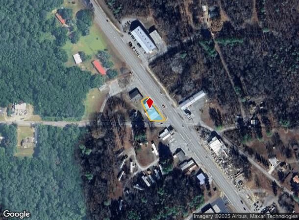
4287 Us 231 Sw
Autorepair
BEG AT INT N LINE OLD GEORGIA RD WITH SW LINE US HWY 231, TH NW 219' SW'LY 90'S SE 148' E 145'S ALG N R/W OLD GEORGIA RD TO P
X
Morgan
01089C0550F
Alabama
2025
0.40 AC
2024
Other Market Areas
030301
Decatur, AL
5,100 SF
08-09-31-0-002-010.000
DEMOGRAPHICS near 4287 Us 231 Sw
1 Mile
3 Mile
5 Mile
2024 Total Population
844
3,736
7,846
2029 Population
867
3,833
8,062
Pop Growth 2024-2029
+ 2.73%
+ 2.60%
+ 2.75%
Average Age
43
43
43
2024 Total Households
356
1,553
3,238
HH Growth 2024-2029
+ 2.53%
+ 2.51%
+ 2.69%
Median Household Inc
$51,053
$59,431
$65,242
Avg Household Size
2.40
2.40
2.40
2024 Avg HH Vehicles
2.00
2.00
2.00
Median Home Value
$179,729
$189,226
$194,177
Median Year Built
1986
1987
1988
Nearby Places
Map Layers
Map Styles
 Street
 Aerial
- Restaurants
- Banks
- Shops
- Fitness
- Groceries
PUBLIC TRANSPORTATION
AIRPORT
Huntsville International-Carl T Jones Field
DRIVE
WALK
Distance
Huntsville International-Carl T Jones Field
46 min
32.5 mi
Freight Ports
Port of Mobile
DRIVE
WALK
Distance
Port of Mobile
382 min
339.9 mi
Nearby Properties
Address
Land Use
TOTAL SIZE
Lot Size
Zoning
Address
Land Use
TOTAL SIZE
Lot Size
Zoning
23,150 SF
30 AC
Address
Land Use
TOTAL SIZE
Lot Size
Zoning
18,390 SF
12 AC
Address
Land Use
TOTAL SIZE
Lot Size
Zoning
5,400 SF
37.20 AC
Address
Land Use
TOTAL SIZE
Lot Size
Zoning
5,248 SF
1.30 AC
Address
Land Use
TOTAL SIZE
Lot Size
Zoning
5,811 SF
4.50 AC
Address
Land Use
TOTAL SIZE
Lot Size
Zoning
5,418 SF
1.90 AC
Address
Land Use
TOTAL SIZE
Lot Size
Zoning
12,250 SF
0.90 AC
Address
Land Use
TOTAL SIZE
Lot Size
Zoning
6,028 SF
3.30 AC
Address
Land Use
TOTAL SIZE
Lot Size
Zoning
1,152 SF
12 AC
Address
Land Use
TOTAL SIZE
Lot Size
Zoning
15,000 SF
1.90 AC
Address
Land Use
TOTAL SIZE
Lot Size
Zoning
3,072 SF
1.29 AC
Address
Land Use
TOTAL SIZE
Lot Size
Zoning
2,278 SF
26 AC
Address
Land Use
TOTAL SIZE
Lot Size
Zoning
14,000 SF
2.60 AC
Address
Land Use
TOTAL SIZE
Lot Size
Zoning
Address
Land Use
TOTAL SIZE
Lot Size
Zoning
16,600 SF
24 AC
Address
Land Use
TOTAL SIZE
Lot Size
Zoning
4,125 SF
3.10 AC
Address
Land Use
TOTAL SIZE
Lot Size
Zoning
5,400 SF
18 AC
Address
Land Use
TOTAL SIZE
Lot Size
Zoning
3,765 SF
2 AC
Address
Land Use
TOTAL SIZE
Lot Size
Zoning
6,000 SF
1.25 AC
Address
Land Use
TOTAL SIZE
Lot Size
Zoning
4,000 SF
1.05 AC
Address
Land Use
TOTAL SIZE
Lot Size
Zoning
5,000 SF
1.80 AC
Address
Land Use
TOTAL SIZE
Lot Size
Zoning
Address
Land Use
TOTAL SIZE
Lot Size
Zoning
8,000 SF
3.60 AC
Address
Land Use
TOTAL SIZE
Lot Size
Zoning
4,800 SF
3.30 AC
Address
Land Use
TOTAL SIZE
Lot Size
Zoning
11,898 SF
4.67 AC
Address
Land Use
TOTAL SIZE
Lot Size
Zoning
5,600 SF
0.90 AC
Address
Land Use
TOTAL SIZE
Lot Size
Zoning
5,000 SF
0.53 AC
Address
Land Use
TOTAL SIZE
Lot Size
Zoning
2,600 SF
4.70 AC
Address
Land Use
TOTAL SIZE
Lot Size
Zoning
6,912 SF
4.80 AC
Address
Land Use
TOTAL SIZE
Lot Size
Zoning
2,286 SF
0.67 AC
The World's #1 Commercial Real Estate Marketplace
Connect with us
© 2026 CoStar Group
The information above has been obtained from sources believed reliable. While we do not doubt its accuracy we have not verified it and make no guarantee, warranty or representation about it. It is your responsibility to independently confirm its accuracy and completeness. Any projections, opinions, assumptions, or estimates used are for example only and do not represent the current or future performance of the property. The value of this transaction to you depends on tax and other factors which should be evaluated by your tax, financial, and legal advisors. You and your advisors should conduct a careful, independent investigation of the property to determine to your satisfaction the suitability of the property for your needs.