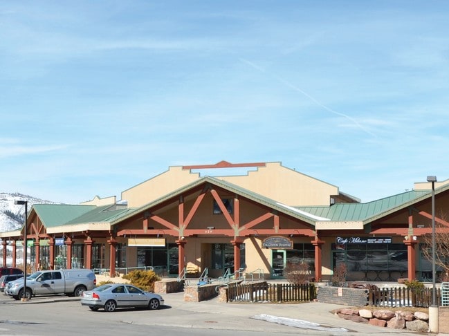
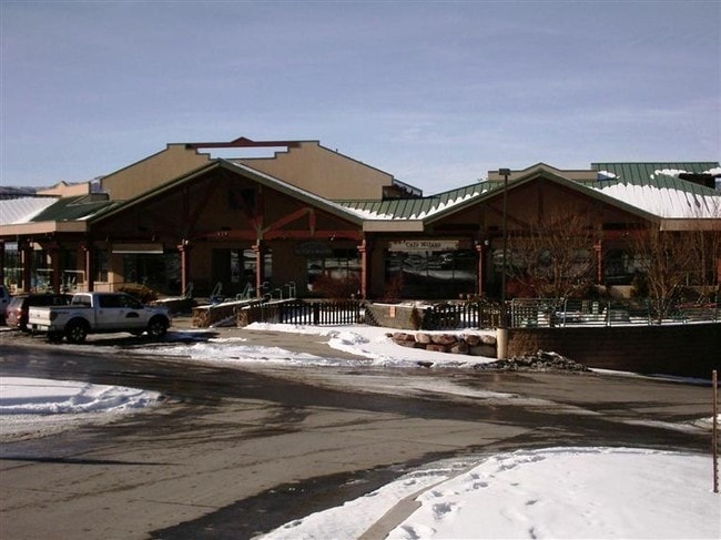
Property Record
429 Edwards Access Rd, Edwards, CO 81632


Property Detail
429 Edwards Access Rd
R043381
SUBDIVISION: NORTHSTAR CENTER PARCEL 1
Charitableorganization
Eagle
B and X Area of moderate flood hazard, usually the area between the limits of the 100-year and 500-year floods.
Colorado
2024
4.87 AC
2025
Colorado Ski Area
000401
Other Market Areas
90,445 SF
Edwards, CO
NEARBY LISTINGS FOR SALE OR LEASE
-
-
View all Edwards listings for lease on LoopNet.com
DEMOGRAPHICS near 429 Edwards Access Rd
1 mile
3 mile
5 mile
2025 Total Population
3,977
10,368
15,349
2030 Population
3,742
9,717
14,363
Pop Growth 2025-2030
(5.91%)
(6.28%)
(6.42%)
Average Age
40
39
39
2025 Total Households
1,544
3,744
5,613
HH Growth 2025-2030
(6.74%)
(7.29%)
(7.55%)
Median Household Inc
$117,277
$106,638
$99,839
Avg Household Size
2.50
2.60
2.60
2025 Avg HH Vehicles
2.00
2.00
2.00
Median Home Value
$885,216
$1,017,473
$1,011,285
Median Year Built
1997
1995
1994
Nearby Places
Map Layers
Map Styles
 Street
 Aerial
Transit
 Traffic
 Biking
Places
Listings with unknown addresses are not visible on the map
- Restaurants
- Banks
- Shops
- Fitness
- Groceries
PUBLIC TRANSPORTATION
AIRPORT
Eagle County Regional
Drive
Walk
Distance
Eagle County Regional
28 min
22.3 mi
SALE & LEASE HISTORY
LISTING DATE
SALE/LEASE

Sep 25, 2016
For Lease
Sep 07, 2018
For Lease
Feb 28, 2017
For Lease
Nearby Properties
Address
Land Use
TOTAL SIZE
Lot Size
Zoning
Address
Land Use
TOTAL SIZE
Lot Size
Zoning
89,878 SF
8.74 AC
Address
Land Use
TOTAL SIZE
Lot Size
Zoning
98,807 SF
7.15 AC
Address
Land Use
TOTAL SIZE
Lot Size
Zoning
10,816 SF
38.75 AC
Address
Land Use
TOTAL SIZE
Lot Size
Zoning
352,335 SF
29.96 AC
Address
Land Use
TOTAL SIZE
Lot Size
Zoning
71,083 SF
7.28 AC
Address
Land Use
TOTAL SIZE
Lot Size
Zoning
98,493 SF
2.51 AC
Address
Land Use
TOTAL SIZE
Lot Size
Zoning
65,400 SF
1.87 AC
Address
Land Use
TOTAL SIZE
Lot Size
Zoning
16.77 AC
Address
Land Use
TOTAL SIZE
Lot Size
Zoning
49,228 SF
9.88 AC
Address
Land Use
TOTAL SIZE
Lot Size
Zoning
3,306 SF
14.94 AC
Address
Land Use
TOTAL SIZE
Lot Size
Zoning
146,951 SF
5.73 AC
Address
Land Use
TOTAL SIZE
Lot Size
Zoning
15,328 SF
2.76 AC
Address
Land Use
TOTAL SIZE
Lot Size
Zoning
3.65 AC
Address
Land Use
TOTAL SIZE
Lot Size
Zoning
58,912 SF
35.60 AC
Address
Land Use
TOTAL SIZE
Lot Size
Zoning
42,017 SF
1.41 AC
Address
Land Use
TOTAL SIZE
Lot Size
Zoning
348,480 SF
8 AC
Address
Land Use
TOTAL SIZE
Lot Size
Zoning
17,570 SF
2.02 AC
Address
Land Use
TOTAL SIZE
Lot Size
Zoning
5.45 AC
Address
Land Use
TOTAL SIZE
Lot Size
Zoning
8.83 AC
Address
Land Use
TOTAL SIZE
Lot Size
Zoning
44,220 SF
157.48 AC
Address
Land Use
TOTAL SIZE
Lot Size
Zoning
61,168 SF
165.88 AC
Address
Land Use
TOTAL SIZE
Lot Size
Zoning
48,050 SF
6.75 AC
Address
Land Use
TOTAL SIZE
Lot Size
Zoning
30,164 SF
184.51 AC
Address
Land Use
TOTAL SIZE
Lot Size
Zoning
5.03 AC
Address
Land Use
TOTAL SIZE
Lot Size
Zoning
3,595 SF
3.10 AC
Address
Land Use
TOTAL SIZE
Lot Size
Zoning
14,022 SF
5.08 AC
Address
Land Use
TOTAL SIZE
Lot Size
Zoning
12,442 SF
0.57 AC
Address
Land Use
TOTAL SIZE
Lot Size
Zoning
Address
Land Use
TOTAL SIZE
Lot Size
Zoning
The World's #1 Commercial Real Estate Marketplace
Connect with us
© 2026 CoStar Group
The information above has been obtained from sources believed reliable. While we do not doubt its accuracy we have not verified it and make no guarantee, warranty or representation about it. It is your responsibility to independently confirm its accuracy and completeness. Any projections, opinions, assumptions, or estimates used are for example only and do not represent the current or future performance of the property. The value of this transaction to you depends on tax and other factors which should be evaluated by your tax, financial, and legal advisors. You and your advisors should conduct a careful, independent investigation of the property to determine to your satisfaction the suitability of the property for your needs.