Property Record
429 Lorimer St, Brooklyn, NY 11206
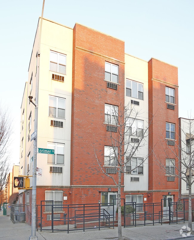
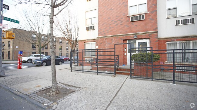
Property Detail
429 Lorimer St
02791-0033
ID2003052400006002
Multifamilydwelling
Kings
R6B
New York
B and X Area of moderate flood hazard, usually the area between the limits of the 100-year and 500-year floods.
33
2024
0.06 AC
2025
Williamsburg
051300
Long Island (New York)
5,000 SF
New York-Jersey City-White Plains, NY-NJ
NEARBY LISTINGS FOR SALE OR LEASE
DEMOGRAPHICS near 429 Lorimer St
1 mile
3 mile
5 mile
2024 Total Population
195,268
1,352,344
3,283,829
2029 Population
198,800
1,376,213
3,333,536
Pop Growth 2024-2029
+ 1.81%
+ 1.77%
+ 1.51%
Average Age
35
38
40
2024 Total Households
74,070
574,815
1,393,178
HH Growth 2024-2029
+ 1.54%
+ 1.89%
+ 1.95%
Median Household Inc
$83,614
$100,462
$100,834
Avg Household Size
2.50
2.20
2.20
2024 Avg HH Vehicles
.00
.00
.00
Median Home Value
$1,019,451
$1,006,685
$937,465
Median Year Built
1966
1949
1952
Nearby Places
Map Layers
Map Styles
 Street
 Aerial
Transit
 Traffic
 Biking
Places
Listings with unknown addresses are not visible on the map
- Restaurants
- Banks
- Shops
- Fitness
- Groceries
Nearby Properties
Address
Land Use
TOTAL SIZE
Lot Size
Zoning
Address
Land Use
TOTAL SIZE
Lot Size
Zoning
8,462,176 SF
61.41 AC
R7-2
Address
Land Use
TOTAL SIZE
Lot Size
Zoning
2,812,739 SF
2.10 AC
C5-3
Address
Land Use
TOTAL SIZE
Lot Size
Zoning
2,400,000 SF
15.14 AC
C5-2
Address
Land Use
TOTAL SIZE
Lot Size
Zoning
2,124,441 SF
17.29 AC
R8
Address
Land Use
TOTAL SIZE
Lot Size
Zoning
1,233,394 SF
1.78 AC
C5-3
Address
Land Use
TOTAL SIZE
Lot Size
Zoning
1,104,505 SF
2.32 AC
C4-7
Address
Land Use
TOTAL SIZE
Lot Size
Zoning
940,000 SF
1.44 AC
C6-2
Address
Land Use
TOTAL SIZE
Lot Size
Zoning
7,058,736 SF
147.61 AC
M3-1
Address
Land Use
TOTAL SIZE
Lot Size
Zoning
869,038 SF
1.53 AC
M1-1
Address
Land Use
TOTAL SIZE
Lot Size
Zoning
1,260,362 SF
4.32 AC
C1-7
Address
Land Use
TOTAL SIZE
Lot Size
Zoning
3,122,165 SF
19.02 AC
R7-2
Address
Land Use
TOTAL SIZE
Lot Size
Zoning
1,653,794 SF
3.15 AC
C6-4
Address
Land Use
TOTAL SIZE
Lot Size
Zoning
1,065,915 SF
2.13 AC
M16R10
Address
Land Use
TOTAL SIZE
Lot Size
Zoning
1,385,425 SF
6.43 AC
R8
Address
Land Use
TOTAL SIZE
Lot Size
Zoning
840,000 SF
1.04 AC
C4-6
Address
Land Use
TOTAL SIZE
Lot Size
Zoning
1,503,235 SF
5.28 AC
C2-7
Address
Land Use
TOTAL SIZE
Lot Size
Zoning
805,287 SF
1 AC
R10
Address
Land Use
TOTAL SIZE
Lot Size
Zoning
1,159,795 SF
1.93 AC
C5-3
Address
Land Use
TOTAL SIZE
Lot Size
Zoning
2,948,300 SF
27.71 AC
R7-2
Address
Land Use
TOTAL SIZE
Lot Size
Zoning
984,760 SF
2.04 AC
M3-1
Address
Land Use
TOTAL SIZE
Lot Size
Zoning
890,142 SF
2.22 AC
R7-1
Address
Land Use
TOTAL SIZE
Lot Size
Zoning
1,079,361 SF
1.07 AC
C5-3
Address
Land Use
TOTAL SIZE
Lot Size
Zoning
818,726 SF
1.65 AC
C1-9
Address
Land Use
TOTAL SIZE
Lot Size
Zoning
383,780 SF
C6-2
Address
Land Use
TOTAL SIZE
Lot Size
Zoning
385,831 SF
0.83 AC
C6-3
Address
Land Use
TOTAL SIZE
Lot Size
Zoning
1,258,851 SF
2.20 AC
C6-4
Address
Land Use
TOTAL SIZE
Lot Size
Zoning
1,359,110 SF
1.89 AC
C5-3
Address
Land Use
TOTAL SIZE
Lot Size
Zoning
722,817 SF
3.26 AC
R8
Address
Land Use
TOTAL SIZE
Lot Size
Zoning
823,085 SF
R8
Address
Land Use
TOTAL SIZE
Lot Size
Zoning
1,658,649 SF
15.93 AC
R7-2
The World's #1 Commercial Real Estate Marketplace
Connect with us
© 2026 CoStar Group
The information above has been obtained from sources believed reliable. While we do not doubt its accuracy we have not verified it and make no guarantee, warranty or representation about it. It is your responsibility to independently confirm its accuracy and completeness. Any projections, opinions, assumptions, or estimates used are for example only and do not represent the current or future performance of the property. The value of this transaction to you depends on tax and other factors which should be evaluated by your tax, financial, and legal advisors. You and your advisors should conduct a careful, independent investigation of the property to determine to your satisfaction the suitability of the property for your needs.