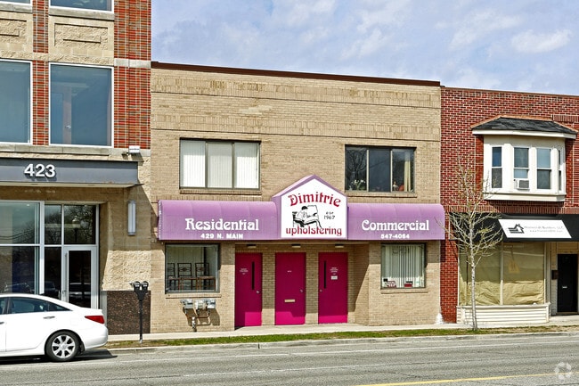
Property Record
427 N Main St, Royal Oak, MI 48067

NEARBY LISTINGS FOR SALE OR LEASE
Property Detail
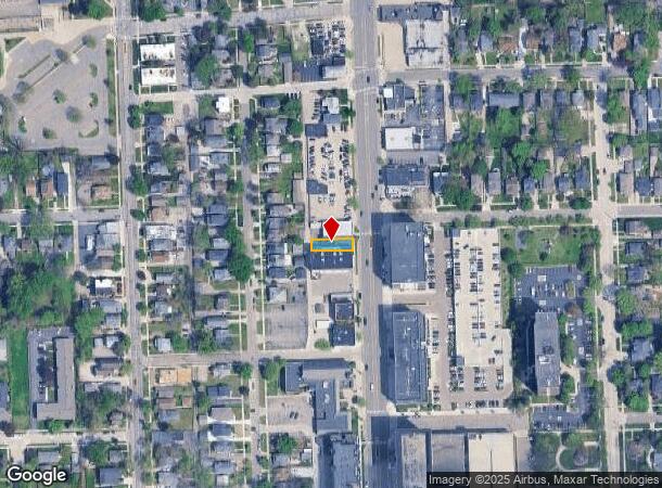
427 N Main St
Detroit-Warren-Dearborn, MI
Willson Park Sub
25-16-483-023
T1N, R11E, SEC 16 WILLSON PARK SUB LOT 18 BLK A
Commercialnec
Oakland
X
Michigan
26163C0100E
18
2024
0.08 AC
2024
Royal Oak
184100
Detroit
2,412 SF
DEMOGRAPHICS near 427 N Main St
1 Mile
3 Mile
5 Mile
2024 Total Population
18,482
141,252
352,074
2029 Population
18,428
139,906
347,921
Pop Growth 2024-2029
(0.29%)
(0.95%)
(1.18%)
Average Age
40
40
41
2024 Total Households
9,436
67,226
156,878
HH Growth 2024-2029
(0.20%)
(0.92%)
(1.15%)
Median Household Inc
$99,526
$82,657
$70,742
Avg Household Size
1.90
2.10
2.20
2024 Avg HH Vehicles
2.00
2.00
2.00
Median Home Value
$321,908
$243,755
$211,206
Median Year Built
1951
1954
1957
Nearby Places
Map Layers
Map Styles
 Street
 Aerial
- Restaurants
- Banks
- Shops
- Fitness
- Groceries
PUBLIC TRANSPORTATION
COMMUTER RAIL
DRIVE
WALK
Distance
2 min
9 min
0.5 mi
DRIVE
WALK
Distance
13 min
5.6 mi
AIRPORT
Windsor International
DRIVE
WALK
Distance
Windsor International
44 min
23.8 mi
Detroit Metro Wayne County
DRIVE
WALK
Distance
Detroit Metro Wayne County
48 min
33.3 mi
SALE & LEASE HISTORY
LISTING DATE
SALE/LEASE

Oct 01, 2019
For Sale
Mar 30, 2022
For Lease
Dec 09, 2020
For Sale
Nearby Properties
Address
Land Use
TOTAL SIZE
Lot Size
Zoning
Address
Land Use
TOTAL SIZE
Lot Size
Zoning
4.20 AC
REG BUS
Address
Land Use
TOTAL SIZE
Lot Size
Zoning
0.81 AC
CBD
Address
Land Use
TOTAL SIZE
Lot Size
Zoning
10,734 SF
3.52 AC
SPEC REDEV
Address
Land Use
TOTAL SIZE
Lot Size
Zoning
187,801 SF
5.49 AC
RM-2
Address
Land Use
TOTAL SIZE
Lot Size
Zoning
15.32 AC
GEN BUS
Address
Land Use
TOTAL SIZE
Lot Size
Zoning
576,924 SF
31.35 AC
Address
Land Use
TOTAL SIZE
Lot Size
Zoning
12.16 AC
PUD
Address
Land Use
TOTAL SIZE
Lot Size
Zoning
228,421 SF
17.18 AC
RMMUL
Address
Land Use
TOTAL SIZE
Lot Size
Zoning
72,457 SF
5.60 AC
OFFICE SVC
Address
Land Use
TOTAL SIZE
Lot Size
Zoning
576,924 SF
36.24 AC
Address
Land Use
TOTAL SIZE
Lot Size
Zoning
349,226 SF
21.62 AC
RMMUL
Address
Land Use
TOTAL SIZE
Lot Size
Zoning
804 SF
1.50 AC
CBD
Address
Land Use
TOTAL SIZE
Lot Size
Zoning
1.46 AC
CBD
Address
Land Use
TOTAL SIZE
Lot Size
Zoning
339,780 SF
22.29 AC
RM-1
Address
Land Use
TOTAL SIZE
Lot Size
Zoning
150,703 SF
Address
Land Use
TOTAL SIZE
Lot Size
Zoning
417,880 SF
6.76 AC
RM-2
Address
Land Use
TOTAL SIZE
Lot Size
Zoning
171,259 SF
1.26 AC
CBD
Address
Land Use
TOTAL SIZE
Lot Size
Zoning
290,448 SF
9.01 AC
O
Address
Land Use
TOTAL SIZE
Lot Size
Zoning
62,528 SF
5.27 AC
M-1 LT
Address
Land Use
TOTAL SIZE
Lot Size
Zoning
13.89 AC
PUD
Address
Land Use
TOTAL SIZE
Lot Size
Zoning
128,309 SF
1.74 AC
Address
Land Use
TOTAL SIZE
Lot Size
Zoning
0.61 AC
CBD
Address
Land Use
TOTAL SIZE
Lot Size
Zoning
1.07 AC
MIX USE 2
Address
Land Use
TOTAL SIZE
Lot Size
Zoning
46,894 SF
0.52 AC
CBD
Address
Land Use
TOTAL SIZE
Lot Size
Zoning
43,437 SF
3.30 AC
REG BUS
Address
Land Use
TOTAL SIZE
Lot Size
Zoning
290,448 SF
8.92 AC
O
Address
Land Use
TOTAL SIZE
Lot Size
Zoning
147,186 SF
3.20 AC
AI
Address
Land Use
TOTAL SIZE
Lot Size
Zoning
137,583 SF
2.96 AC
BI
Address
Land Use
TOTAL SIZE
Lot Size
Zoning
73,701 SF
1.61 AC
PUD
Address
Land Use
TOTAL SIZE
Lot Size
Zoning
44,396 SF
7.86 AC
MULT FAM
The World's #1 Commercial Real Estate Marketplace
Connect with us
© 2025 CoStar Group
The information above has been obtained from sources believed reliable. While we do not doubt its accuracy we have not verified it and make no guarantee, warranty or representation about it. It is your responsibility to independently confirm its accuracy and completeness. Any projections, opinions, assumptions, or estimates used are for example only and do not represent the current or future performance of the property. The value of this transaction to you depends on tax and other factors which should be evaluated by your tax, financial, and legal advisors. You and your advisors should conduct a careful, independent investigation of the property to determine to your satisfaction the suitability of the property for your needs.