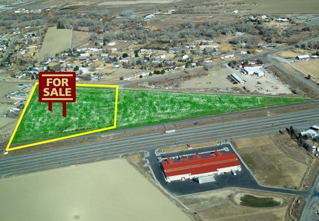
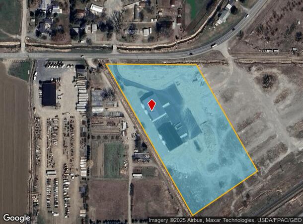
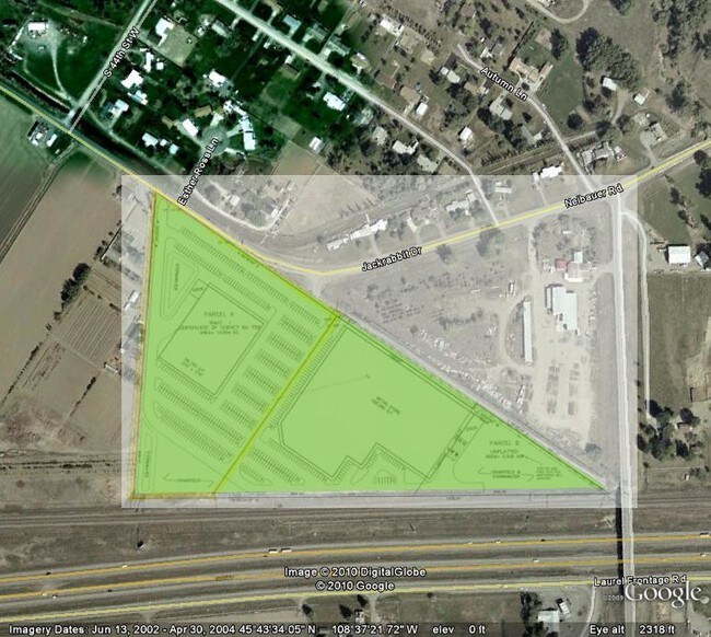
Property Record
4290 Neibauer Rd, Billings, MT 59106

NEARBY LISTINGS FOR SALE OR LEASE
Property Detail
4290 Neibauer Rd
03-0926-27-1-11-01-0000
01 Certificate/Surv 759
Commercialnec
S27, T01 S, R25 E, C.O.S. 3469, PARCEL 1A, ACRES 8.041, (23)
X
Yellowstone
30111C1455E
Montana
2024
8.04 AC
2025
Billings
001404
Other Market Areas
9,600 SF
Billings, MT
DEMOGRAPHICS near 4290 Neibauer Rd
1 Mile
3 Mile
5 Mile
2024 Total Population
542
14,960
52,831
2029 Population
578
16,343
57,542
Pop Growth 2024-2029
+ 6.64%
+ 9.24%
+ 8.92%
Average Age
42
40
41
2024 Total Households
197
6,639
22,648
HH Growth 2024-2029
+ 7.11%
+ 9.49%
+ 9.13%
Median Household Inc
$127,308
$72,135
$71,938
Avg Household Size
2.60
2.20
2.30
2024 Avg HH Vehicles
3.00
2.00
2.00
Median Home Value
$434,545
$308,881
$303,029
Median Year Built
1989
1996
1992
Nearby Places
Map Layers
Map Styles
 Street
 Aerial
- Restaurants
- Banks
- Shops
- Fitness
- Groceries
PUBLIC TRANSPORTATION
AIRPORT
Billings Logan International
DRIVE
WALK
Distance
Billings Logan International
27 min
11.1 mi
Freight Ports
Port of Everett
DRIVE
WALK
Distance
Port of Everett
878 min
836.8 mi
SALE & LEASE HISTORY
LISTING DATE
SALE/LEASE

Sep 24, 2016
For Sale
Jan 10, 2018
For Sale
Nearby Properties
Address
Land Use
TOTAL SIZE
Lot Size
Zoning
Address
Land Use
TOTAL SIZE
Lot Size
Zoning
145.51 AC
Address
Land Use
TOTAL SIZE
Lot Size
Zoning
343,075 SF
0.56 AC
Address
Land Use
TOTAL SIZE
Lot Size
Zoning
136,588 SF
21.01 AC
CI
Address
Land Use
TOTAL SIZE
Lot Size
Zoning
32,460 SF
10.88 AC
A-1
Address
Land Use
TOTAL SIZE
Lot Size
Zoning
188,030 SF
13.88 AC
A-1
Address
Land Use
TOTAL SIZE
Lot Size
Zoning
259,684 SF
14.73 AC
Address
Land Use
TOTAL SIZE
Lot Size
Zoning
173,042 SF
10.27 AC
Address
Land Use
TOTAL SIZE
Lot Size
Zoning
156,883 SF
12.86 AC
Address
Land Use
TOTAL SIZE
Lot Size
Zoning
70,034 SF
7.29 AC
Address
Land Use
TOTAL SIZE
Lot Size
Zoning
77.63 AC
Address
Land Use
TOTAL SIZE
Lot Size
Zoning
173,807 SF
11.56 AC
CI
Address
Land Use
TOTAL SIZE
Lot Size
Zoning
156.04 AC
Address
Land Use
TOTAL SIZE
Lot Size
Zoning
16,656 SF
10.85 AC
Address
Land Use
TOTAL SIZE
Lot Size
Zoning
109,467 SF
5.97 AC
Address
Land Use
TOTAL SIZE
Lot Size
Zoning
13,216 SF
144.80 AC
A-1
Address
Land Use
TOTAL SIZE
Lot Size
Zoning
177,290 SF
14.59 AC
HC
Address
Land Use
TOTAL SIZE
Lot Size
Zoning
151,056 SF
49.20 AC
A-1
Address
Land Use
TOTAL SIZE
Lot Size
Zoning
42,186 SF
13.43 AC
Address
Land Use
TOTAL SIZE
Lot Size
Zoning
11,210 SF
14.37 AC
Address
Land Use
TOTAL SIZE
Lot Size
Zoning
168,560 SF
24.67 AC
Address
Land Use
TOTAL SIZE
Lot Size
Zoning
67.17 AC
Address
Land Use
TOTAL SIZE
Lot Size
Zoning
7,538 SF
59.81 AC
A-1
Address
Land Use
TOTAL SIZE
Lot Size
Zoning
127,408 SF
7.98 AC
A-1
Address
Land Use
TOTAL SIZE
Lot Size
Zoning
38,313 SF
3.27 AC
Address
Land Use
TOTAL SIZE
Lot Size
Zoning
86,332 SF
11.18 AC
Address
Land Use
TOTAL SIZE
Lot Size
Zoning
22,548 SF
11.39 AC
PUD
Address
Land Use
TOTAL SIZE
Lot Size
Zoning
22,144 SF
9.64 AC
PUD
Address
Land Use
TOTAL SIZE
Lot Size
Zoning
69,342 SF
24.57 AC
P
Address
Land Use
TOTAL SIZE
Lot Size
Zoning
59,920 SF
5.68 AC
The World's #1 Commercial Real Estate Marketplace
Connect with us
© 2026 CoStar Group
The information above has been obtained from sources believed reliable. While we do not doubt its accuracy we have not verified it and make no guarantee, warranty or representation about it. It is your responsibility to independently confirm its accuracy and completeness. Any projections, opinions, assumptions, or estimates used are for example only and do not represent the current or future performance of the property. The value of this transaction to you depends on tax and other factors which should be evaluated by your tax, financial, and legal advisors. You and your advisors should conduct a careful, independent investigation of the property to determine to your satisfaction the suitability of the property for your needs.