Property Record
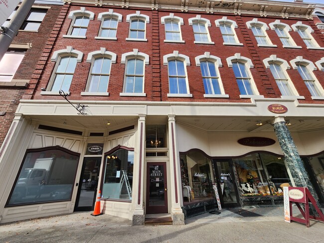
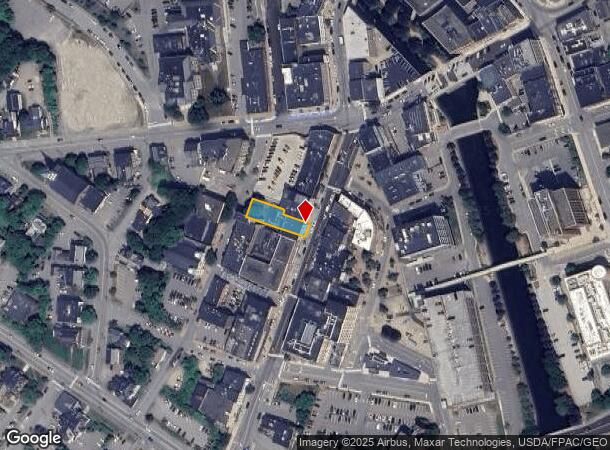
43 Main St, Bangor, ME 04401
This Property Is For Sale
NEARBY LISTINGS FOR SALE OR LEASE
Property Detail
43 Main St
BANG-000042-000000-000108
Penobscot
Storebuilding
Maine
X
108
23019C2117D
0.19 AC
2024
Downtown Bangor
2024
Other Market Areas
000200
Bangor, ME
9,640 SF
DEMOGRAPHICS near 43 Main St
1 Mile
3 Mile
5 Mile
2024 Total Population
15,775
37,137
50,843
2029 Population
16,161
38,087
52,149
Pop Growth 2024-2029
+ 2.45%
+ 2.56%
+ 2.57%
Average Age
41
43
43
2024 Total Households
7,945
17,315
22,987
HH Growth 2024-2029
+ 2.66%
+ 2.73%
+ 2.71%
Median Household Inc
$39,015
$50,587
$54,916
Avg Household Size
1.90
2.00
2.10
2024 Avg HH Vehicles
1.00
1.00
2.00
Median Home Value
$185,760
$191,165
$207,076
Median Year Built
1947
1958
1967
Nearby Places
- Restaurants
- Banks
- Shops
- Fitness
- Groceries
PUBLIC TRANSPORTATION
AIRPORT
Bangor International
DRIVE
WALK
Distance
Bangor International
12 min
6.0 mi
Freight Ports
Searsport, ME
DRIVE
WALK
Distance
Searsport, ME
47 min
30.6 mi
Nearby Properties
Address
Land Use
TOTAL SIZE
Lot Size
Zoning
Address
Land Use
TOTAL SIZE
Lot Size
Zoning
466.65 AC
ADD
Address
Land Use
TOTAL SIZE
Lot Size
Zoning
76,649 SF
100 AC
G&ISD
Address
Land Use
TOTAL SIZE
Lot Size
Zoning
186,220 SF
93.91 AC
G&SD
Address
Land Use
TOTAL SIZE
Lot Size
Zoning
609,180 SF
6.68 AC
USD
Address
Land Use
TOTAL SIZE
Lot Size
Zoning
307,200 SF
99.21 AC
G&ISD
Address
Land Use
TOTAL SIZE
Lot Size
Zoning
Address
Land Use
TOTAL SIZE
Lot Size
Zoning
6.37 AC
UID
Address
Land Use
TOTAL SIZE
Lot Size
Zoning
243,694 SF
2.95 AC
G&ISD
Address
Land Use
TOTAL SIZE
Lot Size
Zoning
11,000 SF
188.98 AC
LDR
Address
Land Use
TOTAL SIZE
Lot Size
Zoning
87,750 SF
ADD
Address
Land Use
TOTAL SIZE
Lot Size
Zoning
124,368 SF
11.75 AC
G&ISD
Address
Land Use
TOTAL SIZE
Lot Size
Zoning
241,898 SF
62.50 AC
G&ISD
Address
Land Use
TOTAL SIZE
Lot Size
Zoning
146,924 SF
2.62 AC
G&ISD
Address
Land Use
TOTAL SIZE
Lot Size
Zoning
400 SF
3.44 AC
WDD
Address
Land Use
TOTAL SIZE
Lot Size
Zoning
100,800 SF
1.34 AC
DDD
Address
Land Use
TOTAL SIZE
Lot Size
Zoning
12,950 SF
23.39 AC
31 - I
Address
Land Use
TOTAL SIZE
Lot Size
Zoning
168,615 SF
19.44 AC
MDR-1
Address
Land Use
TOTAL SIZE
Lot Size
Zoning
38 AC
G&ISD
Address
Land Use
TOTAL SIZE
Lot Size
Zoning
Address
Land Use
TOTAL SIZE
Lot Size
Zoning
115,044 SF
13.30 AC
G&ISD
Address
Land Use
TOTAL SIZE
Lot Size
Zoning
226,625 SF
S&PS
Address
Land Use
TOTAL SIZE
Lot Size
Zoning
94,081 SF
17.56 AC
G&ISD
Address
Land Use
TOTAL SIZE
Lot Size
Zoning
184,000 SF
16.43 AC
31 - I
Address
Land Use
TOTAL SIZE
Lot Size
Zoning
110,031 SF
3.81 AC
GC&S
Address
Land Use
TOTAL SIZE
Lot Size
Zoning
208,790 SF
50.33 AC
S&PS
Address
Land Use
TOTAL SIZE
Lot Size
Zoning
186,197 SF
21.70 AC
S&PS
Address
Land Use
TOTAL SIZE
Lot Size
Zoning
68,708 SF
7.85 AC
PB
Address
Land Use
TOTAL SIZE
Lot Size
Zoning
183,507 SF
44.60 AC
G&ISD
Address
Land Use
TOTAL SIZE
Lot Size
Zoning
119,930 SF
9.50 AC
S&PS
Address
Land Use
TOTAL SIZE
Lot Size
Zoning
109,507 SF
1.96 AC
G&ISD
The World's #1 Commercial Real Estate Marketplace
Connect with us
© 2025 CoStar Group
The information above has been obtained from sources believed reliable. While we do not doubt its accuracy we have not verified it and make no guarantee, warranty or representation about it. It is your responsibility to independently confirm its accuracy and completeness. Any projections, opinions, assumptions, or estimates used are for example only and do not represent the current or future performance of the property. The value of this transaction to you depends on tax and other factors which should be evaluated by your tax, financial, and legal advisors. You and your advisors should conduct a careful, independent investigation of the property to determine to your satisfaction the suitability of the property for your needs.