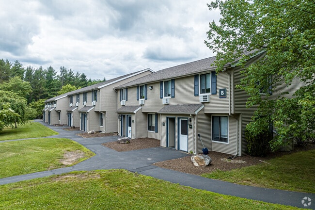
Property Record
43 Burt Latham Rd, Willington, CT 06279
NEARBY LISTINGS FOR SALE OR LEASE
-
-
View all Willington listings for sale on LoopNet.com
Property Detail
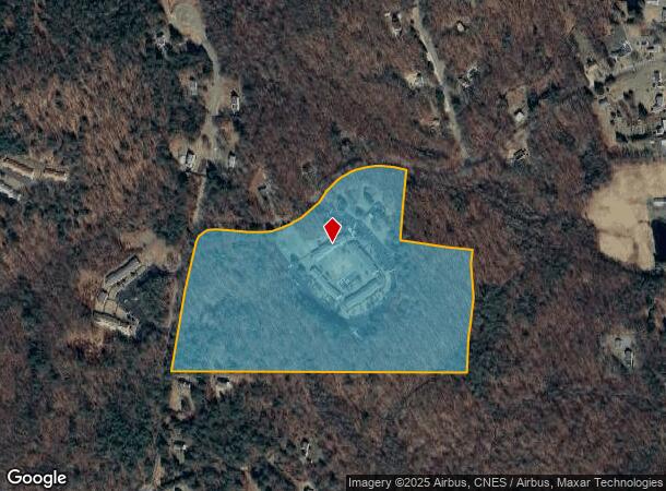
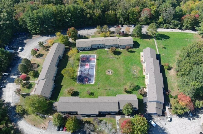
43 Burt Latham Rd
Hartford-West Hartford-East Hartford, CT
Tolland
WILL-000000-000000-194600
Connecticut
Apartmenthouse5plusunits
7-0
2025
34 AC
2025
Mansfield/Tolland/Willington
840100
Hartford
61,155 SF
DEMOGRAPHICS near 43 Burt Latham Rd
1 Mile
3 Mile
5 Mile
2024 Total Population
1,404
11,924
37,811
2029 Population
1,418
12,015
37,696
Pop Growth 2024-2029
+ 1.00%
+ 0.76%
(0.30%)
Average Age
38
37
34
2024 Total Households
646
4,184
10,227
HH Growth 2024-2029
+ 1.08%
+ 0.45%
(0.37%)
Median Household Inc
$44,394
$46,881
$66,379
Avg Household Size
2.20
2.30
2.40
2024 Avg HH Vehicles
2.00
2.00
2.00
Median Home Value
$288,488
$272,794
$298,308
Median Year Built
1974
1975
1976
Nearby Places
Map Layers
Map Styles
 Street
 Aerial
- Restaurants
- Banks
- Shops
- Fitness
- Groceries
PUBLIC TRANSPORTATION
AIRPORT
Bradley International
DRIVE
WALK
Distance
Bradley International
60 min
33.5 mi
SALE & LEASE HISTORY
LISTING DATE
SALE/LEASE

Jan 06, 2021
For Sale
Nearby Properties
Address
Land Use
TOTAL SIZE
Lot Size
Zoning
Address
Land Use
TOTAL SIZE
Lot Size
Zoning
121,528 SF
Address
Land Use
TOTAL SIZE
Lot Size
Zoning
171,605 SF
5.30 AC
PB4
Address
Land Use
TOTAL SIZE
Lot Size
Zoning
35,212 SF
3.20 AC
I
Address
Land Use
TOTAL SIZE
Lot Size
Zoning
Address
Land Use
TOTAL SIZE
Lot Size
Zoning
83,869 SF
I
Address
Land Use
TOTAL SIZE
Lot Size
Zoning
168,410 SF
100.15 AC
RDD
Address
Land Use
TOTAL SIZE
Lot Size
Zoning
23.33 AC
PB3
Address
Land Use
TOTAL SIZE
Lot Size
Zoning
66,136 SF
1 AC
I
Address
Land Use
TOTAL SIZE
Lot Size
Zoning
9.48 AC
DMR
Address
Land Use
TOTAL SIZE
Lot Size
Zoning
24,067 SF
1 AC
I
Address
Land Use
TOTAL SIZE
Lot Size
Zoning
43,134 SF
1 AC
I
Address
Land Use
TOTAL SIZE
Lot Size
Zoning
46,000 SF
1 AC
Address
Land Use
TOTAL SIZE
Lot Size
Zoning
10,000 SF
I
Address
Land Use
TOTAL SIZE
Lot Size
Zoning
110,426 SF
1 AC
I
Address
Land Use
TOTAL SIZE
Lot Size
Zoning
74,852 SF
1 AC
I
Address
Land Use
TOTAL SIZE
Lot Size
Zoning
78,314 SF
62.05 AC
R80
Address
Land Use
TOTAL SIZE
Lot Size
Zoning
83,216 SF
1 AC
I
Address
Land Use
TOTAL SIZE
Lot Size
Zoning
47,591 SF
1 AC
I
Address
Land Use
TOTAL SIZE
Lot Size
Zoning
23 AC
RAR90
Address
Land Use
TOTAL SIZE
Lot Size
Zoning
75,689 SF
20 AC
R80
Address
Land Use
TOTAL SIZE
Lot Size
Zoning
63,016 SF
8.60 AC
R80
Address
Land Use
TOTAL SIZE
Lot Size
Zoning
35,127 SF
I
Address
Land Use
TOTAL SIZE
Lot Size
Zoning
35,127 SF
I
Address
Land Use
TOTAL SIZE
Lot Size
Zoning
35,127 SF
I
Address
Land Use
TOTAL SIZE
Lot Size
Zoning
35,127 SF
I
Address
Land Use
TOTAL SIZE
Lot Size
Zoning
35,127 SF
I
Address
Land Use
TOTAL SIZE
Lot Size
Zoning
34,014 SF
I
Address
Land Use
TOTAL SIZE
Lot Size
Zoning
Address
Land Use
TOTAL SIZE
Lot Size
Zoning
113,904 SF
38.80 AC
R80
Address
Land Use
TOTAL SIZE
Lot Size
Zoning
21,682 SF
1 AC
The World's #1 Commercial Real Estate Marketplace
Connect with us
© 2026 CoStar Group
The information above has been obtained from sources believed reliable. While we do not doubt its accuracy we have not verified it and make no guarantee, warranty or representation about it. It is your responsibility to independently confirm its accuracy and completeness. Any projections, opinions, assumptions, or estimates used are for example only and do not represent the current or future performance of the property. The value of this transaction to you depends on tax and other factors which should be evaluated by your tax, financial, and legal advisors. You and your advisors should conduct a careful, independent investigation of the property to determine to your satisfaction the suitability of the property for your needs.