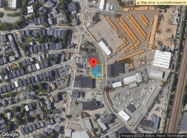
Property Record
43 Freeport St, Dorchester, MA 02122

NEARBY LISTINGS FOR SALE OR LEASE
Property Detail
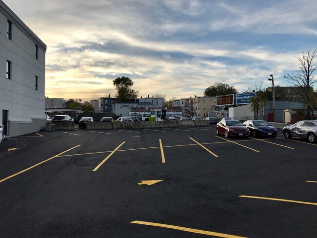
43 Freeport St
Commercialbuilding
Suffolk
X
Massachusetts
25025C0091J
0.36 AC
2025
Roxbury/Dorchester
2025
Boston
091600
Boston-Cambridge-Newton, MA-NH
18,000 SF
DORC-000000-000015-000333-000010
DEMOGRAPHICS near 43 Freeport St
1 Mile
3 Mile
5 Mile
2024 Total Population
45,216
326,096
720,372
2029 Population
42,295
310,067
694,481
Pop Growth 2024-2029
(6.46%)
(4.92%)
(3.59%)
Average Age
38
38
38
2024 Total Households
15,863
128,739
299,771
HH Growth 2024-2029
(7.12%)
(5.33%)
(3.84%)
Median Household Inc
$63,470
$72,976
$89,028
Avg Household Size
2.70
2.30
2.20
2024 Avg HH Vehicles
1.00
1.00
1.00
Median Home Value
$656,704
$712,410
$764,677
Median Year Built
1947
1949
1950
Nearby Places
Map Layers
Map Styles
 Street
 Aerial
- Restaurants
- Banks
- Shops
- Fitness
- Groceries
PUBLIC TRANSPORTATION
TRANSIT/SUBWAY
Fields Corner Station (Red Line - Massachusetts Bay Transportation Authority Subway (The T))
DRIVE
WALK
Distance
Fields Corner Station (Red Line - Massachusetts Bay Transportation Authority Subway (The T))
2 min
12 min
0.6 mi
Savin Hill Station (Red Line - Massachusetts Bay Transportation Authority Subway (The T))
DRIVE
WALK
Distance
Savin Hill Station (Red Line - Massachusetts Bay Transportation Authority Subway (The T))
5 min
13 min
0.7 mi
COMMUTER RAIL
Uphams Corner (Fairmount Line - Massachusetts Bay Transportation Authority Commuter Rail (Purple Line))
DRIVE
WALK
Distance
Uphams Corner (Fairmount Line - Massachusetts Bay Transportation Authority Commuter Rail (Purple Line))
3 min
1.2 mi
DRIVE
WALK
Distance
3 min
1.4 mi
AIRPORT
General Edward Lawrence Logan International
DRIVE
WALK
Distance
General Edward Lawrence Logan International
13 min
6.8 mi
Freight Ports
Port of Boston
DRIVE
WALK
Distance
Port of Boston
11 min
4.6 mi
SALE & LEASE HISTORY
LISTING DATE
SALE/LEASE

Sep 25, 2016
For Lease
Nearby Properties
Address
Land Use
TOTAL SIZE
Lot Size
Zoning
Address
Land Use
TOTAL SIZE
Lot Size
Zoning
909,764 SF
25.13 AC
E
Address
Land Use
TOTAL SIZE
Lot Size
Zoning
408,667 SF
3.27 AC
C
Address
Land Use
TOTAL SIZE
Lot Size
Zoning
825,000 SF
5.17 AC
E
Address
Land Use
TOTAL SIZE
Lot Size
Zoning
118,759 SF
0.92 AC
C
Address
Land Use
TOTAL SIZE
Lot Size
Zoning
377,634 SF
4.86 AC
E
Address
Land Use
TOTAL SIZE
Lot Size
Zoning
227,107 SF
7.70 AC
E
Address
Land Use
TOTAL SIZE
Lot Size
Zoning
341,500 SF
1.18 AC
RC
Address
Land Use
TOTAL SIZE
Lot Size
Zoning
262,120 SF
0.62 AC
C
Address
Land Use
TOTAL SIZE
Lot Size
Zoning
259,990 SF
2.84 AC
E
Address
Land Use
TOTAL SIZE
Lot Size
Zoning
547,851 SF
8.14 AC
E
Address
Land Use
TOTAL SIZE
Lot Size
Zoning
305,455 SF
0.54 AC
RC
Address
Land Use
TOTAL SIZE
Lot Size
Zoning
303,055 SF
2.15 AC
RC
Address
Land Use
TOTAL SIZE
Lot Size
Zoning
269,232 SF
0.46 AC
C
Address
Land Use
TOTAL SIZE
Lot Size
Zoning
259,607 SF
2.53 AC
A
Address
Land Use
TOTAL SIZE
Lot Size
Zoning
468,308 SF
0.78 AC
E
Address
Land Use
TOTAL SIZE
Lot Size
Zoning
249,135 SF
1.99 AC
RC
Address
Land Use
TOTAL SIZE
Lot Size
Zoning
873,760 SF
38.08 AC
C
Address
Land Use
TOTAL SIZE
Lot Size
Zoning
514,080 SF
0.20 AC
E
Address
Land Use
TOTAL SIZE
Lot Size
Zoning
522,465 SF
5.34 AC
E
Address
Land Use
TOTAL SIZE
Lot Size
Zoning
76,658 SF
0.38 AC
E
Address
Land Use
TOTAL SIZE
Lot Size
Zoning
281,800 SF
1.17 AC
C
Address
Land Use
TOTAL SIZE
Lot Size
Zoning
559,680 SF
3.77 AC
C
Address
Land Use
TOTAL SIZE
Lot Size
Zoning
172,000 SF
0.31 AC
A
Address
Land Use
TOTAL SIZE
Lot Size
Zoning
137,100 SF
0.86 AC
E
Address
Land Use
TOTAL SIZE
Lot Size
Zoning
130,573 SF
0.83 AC
A
Address
Land Use
TOTAL SIZE
Lot Size
Zoning
3.15 AC
C
Address
Land Use
TOTAL SIZE
Lot Size
Zoning
256,069 SF
0.47 AC
A
Address
Land Use
TOTAL SIZE
Lot Size
Zoning
118,592 SF
0.34 AC
E
Address
Land Use
TOTAL SIZE
Lot Size
Zoning
251,272 SF
3.77 AC
BUSC
Address
Land Use
TOTAL SIZE
Lot Size
Zoning
211,263 SF
4.72 AC
E
The World's #1 Commercial Real Estate Marketplace
Connect with us
© 2026 CoStar Group
The information above has been obtained from sources believed reliable. While we do not doubt its accuracy we have not verified it and make no guarantee, warranty or representation about it. It is your responsibility to independently confirm its accuracy and completeness. Any projections, opinions, assumptions, or estimates used are for example only and do not represent the current or future performance of the property. The value of this transaction to you depends on tax and other factors which should be evaluated by your tax, financial, and legal advisors. You and your advisors should conduct a careful, independent investigation of the property to determine to your satisfaction the suitability of the property for your needs.