Property Record
430 E Main St, Middleton, ID 83644


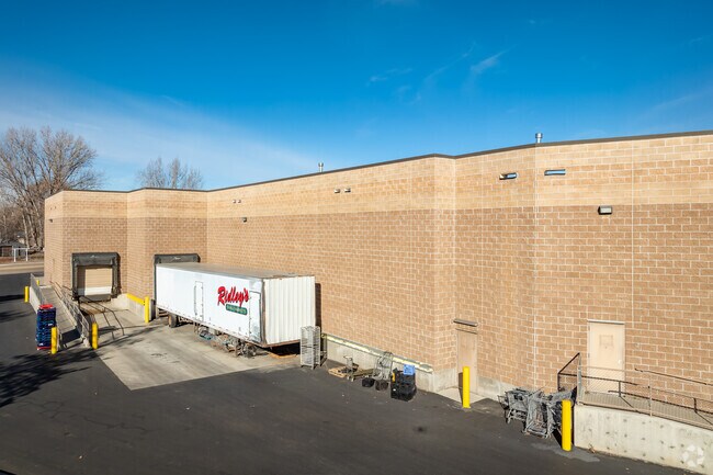
Property Detail
430 E Main St
Boise City, ID
PORTION OF BLOCKS L,O&Q
1801300000
Canyon
Commercialnec
Idaho
B and X Area of moderate flood hazard, usually the area between the limits of the 100-year and 500-year floods.
1,2,3
2024
4.47 AC
2025
Middleton
021901
Boise City/Nampa
NEARBY LISTINGS FOR SALE OR LEASE
-
-
View all Middleton listings for sale on LoopNet.com
DEMOGRAPHICS near 430 E Main St
1 mile
3 mile
5 mile
2025 Total Population
6,484
21,941
62,311
2030 Population
7,233
24,743
69,881
Pop Growth 2025-2030
+ 11.55%
+ 12.77%
+ 12.15%
Average Age
37
37
37
2025 Total Households
2,208
7,108
20,228
HH Growth 2025-2030
+ 11.91%
+ 13.06%
+ 12.47%
Median Household Inc
$72,520
$82,235
$70,978
Avg Household Size
3.00
3.10
3.00
2025 Avg HH Vehicles
3.00
3.00
2.00
Median Home Value
$359,881
$406,497
$380,042
Median Year Built
2001
2008
2003
Nearby Places
Map Layers
Map Styles
 Street
 Aerial
Layers
 Traffic
 Biking
Places
Listings with unknown addresses are not visible on the map
- Restaurants
- Banks
- Shops
- Fitness
- Groceries
PUBLIC TRANSPORTATION
AIRPORT
Boise Air Trml/Gowen Field
Drive
Walk
Distance
Boise Air Trml/Gowen Field
57 min
32.0 mi
Freight Ports
Port of Portland
Drive
Walk
Distance
Port of Portland
451 min
407.7 mi
Nearby Properties
Address
Land Use
TOTAL SIZE
Lot Size
Zoning
Address
Land Use
TOTAL SIZE
Lot Size
Zoning
15.55 AC
Address
Land Use
TOTAL SIZE
Lot Size
Zoning
16.40 AC
Address
Land Use
TOTAL SIZE
Lot Size
Zoning
Address
Land Use
TOTAL SIZE
Lot Size
Zoning
25.87 AC
Address
Land Use
TOTAL SIZE
Lot Size
Zoning
15,490 SF
47.33 AC
M1
Address
Land Use
TOTAL SIZE
Lot Size
Zoning
4.63 AC
Address
Land Use
TOTAL SIZE
Lot Size
Zoning
55,920 SF
7.47 AC
M1
Address
Land Use
TOTAL SIZE
Lot Size
Zoning
9.55 AC
Address
Land Use
TOTAL SIZE
Lot Size
Zoning
20.18 AC
Address
Land Use
TOTAL SIZE
Lot Size
Zoning
4.93 AC
Address
Land Use
TOTAL SIZE
Lot Size
Zoning
48,896 SF
9.39 AC
Address
Land Use
TOTAL SIZE
Lot Size
Zoning
15.69 AC
M1
Address
Land Use
TOTAL SIZE
Lot Size
Zoning
4.89 AC
M1
Address
Land Use
TOTAL SIZE
Lot Size
Zoning
48,600 SF
2.17 AC
M1
Address
Land Use
TOTAL SIZE
Lot Size
Zoning
13.44 AC
Address
Land Use
TOTAL SIZE
Lot Size
Zoning
1.08 AC
M1
Address
Land Use
TOTAL SIZE
Lot Size
Zoning
1,368 SF
4.73 AC
Address
Land Use
TOTAL SIZE
Lot Size
Zoning
14.45 AC
Address
Land Use
TOTAL SIZE
Lot Size
Zoning
2.36 AC
M1
Address
Land Use
TOTAL SIZE
Lot Size
Zoning
62,950 SF
8.40 AC
M1
Address
Land Use
TOTAL SIZE
Lot Size
Zoning
3.76 AC
Address
Land Use
TOTAL SIZE
Lot Size
Zoning
23.41 AC
C1
Address
Land Use
TOTAL SIZE
Lot Size
Zoning
49.81 AC
R1
Address
Land Use
TOTAL SIZE
Lot Size
Zoning
Address
Land Use
TOTAL SIZE
Lot Size
Zoning
2.79 AC
Address
Land Use
TOTAL SIZE
Lot Size
Zoning
5.96 AC
Address
Land Use
TOTAL SIZE
Lot Size
Zoning
34,130 SF
5.28 AC
M1
Address
Land Use
TOTAL SIZE
Lot Size
Zoning
49.11 AC
C1
Address
Land Use
TOTAL SIZE
Lot Size
Zoning
57.19 AC
The World's #1 Commercial Real Estate Marketplace
Connect with us
© 2026 CoStar Group
The information above has been obtained from sources believed reliable. While we do not doubt its accuracy we have not verified it and make no guarantee, warranty or representation about it. It is your responsibility to independently confirm its accuracy and completeness. Any projections, opinions, assumptions, or estimates used are for example only and do not represent the current or future performance of the property. The value of this transaction to you depends on tax and other factors which should be evaluated by your tax, financial, and legal advisors. You and your advisors should conduct a careful, independent investigation of the property to determine to your satisfaction the suitability of the property for your needs.