Property Record
430 Edenwold Rd, Madison, TN 37115


NEARBY LISTINGS FOR SALE OR LEASE
Property Detail
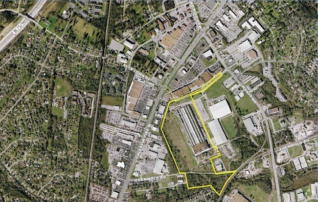
430 Edenwold Rd
034-06-0-003
E/S GALLATIN PK S OF MYATT DR
Publicstorage
Davidson
X
Tennessee
47037C0137K
40.15 AC
2025
North
2025
Nashville
010404
Nashville-Davidson--Murfreesboro--Franklin, TN
112,056 SF
DEMOGRAPHICS near 430 Edenwold Rd
1 Mile
3 Mile
5 Mile
2024 Total Population
5,453
46,001
106,217
2029 Population
5,278
45,985
109,017
Pop Growth 2024-2029
(3.21%)
(0.03%)
+ 2.64%
Average Age
39
39
40
2024 Total Households
2,253
19,481
44,089
HH Growth 2024-2029
(3.68%)
(0.41%)
+ 2.32%
Median Household Inc
$50,041
$54,712
$60,815
Avg Household Size
2.40
2.30
2.30
2024 Avg HH Vehicles
2.00
2.00
2.00
Median Home Value
$229,103
$257,377
$288,225
Median Year Built
1983
1983
1982
Nearby Places
Map Layers
Map Styles
 Street
 Aerial
- Restaurants
- Banks
- Shops
- Fitness
- Groceries
PUBLIC TRANSPORTATION
AIRPORT
Nashville International
DRIVE
WALK
Distance
Nashville International
27 min
16.4 mi
Freight Ports
Port of Mobile
DRIVE
WALK
Distance
Port of Mobile
501 min
457.0 mi
Nearby Properties
Address
Land Use
TOTAL SIZE
Lot Size
Zoning
Address
Land Use
TOTAL SIZE
Lot Size
Zoning
26,434 SF
12.86 AC
RM20
Address
Land Use
TOTAL SIZE
Lot Size
Zoning
11,088 SF
21.28 AC
RS7.5
Address
Land Use
TOTAL SIZE
Lot Size
Zoning
17,292 SF
12.35 AC
RM20
Address
Land Use
TOTAL SIZE
Lot Size
Zoning
30,534 SF
19.77 AC
SP
Address
Land Use
TOTAL SIZE
Lot Size
Zoning
102,431 SF
19.59 AC
6ZZ
Address
Land Use
TOTAL SIZE
Lot Size
Zoning
336,784 SF
41.54 AC
IR
Address
Land Use
TOTAL SIZE
Lot Size
Zoning
16,770 SF
76.79 AC
RM4
Address
Land Use
TOTAL SIZE
Lot Size
Zoning
17,214 SF
40.52 AC
RM9
Address
Land Use
TOTAL SIZE
Lot Size
Zoning
169,292 SF
12 AC
RM20
Address
Land Use
TOTAL SIZE
Lot Size
Zoning
6,120 SF
17.46 AC
R10
Address
Land Use
TOTAL SIZE
Lot Size
Zoning
25,212 SF
31.56 AC
Address
Land Use
TOTAL SIZE
Lot Size
Zoning
31,528 SF
17.61 AC
6ZZ
Address
Land Use
TOTAL SIZE
Lot Size
Zoning
26,872 SF
24.16 AC
6ZZ
Address
Land Use
TOTAL SIZE
Lot Size
Zoning
72,951 SF
5.31 AC
6ZZ
Address
Land Use
TOTAL SIZE
Lot Size
Zoning
3,993 SF
21.86 AC
6ZZ
Address
Land Use
TOTAL SIZE
Lot Size
Zoning
42,840 SF
21.43 AC
CS
Address
Land Use
TOTAL SIZE
Lot Size
Zoning
3,312 SF
33.03 AC
IR
Address
Land Use
TOTAL SIZE
Lot Size
Zoning
12,576 SF
16.09 AC
6ZZ
Address
Land Use
TOTAL SIZE
Lot Size
Zoning
191,733 SF
62.90 AC
MULTI-ZONE
Address
Land Use
TOTAL SIZE
Lot Size
Zoning
34,752 SF
19.09 AC
CS
Address
Land Use
TOTAL SIZE
Lot Size
Zoning
93,000 SF
16.44 AC
IR
Address
Land Use
TOTAL SIZE
Lot Size
Zoning
26,610 SF
6.66 AC
RS20
Address
Land Use
TOTAL SIZE
Lot Size
Zoning
3,864 SF
4.05 AC
RS5
Address
Land Use
TOTAL SIZE
Lot Size
Zoning
21,356 SF
11.25 AC
6ZZ
Address
Land Use
TOTAL SIZE
Lot Size
Zoning
28,000 SF
38.86 AC
6ZZ
Address
Land Use
TOTAL SIZE
Lot Size
Zoning
10,312 SF
15.03 AC
6ZZ
Address
Land Use
TOTAL SIZE
Lot Size
Zoning
17,500 SF
17.56 AC
SCR
Address
Land Use
TOTAL SIZE
Lot Size
Zoning
49,752 SF
5.36 AC
RS20
Address
Land Use
TOTAL SIZE
Lot Size
Zoning
10,336 SF
17.70 AC
6ZZ
The World's #1 Commercial Real Estate Marketplace
Connect with us
© 2025 CoStar Group
The information above has been obtained from sources believed reliable. While we do not doubt its accuracy we have not verified it and make no guarantee, warranty or representation about it. It is your responsibility to independently confirm its accuracy and completeness. Any projections, opinions, assumptions, or estimates used are for example only and do not represent the current or future performance of the property. The value of this transaction to you depends on tax and other factors which should be evaluated by your tax, financial, and legal advisors. You and your advisors should conduct a careful, independent investigation of the property to determine to your satisfaction the suitability of the property for your needs.