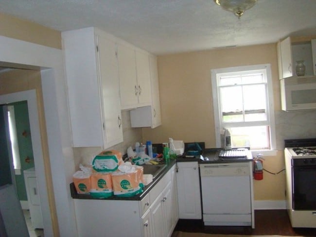
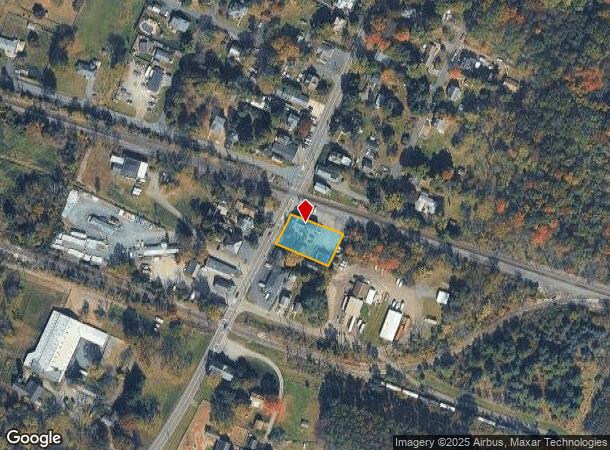
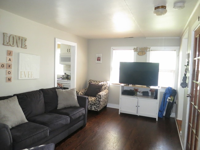
Property Record
430 Main St, Three Bridges, NJ 08887
NEARBY LISTINGS FOR SALE OR LEASE
Property Detail
430 Main St
22-00093-0000-00080
Three Bridges Tavern Inc
Vacantlandnec
Hunterdon
X
New Jersey
34019C0268F
80
2024
0.45 AC
2025
Hunterdon
011202
Northern New Jersey
4,242 SF
Newark, NJ
DEMOGRAPHICS near 430 Main St
1 mile
3 mile
5 mile
2024 Total Population
989
16,580
41,384
2029 Population
993
16,874
41,974
Pop Growth 2024-2029
+ 0.40%
+ 1.77%
+ 1.43%
Average Age
44
44
43
2024 Total Households
360
6,374
15,383
HH Growth 2024-2029
+ 0.56%
+ 1.84%
+ 1.46%
Median Household Inc
$146,474
$132,095
$135,055
Avg Household Size
2.70
2.60
2.60
2024 Avg HH Vehicles
2.00
2.00
2.00
Median Home Value
$510,736
$455,869
$480,313
Median Year Built
1981
1984
1982
Nearby Places
Map Layers
Map Styles
 Street
 Aerial
Transit
 Traffic
 Biking
Places
Listings with unknown addresses are not visible on the map
- Restaurants
- Banks
- Shops
- Fitness
- Groceries
PUBLIC TRANSPORTATION
COMMUTER RAIL
North Branch (Raritan Valley Line - NJ Transit Commuter Rail (NJ Transit))
Drive
Walk
Distance
North Branch (Raritan Valley Line - NJ Transit Commuter Rail (NJ Transit))
18 min
9.0 mi
AIRPORT
Trenton Mercer
Drive
Walk
Distance
Trenton Mercer
39 min
23.4 mi
Newark Liberty International
Drive
Walk
Distance
Newark Liberty International
56 min
44.1 mi
Lehigh Valley International
Drive
Walk
Distance
Lehigh Valley International
67 min
47.1 mi
Freight Ports
New York Container Terminal
Drive
Walk
Distance
New York Container Terminal
57 min
43.2 mi
SALE & LEASE HISTORY
LISTING DATE
SALE/LEASE

Sep 24, 2016
For Sale
Sep 01, 2017
For Sale
Jun 18, 2019
For Sale
Aug 28, 2017
For Sale
Nearby Properties
Address
Land Use
TOTAL SIZE
Lot Size
Zoning
Address
Land Use
TOTAL SIZE
Lot Size
Zoning
68.38 AC
P
Address
Land Use
TOTAL SIZE
Lot Size
Zoning
7.88 AC
CR
Address
Land Use
TOTAL SIZE
Lot Size
Zoning
39.32 AC
P
Address
Land Use
TOTAL SIZE
Lot Size
Zoning
19.85 AC
B-2
Address
Land Use
TOTAL SIZE
Lot Size
Zoning
26.03 AC
I-2
Address
Land Use
TOTAL SIZE
Lot Size
Zoning
108.22 AC
I-2
Address
Land Use
TOTAL SIZE
Lot Size
Zoning
1,418 SF
19.67 AC
P
Address
Land Use
TOTAL SIZE
Lot Size
Zoning
16.01 AC
I-2
Address
Land Use
TOTAL SIZE
Lot Size
Zoning
8.07 AC
I-2
Address
Land Use
TOTAL SIZE
Lot Size
Zoning
38.30 AC
O-2
Address
Land Use
TOTAL SIZE
Lot Size
Zoning
7.09 AC
I-2
Address
Land Use
TOTAL SIZE
Lot Size
Zoning
12 AC
R-5
Address
Land Use
TOTAL SIZE
Lot Size
Zoning
2,360 SF
36.04 AC
I-2
Address
Land Use
TOTAL SIZE
Lot Size
Zoning
17.88 AC
O-2
Address
Land Use
TOTAL SIZE
Lot Size
Zoning
1,968 SF
5.99 AC
B-2
Address
Land Use
TOTAL SIZE
Lot Size
Zoning
14.32 AC
AG
Address
Land Use
TOTAL SIZE
Lot Size
Zoning
28.68 AC
I-2
Address
Land Use
TOTAL SIZE
Lot Size
Zoning
7.69 AC
I-2
Address
Land Use
TOTAL SIZE
Lot Size
Zoning
48,738 SF
4.44 AC
GA
Address
Land Use
TOTAL SIZE
Lot Size
Zoning
7.14 AC
PCOS
Address
Land Use
TOTAL SIZE
Lot Size
Zoning
6.46 AC
I-2
Address
Land Use
TOTAL SIZE
Lot Size
Zoning
8.50 AC
VR
Address
Land Use
TOTAL SIZE
Lot Size
Zoning
8.74 AC
I-2
Address
Land Use
TOTAL SIZE
Lot Size
Zoning
3.17 AC
P
Address
Land Use
TOTAL SIZE
Lot Size
Zoning
4.14 AC
B-2
Address
Land Use
TOTAL SIZE
Lot Size
Zoning
7.26 AC
I-2
Address
Land Use
TOTAL SIZE
Lot Size
Zoning
18.76 AC
I-2
Address
Land Use
TOTAL SIZE
Lot Size
Zoning
7.75 AC
R-3
Address
Land Use
TOTAL SIZE
Lot Size
Zoning
1,305 SF
9.50 AC
O-2
Address
Land Use
TOTAL SIZE
Lot Size
Zoning
14.77 AC
I-2
The World's #1 Commercial Real Estate Marketplace
Connect with us
© 2026 CoStar Group
The information above has been obtained from sources believed reliable. While we do not doubt its accuracy we have not verified it and make no guarantee, warranty or representation about it. It is your responsibility to independently confirm its accuracy and completeness. Any projections, opinions, assumptions, or estimates used are for example only and do not represent the current or future performance of the property. The value of this transaction to you depends on tax and other factors which should be evaluated by your tax, financial, and legal advisors. You and your advisors should conduct a careful, independent investigation of the property to determine to your satisfaction the suitability of the property for your needs.