Property Record
430 N Dean St, Adrian, MI 49221

NEARBY LISTINGS FOR SALE OR LEASE
-
-
View all Adrian listings for lease on LoopNet.com
Property Detail
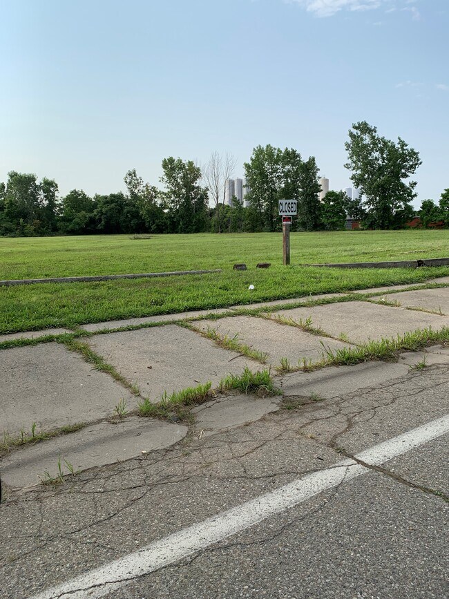
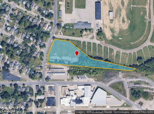
430 N Dean St
Adrian, MI
Ft From Se Cor Assrs Sub
XA0-100-0017-00
BEG N 3^30' E 206.37 FT FROM SE COR ASSRS SUB OF LOTS 9-10-19 & 20 BLK 6 A J COMSTOCKS EASTERN ADD NO. 2 TH S 88^42' E 66.23
Industrialacreage
Lenawee
X
Michigan
26091C0194D
9-10,19
2024
3.27 AC
2025
Lenawee County
061301
Toledo
DEMOGRAPHICS near 430 N Dean St
1 Mile
3 Mile
5 Mile
2024 Total Population
6,626
29,466
38,066
2029 Population
6,609
29,197
37,688
Pop Growth 2024-2029
(0.26%)
(0.91%)
(0.99%)
Average Age
38
40
40
2024 Total Households
2,563
10,755
13,844
HH Growth 2024-2029
(0.35%)
(0.97%)
(1.05%)
Median Household Inc
$26,828
$44,157
$49,703
Avg Household Size
2.40
2.30
2.40
2024 Avg HH Vehicles
2.00
2.00
2.00
Median Home Value
$60,884
$119,754
$140,223
Median Year Built
1949
1964
1970
Nearby Places
Map Layers
Map Styles
 Street
 Aerial
- Restaurants
- Banks
- Shops
- Fitness
- Groceries
PUBLIC TRANSPORTATION
AIRPORT
Eugene F Kranz Toledo Express
DRIVE
WALK
Distance
Eugene F Kranz Toledo Express
61 min
38.2 mi
Freight Ports
Port of Toledo
DRIVE
WALK
Distance
Port of Toledo
63 min
41.9 mi
SALE & LEASE HISTORY
LISTING DATE
SALE/LEASE

Nov 19, 2018
For Lease
Jan 11, 2017
For Sale
Nearby Properties
Address
Land Use
TOTAL SIZE
Lot Size
Zoning
Address
Land Use
TOTAL SIZE
Lot Size
Zoning
198,348 SF
28.50 AC
Address
Land Use
TOTAL SIZE
Lot Size
Zoning
297,470 SF
31.39 AC
I-2
Address
Land Use
TOTAL SIZE
Lot Size
Zoning
21.68 AC
B-4
Address
Land Use
TOTAL SIZE
Lot Size
Zoning
Address
Land Use
TOTAL SIZE
Lot Size
Zoning
51,068 SF
7.07 AC
Address
Land Use
TOTAL SIZE
Lot Size
Zoning
122,669 SF
14.27 AC
B-4
Address
Land Use
TOTAL SIZE
Lot Size
Zoning
83,180 SF
3.14 AC
ERO
Address
Land Use
TOTAL SIZE
Lot Size
Zoning
101,287 SF
16.98 AC
B-4
Address
Land Use
TOTAL SIZE
Lot Size
Zoning
805,326 SF
50.38 AC
Address
Land Use
TOTAL SIZE
Lot Size
Zoning
136,850 SF
10.37 AC
RM-1
Address
Land Use
TOTAL SIZE
Lot Size
Zoning
35,880 SF
2.45 AC
Address
Land Use
TOTAL SIZE
Lot Size
Zoning
512,408 SF
33.83 AC
I-2
Address
Land Use
TOTAL SIZE
Lot Size
Zoning
53,333 SF
6.70 AC
B-4
Address
Land Use
TOTAL SIZE
Lot Size
Zoning
86,479 SF
4.79 AC
Address
Land Use
TOTAL SIZE
Lot Size
Zoning
49,676 SF
0.94 AC
RM-2
Address
Land Use
TOTAL SIZE
Lot Size
Zoning
29.25 AC
B-4
Address
Land Use
TOTAL SIZE
Lot Size
Zoning
42,682 SF
6.41 AC
B-2
Address
Land Use
TOTAL SIZE
Lot Size
Zoning
191,777 SF
6.15 AC
E-1
Address
Land Use
TOTAL SIZE
Lot Size
Zoning
35,534 SF
4.48 AC
Address
Land Use
TOTAL SIZE
Lot Size
Zoning
30,451 SF
7.99 AC
Address
Land Use
TOTAL SIZE
Lot Size
Zoning
17,751 SF
2.76 AC
B-2
Address
Land Use
TOTAL SIZE
Lot Size
Zoning
72,839 SF
7.05 AC
RM-1
Address
Land Use
TOTAL SIZE
Lot Size
Zoning
37.20 AC
Address
Land Use
TOTAL SIZE
Lot Size
Zoning
288,960 SF
20.14 AC
Address
Land Use
TOTAL SIZE
Lot Size
Zoning
5,459 SF
10.01 AC
Address
Land Use
TOTAL SIZE
Lot Size
Zoning
26,404 SF
7.12 AC
ERO
Address
Land Use
TOTAL SIZE
Lot Size
Zoning
68,520 SF
7.01 AC
RM-1
Address
Land Use
TOTAL SIZE
Lot Size
Zoning
352,875 SF
12.08 AC
I-1
Address
Land Use
TOTAL SIZE
Lot Size
Zoning
123,550 SF
29.33 AC
I-1
Address
Land Use
TOTAL SIZE
Lot Size
Zoning
3.82 AC
I-1
The World's #1 Commercial Real Estate Marketplace
Connect with us
© 2025 CoStar Group
The information above has been obtained from sources believed reliable. While we do not doubt its accuracy we have not verified it and make no guarantee, warranty or representation about it. It is your responsibility to independently confirm its accuracy and completeness. Any projections, opinions, assumptions, or estimates used are for example only and do not represent the current or future performance of the property. The value of this transaction to you depends on tax and other factors which should be evaluated by your tax, financial, and legal advisors. You and your advisors should conduct a careful, independent investigation of the property to determine to your satisfaction the suitability of the property for your needs.