Property Record
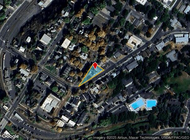
430 Ne Maple St, Pullman, WA 99163

NEARBY LISTINGS FOR SALE OR LEASE
-
-
View all Pullman listings for sale on LoopNet.com
Property Detail
430 Ne Maple St
Other Market Areas
Pullman Reaneys
Pullman, WA
PULLMAN REANEYS 2ND, LOT 01, BLOCK 01
112350001010002
Whitman
Multifamilydwelling
Washington
2025
01
2025
0.29 AC
000100
Washington State Area
DEMOGRAPHICS near 430 Ne Maple St
1 Mile
3 Mile
5 Mile
2024 Total Population
20,025
34,241
34,965
2029 Population
20,254
34,606
35,322
Pop Growth 2024-2029
+ 1.14%
+ 1.07%
+ 1.02%
Average Age
29
30
30
2024 Total Households
7,107
13,110
13,427
HH Growth 2024-2029
+ 1.97%
+ 1.32%
+ 1.24%
Median Household Inc
$27,706
$34,330
$34,640
Avg Household Size
2.10
2.10
2.10
2024 Avg HH Vehicles
2.00
2.00
2.00
Median Home Value
$340,636
$371,195
$366,865
Median Year Built
1980
1988
1987
Nearby Places
Map Layers
Map Styles
 Street
 Aerial
- Restaurants
- Banks
- Shops
- Fitness
- Groceries
PUBLIC TRANSPORTATION
AIRPORT
Pullman/Moscow Regional
DRIVE
WALK
Distance
Pullman/Moscow Regional
9 min
4.8 mi
Lewiston/Nez Perce County
DRIVE
WALK
Distance
Lewiston/Nez Perce County
59 min
36.0 mi
Freight Ports
Port of Tacoma
DRIVE
WALK
Distance
Port of Tacoma
382 min
299.5 mi
Nearby Properties
Address
Land Use
TOTAL SIZE
Lot Size
Zoning
Address
Land Use
TOTAL SIZE
Lot Size
Zoning
12,941 SF
54.37 AC
Address
Land Use
TOTAL SIZE
Lot Size
Zoning
15,106 SF
10.70 AC
Address
Land Use
TOTAL SIZE
Lot Size
Zoning
269,055 SF
68.10 AC
Address
Land Use
TOTAL SIZE
Lot Size
Zoning
192,368 SF
4 AC
Address
Land Use
TOTAL SIZE
Lot Size
Zoning
207,171 SF
10 AC
Address
Land Use
TOTAL SIZE
Lot Size
Zoning
103,039 SF
Address
Land Use
TOTAL SIZE
Lot Size
Zoning
Address
Land Use
TOTAL SIZE
Lot Size
Zoning
147,697 SF
27.52 AC
Address
Land Use
TOTAL SIZE
Lot Size
Zoning
13.55 AC
Address
Land Use
TOTAL SIZE
Lot Size
Zoning
390,660 SF
Address
Land Use
TOTAL SIZE
Lot Size
Zoning
11.49 AC
Address
Land Use
TOTAL SIZE
Lot Size
Zoning
23,868 SF
12.70 AC
Address
Land Use
TOTAL SIZE
Lot Size
Zoning
2.79 AC
Address
Land Use
TOTAL SIZE
Lot Size
Zoning
Address
Land Use
TOTAL SIZE
Lot Size
Zoning
93,290 SF
12.04 AC
Address
Land Use
TOTAL SIZE
Lot Size
Zoning
10.27 AC
Address
Land Use
TOTAL SIZE
Lot Size
Zoning
8.44 AC
Address
Land Use
TOTAL SIZE
Lot Size
Zoning
194,697 SF
9.40 AC
Address
Land Use
TOTAL SIZE
Lot Size
Zoning
208,000 SF
0.12 AC
Address
Land Use
TOTAL SIZE
Lot Size
Zoning
89,760 SF
Address
Land Use
TOTAL SIZE
Lot Size
Zoning
93,193 SF
4 AC
Address
Land Use
TOTAL SIZE
Lot Size
Zoning
8.40 AC
Address
Land Use
TOTAL SIZE
Lot Size
Zoning
Address
Land Use
TOTAL SIZE
Lot Size
Zoning
7.02 AC
Address
Land Use
TOTAL SIZE
Lot Size
Zoning
7.57 AC
Address
Land Use
TOTAL SIZE
Lot Size
Zoning
37,524 SF
9 AC
Address
Land Use
TOTAL SIZE
Lot Size
Zoning
446,606 SF
11.69 AC
Address
Land Use
TOTAL SIZE
Lot Size
Zoning
15,156 SF
7.40 AC
Address
Land Use
TOTAL SIZE
Lot Size
Zoning
74,172 SF
Address
Land Use
TOTAL SIZE
Lot Size
Zoning
5.02 AC
The World's #1 Commercial Real Estate Marketplace
Connect with us
© 2026 CoStar Group
The information above has been obtained from sources believed reliable. While we do not doubt its accuracy we have not verified it and make no guarantee, warranty or representation about it. It is your responsibility to independently confirm its accuracy and completeness. Any projections, opinions, assumptions, or estimates used are for example only and do not represent the current or future performance of the property. The value of this transaction to you depends on tax and other factors which should be evaluated by your tax, financial, and legal advisors. You and your advisors should conduct a careful, independent investigation of the property to determine to your satisfaction the suitability of the property for your needs.