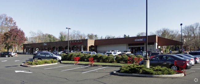
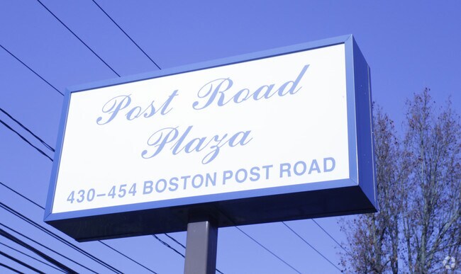
Property Record
430 Post Rd, Darien, CT 06820

Property Detail
430 Post Rd
Storebuilding
FAIRFIELD
DB2
Connecticut
C and X Area of minimal flood hazard, usually depicted on FIRMs as above the 500-year flood level.
1.84 AC
2024
Darien
2025
Westchester/So Connecticut
030200
Bridgeport-Stamford-Danbury, CT
19,864 SF
DARI-000035-000000-000001
NEARBY LISTINGS FOR SALE OR LEASE
DEMOGRAPHICS near 430 Post Rd
1 mile
3 mile
5 mile
2025 Total Population
6,950
71,620
215,847
2030 Population
7,208
73,261
220,839
Pop Growth 2025-2030
+ 3.71%
+ 2.29%
+ 2.31%
Average Age
40
40
40
2025 Total Households
2,350
25,787
84,499
HH Growth 2025-2030
+ 3.57%
+ 2.27%
+ 2.45%
Median Household Inc
$230,447
$123,936
$112,458
Avg Household Size
2.90
2.70
2.50
2025 Avg HH Vehicles
2.00
2.00
2.00
Median Home Value
$1,077,554
$886,316
$715,683
Median Year Built
1964
1963
1967
Nearby Places
Map Layers
Map Styles
 Street
 Aerial
Transit
 Traffic
 Biking
Places
Listings with unknown addresses are not visible on the map
- Restaurants
- Banks
- Shops
- Fitness
- Groceries
PUBLIC TRANSPORTATION
TRANSIT/SUBWAY
Darien Station (New Haven Line - Metro-North Commuter Railroad Company (Metro-North))
Drive
Walk
Distance
Darien Station (New Haven Line - Metro-North Commuter Railroad Company (Metro-North))
3 min
20 min
1.0 mi
COMMUTER RAIL
Darien Station (New Haven Line - Metro-North Commuter Railroad Company (Metro-North))
Drive
Walk
Distance
Darien Station (New Haven Line - Metro-North Commuter Railroad Company (Metro-North))
3 min
20 min
1.0 mi
Rowayton Station (New Haven Line - Metro-North Commuter Railroad Company (Metro-North))
Drive
Walk
Distance
Rowayton Station (New Haven Line - Metro-North Commuter Railroad Company (Metro-North))
5 min
1.9 mi
AIRPORT
Westchester County
Drive
Walk
Distance
Westchester County
30 min
17.8 mi
LaGuardia
Drive
Walk
Distance
LaGuardia
56 min
37.0 mi
Freight Ports
Port of New Haven
Drive
Walk
Distance
Port of New Haven
53 min
36.3 mi
Nearby Properties
Address
Land Use
TOTAL SIZE
Lot Size
Zoning
Address
Land Use
TOTAL SIZE
Lot Size
Zoning
8.91 AC
DC
Address
Land Use
TOTAL SIZE
Lot Size
Zoning
336,000 SF
40 AC
MU
Address
Land Use
TOTAL SIZE
Lot Size
Zoning
32.06 AC
DMR
Address
Land Use
TOTAL SIZE
Lot Size
Zoning
124,373 SF
13.87 AC
A2
Address
Land Use
TOTAL SIZE
Lot Size
Zoning
17 AC
A2
Address
Land Use
TOTAL SIZE
Lot Size
Zoning
Address
Land Use
TOTAL SIZE
Lot Size
Zoning
128,459 SF
1.49 AC
I1
Address
Land Use
TOTAL SIZE
Lot Size
Zoning
45.90 AC
R-1
Address
Land Use
TOTAL SIZE
Lot Size
Zoning
130,394 SF
28.72 AC
B
Address
Land Use
TOTAL SIZE
Lot Size
Zoning
202.60 AC
WAVE
Address
Land Use
TOTAL SIZE
Lot Size
Zoning
41.63 AC
A2
Address
Land Use
TOTAL SIZE
Lot Size
Zoning
171,335 SF
25.94 AC
MU
Address
Land Use
TOTAL SIZE
Lot Size
Zoning
58,269 SF
9.86 AC
MU
Address
Land Use
TOTAL SIZE
Lot Size
Zoning
200,704 SF
Address
Land Use
TOTAL SIZE
Lot Size
Zoning
175,791 SF
1.58 AC
CBDB
Address
Land Use
TOTAL SIZE
Lot Size
Zoning
9.76 AC
B1
Address
Land Use
TOTAL SIZE
Lot Size
Zoning
132,185 SF
3.99 AC
DO
Address
Land Use
TOTAL SIZE
Lot Size
Zoning
141,174 SF
10.75 AC
B2
Address
Land Use
TOTAL SIZE
Lot Size
Zoning
3.40 AC
RPDD
Address
Land Use
TOTAL SIZE
Lot Size
Zoning
119,531 SF
17.92 AC
D
Address
Land Use
TOTAL SIZE
Lot Size
Zoning
12.71 AC
B2
Address
Land Use
TOTAL SIZE
Lot Size
Zoning
10.53 AC
B2
Address
Land Use
TOTAL SIZE
Lot Size
Zoning
110,187 SF
10.09 AC
B2
Address
Land Use
TOTAL SIZE
Lot Size
Zoning
4,378 SF
1.46 AC
NB
Address
Land Use
TOTAL SIZE
Lot Size
Zoning
9.60 AC
MU
Address
Land Use
TOTAL SIZE
Lot Size
Zoning
9.75 AC
B2
Address
Land Use
TOTAL SIZE
Lot Size
Zoning
96,563 SF
9.49 AC
DC
Address
Land Use
TOTAL SIZE
Lot Size
Zoning
24,704 SF
1.52 AC
I1
Address
Land Use
TOTAL SIZE
Lot Size
Zoning
135,048 SF
1.90 AC
WSDD
Address
Land Use
TOTAL SIZE
Lot Size
Zoning
133,560 SF
2.30 AC
I1
The World's #1 Commercial Real Estate Marketplace
Connect with us
© 2026 CoStar Group
The information above has been obtained from sources believed reliable. While we do not doubt its accuracy we have not verified it and make no guarantee, warranty or representation about it. It is your responsibility to independently confirm its accuracy and completeness. Any projections, opinions, assumptions, or estimates used are for example only and do not represent the current or future performance of the property. The value of this transaction to you depends on tax and other factors which should be evaluated by your tax, financial, and legal advisors. You and your advisors should conduct a careful, independent investigation of the property to determine to your satisfaction the suitability of the property for your needs.