Property Record
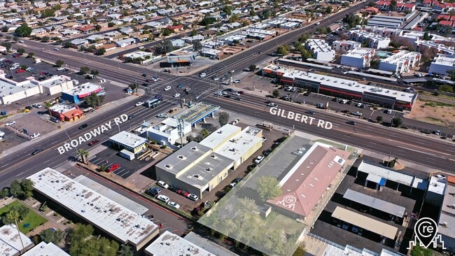
430 S Gilbert Rd, Mesa, AZ 85204


Property Detail
430 S Gilbert Rd
139-01-170
KACHINA PARKWAY UNIT 4 TRACT B THROUGH D MCR 182-05
Animalhospitalvet
Maricopa
C-C
Arizona
C and X Area of minimal flood hazard, usually depicted on FIRMs as above the 500-year flood level.
b
2025
0.65 AC
2025
Red Mountain/Mesa
421802
Phoenix
6,924 SF
Phoenix-Mesa-Chandler, AZ
NEARBY LISTINGS FOR SALE OR LEASE
DEMOGRAPHICS near 430 S Gilbert Rd
1 mile
3 mile
5 mile
2025 Total Population
25,776
164,552
376,035
2030 Population
26,606
170,158
389,752
Pop Growth 2025-2030
+ 3.22%
+ 3.41%
+ 3.65%
Average Age
35
38
39
2025 Total Households
8,808
59,364
140,638
HH Growth 2025-2030
+ 3.50%
+ 3.75%
+ 3.93%
Median Household Inc
$62,433
$72,985
$76,025
Avg Household Size
2.80
2.70
2.60
2025 Avg HH Vehicles
2.00
2.00
2.00
Median Home Value
$338,170
$384,543
$421,867
Median Year Built
1978
1982
1985
Nearby Places
Map Layers
Map Styles
 Street
 Aerial
Transit
 Traffic
 Biking
Places
Listings with unknown addresses are not visible on the map
- Restaurants
- Banks
- Shops
- Fitness
- Groceries
PUBLIC TRANSPORTATION
AIRPORT
Phoenix-Mesa Gateway
Drive
Walk
Distance
Phoenix-Mesa Gateway
23 min
14.3 mi
Phoenix Sky Harbor International
Drive
Walk
Distance
Phoenix Sky Harbor International
26 min
17.6 mi
SALE & LEASE HISTORY
LISTING DATE
SALE/LEASE

Jan 23, 2023
For Sale
Nearby Properties
Address
Land Use
TOTAL SIZE
Lot Size
Zoning
Address
Land Use
TOTAL SIZE
Lot Size
Zoning
125,356 SF
21.63 AC
R-9
Address
Land Use
TOTAL SIZE
Lot Size
Zoning
7.90 AC
Address
Land Use
TOTAL SIZE
Lot Size
Zoning
184,558 SF
6.18 AC
Address
Land Use
TOTAL SIZE
Lot Size
Zoning
127,962 SF
18.60 AC
I-1
Address
Land Use
TOTAL SIZE
Lot Size
Zoning
5.92 AC
I-1
Address
Land Use
TOTAL SIZE
Lot Size
Zoning
4.96 AC
Address
Land Use
TOTAL SIZE
Lot Size
Zoning
30,075 SF
6.86 AC
I-1
Address
Land Use
TOTAL SIZE
Lot Size
Zoning
377,442 SF
0.21 AC
C-DT
Address
Land Use
TOTAL SIZE
Lot Size
Zoning
400,798 SF
55.94 AC
PF
Address
Land Use
TOTAL SIZE
Lot Size
Zoning
62,328 SF
2.65 AC
Address
Land Use
TOTAL SIZE
Lot Size
Zoning
281,301 SF
19.13 AC
I-1
Address
Land Use
TOTAL SIZE
Lot Size
Zoning
13,336 SF
1.98 AC
I-2
Address
Land Use
TOTAL SIZE
Lot Size
Zoning
579,506 SF
17.78 AC
PF
Address
Land Use
TOTAL SIZE
Lot Size
Zoning
20.08 AC
Address
Land Use
TOTAL SIZE
Lot Size
Zoning
185,382 SF
23.37 AC
C-G
Address
Land Use
TOTAL SIZE
Lot Size
Zoning
454,015 SF
10.03 AC
DB1
Address
Land Use
TOTAL SIZE
Lot Size
Zoning
427,210 SF
38.33 AC
PF
Address
Land Use
TOTAL SIZE
Lot Size
Zoning
572,119 SF
22.45 AC
PF
Address
Land Use
TOTAL SIZE
Lot Size
Zoning
344,641 SF
21.43 AC
I-1
Address
Land Use
TOTAL SIZE
Lot Size
Zoning
348,151 SF
20.69 AC
LI
Address
Land Use
TOTAL SIZE
Lot Size
Zoning
1.46 AC
C-G
Address
Land Use
TOTAL SIZE
Lot Size
Zoning
478,411 SF
4.07 AC
CDT
Address
Land Use
TOTAL SIZE
Lot Size
Zoning
1.17 AC
Address
Land Use
TOTAL SIZE
Lot Size
Zoning
199,472 SF
4.79 AC
C-DT
Address
Land Use
TOTAL SIZE
Lot Size
Zoning
1.62 AC
Address
Land Use
TOTAL SIZE
Lot Size
Zoning
367,012 SF
19.91 AC
M-H
Address
Land Use
TOTAL SIZE
Lot Size
Zoning
100,580 SF
22.70 AC
C-G
Address
Land Use
TOTAL SIZE
Lot Size
Zoning
26,951 SF
1.08 AC
I-1
Address
Land Use
TOTAL SIZE
Lot Size
Zoning
92,285 SF
7.90 AC
PEP
Address
Land Use
TOTAL SIZE
Lot Size
Zoning
233,188 SF
7.34 AC
RM4
The World's #1 Commercial Real Estate Marketplace
Connect with us
© 2026 CoStar Group
The information above has been obtained from sources believed reliable. While we do not doubt its accuracy we have not verified it and make no guarantee, warranty or representation about it. It is your responsibility to independently confirm its accuracy and completeness. Any projections, opinions, assumptions, or estimates used are for example only and do not represent the current or future performance of the property. The value of this transaction to you depends on tax and other factors which should be evaluated by your tax, financial, and legal advisors. You and your advisors should conduct a careful, independent investigation of the property to determine to your satisfaction the suitability of the property for your needs.