Property Record
430 Storm Branch Rd, Beech Island, SC 29842
NEARBY LISTINGS FOR SALE OR LEASE
Property Detail
430 Storm Branch Rd
Augusta-Richmond County, GA-SC
Comm N Augusta Atomic Road 01
024-18-01-001
SOUTH OF HWY 145
Farms
Aiken
X
South Carolina
13245C0135H
030
2025
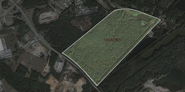
110.29 AC
2025
Outlying Aiken County
020904
Augusta/Richmond County
320 SF
DEMOGRAPHICS near 430 Storm Branch Rd
1 mile
3 mile
5 mile
2024 Total Population
765
17,897
58,706
2029 Population
798
18,706
62,117
Pop Growth 2024-2029
+ 4.31%
+ 4.52%
+ 5.81%
Average Age
40
39
41
2024 Total Households
310
7,343
24,825
HH Growth 2024-2029
+ 4.19%
+ 4.40%
+ 5.61%
Median Household Inc
$34,201
$37,946
$43,243
Avg Household Size
2.40
2.40
2.30
2024 Avg HH Vehicles
2.00
2.00
2.00
Median Home Value
$94,148
$113,478
$149,454
Median Year Built
1972
1970
1974
Nearby Places
Map Layers
Map Styles
 Street
 Aerial
Transit
 Traffic
 Biking
Places
Listings with unknown addresses are not visible on the map
- Restaurants
- Banks
- Shops
- Fitness
- Groceries
PUBLIC TRANSPORTATION
AIRPORT
Augusta Regional at Bush Field
Drive
Walk
Distance
Augusta Regional at Bush Field
26 min
13.5 mi
Freight Ports
Georgia Ports - Savannah
Drive
Walk
Distance
Georgia Ports - Savannah
164 min
123.2 mi
SALE & LEASE HISTORY
LISTING DATE
SALE/LEASE

Jun 01, 2018
For Sale
Nearby Properties
Address
Land Use
TOTAL SIZE
Lot Size
Zoning
Address
Land Use
TOTAL SIZE
Lot Size
Zoning
87,336 SF
32.85 AC
Address
Land Use
TOTAL SIZE
Lot Size
Zoning
60,606 SF
30.62 AC
Address
Land Use
TOTAL SIZE
Lot Size
Zoning
88,279 SF
19.63 AC
R-1C
Address
Land Use
TOTAL SIZE
Lot Size
Zoning
52,613 SF
82.26 AC
Address
Land Use
TOTAL SIZE
Lot Size
Zoning
59,280 SF
11.12 AC
Address
Land Use
TOTAL SIZE
Lot Size
Zoning
40,980 SF
5.15 AC
Address
Land Use
TOTAL SIZE
Lot Size
Zoning
34,522 SF
2.59 AC
Address
Land Use
TOTAL SIZE
Lot Size
Zoning
40,190 SF
25.91 AC
R-3B
Address
Land Use
TOTAL SIZE
Lot Size
Zoning
84,292 SF
38.96 AC
Address
Land Use
TOTAL SIZE
Lot Size
Zoning
2,954 SF
25.91 AC
R-3B
Address
Land Use
TOTAL SIZE
Lot Size
Zoning
473 AC
Address
Land Use
TOTAL SIZE
Lot Size
Zoning
67,090 SF
25.91 AC
R-3B
Address
Land Use
TOTAL SIZE
Lot Size
Zoning
12,449 SF
2.20 AC
Address
Land Use
TOTAL SIZE
Lot Size
Zoning
3,308 SF
2.20 AC
Address
Land Use
TOTAL SIZE
Lot Size
Zoning
30.36 AC
Address
Land Use
TOTAL SIZE
Lot Size
Zoning
56,940 SF
63.08 AC
Address
Land Use
TOTAL SIZE
Lot Size
Zoning
28.62 AC
Address
Land Use
TOTAL SIZE
Lot Size
Zoning
28.61 AC
Address
Land Use
TOTAL SIZE
Lot Size
Zoning
17,640 SF
9.35 AC
HI
Address
Land Use
TOTAL SIZE
Lot Size
Zoning
9,909 SF
2.95 AC
Address
Land Use
TOTAL SIZE
Lot Size
Zoning
17,654 SF
7.54 AC
B-1
Address
Land Use
TOTAL SIZE
Lot Size
Zoning
Address
Land Use
TOTAL SIZE
Lot Size
Zoning
5.99 AC
Address
Land Use
TOTAL SIZE
Lot Size
Zoning
19.70 AC
Address
Land Use
TOTAL SIZE
Lot Size
Zoning
3,592 SF
25.91 AC
R-3B
Address
Land Use
TOTAL SIZE
Lot Size
Zoning
11,000 SF
18.30 AC
Address
Land Use
TOTAL SIZE
Lot Size
Zoning
7,000 SF
11.30 AC
Address
Land Use
TOTAL SIZE
Lot Size
Zoning
6,426 SF
3.07 AC
HI
Address
Land Use
TOTAL SIZE
Lot Size
Zoning
Address
Land Use
TOTAL SIZE
Lot Size
Zoning
3,592 SF
26.31 AC
R-3B
The World's #1 Commercial Real Estate Marketplace
Connect with us
© 2026 CoStar Group
The information above has been obtained from sources believed reliable. While we do not doubt its accuracy we have not verified it and make no guarantee, warranty or representation about it. It is your responsibility to independently confirm its accuracy and completeness. Any projections, opinions, assumptions, or estimates used are for example only and do not represent the current or future performance of the property. The value of this transaction to you depends on tax and other factors which should be evaluated by your tax, financial, and legal advisors. You and your advisors should conduct a careful, independent investigation of the property to determine to your satisfaction the suitability of the property for your needs.