Property Record
430 W Napa St, Sonoma, CA 95476


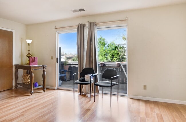

This Property Is For Sale
NEARBY LISTINGS FOR SALE OR LEASE
Property Detail
430 W Napa St
Santa Rosa, CA
Piphers 04 St Add
018-193-048
2011 FM 018-193-045 & 046 VM CITY OF SONOMA
Commercialofficeresidentialmixeduse
Sonoma
X
California
06097C0937E
9
2024
0.30 AC
2025
Sonoma/Wine Country
150205
North Bay/Santa Rosa
6,946 SF
DEMOGRAPHICS near 430 W Napa St
1 Mile
3 Mile
5 Mile
2024 Total Population
10,731
32,135
35,080
2029 Population
10,727
31,785
34,607
Pop Growth 2024-2029
(0.04%)
(1.09%)
(1.35%)
Average Age
49
47
47
2024 Total Households
5,067
13,726
14,949
HH Growth 2024-2029
(0.02%)
(1.09%)
(1.34%)
Median Household Inc
$99,613
$102,903
$106,266
Avg Household Size
2.10
2.30
2.30
2024 Avg HH Vehicles
2.00
2.00
2.00
Median Home Value
$832,589
$844,986
$867,717
Median Year Built
1975
1977
1976
Nearby Places
Map Layers
Map Styles
 Street
 Aerial
- Restaurants
- Banks
- Shops
- Fitness
- Groceries
PUBLIC TRANSPORTATION
AIRPORT
Charles M Schulz - Sonoma County
DRIVE
WALK
Distance
Charles M Schulz - Sonoma County
47 min
28.8 mi
Freight Ports
Port of Richmond
DRIVE
WALK
Distance
Port of Richmond
57 min
39.2 mi
Nearby Properties
Address
Land Use
TOTAL SIZE
Lot Size
Zoning
Address
Land Use
TOTAL SIZE
Lot Size
Zoning
56,325 SF
6 AC
K
Address
Land Use
TOTAL SIZE
Lot Size
Zoning
52,919 SF
5.08 AC
Address
Land Use
TOTAL SIZE
Lot Size
Zoning
146,481 SF
9.20 AC
Address
Land Use
TOTAL SIZE
Lot Size
Zoning
126,258 SF
5.83 AC
Address
Land Use
TOTAL SIZE
Lot Size
Zoning
131,876 SF
5.46 AC
R3
Address
Land Use
TOTAL SIZE
Lot Size
Zoning
54,660 SF
1.70 AC
R11UA
Address
Land Use
TOTAL SIZE
Lot Size
Zoning
59,651 SF
3.28 AC
RR3
Address
Land Use
TOTAL SIZE
Lot Size
Zoning
228,000 SF
11.27 AC
Address
Land Use
TOTAL SIZE
Lot Size
Zoning
234,600 SF
12.01 AC
Address
Land Use
TOTAL SIZE
Lot Size
Zoning
295,680 SF
16.85 AC
Address
Land Use
TOTAL SIZE
Lot Size
Zoning
6,855 SF
120.70 AC
Address
Land Use
TOTAL SIZE
Lot Size
Zoning
38,031 SF
0.51 AC
Address
Land Use
TOTAL SIZE
Lot Size
Zoning
39,612 SF
2.02 AC
R11UA
Address
Land Use
TOTAL SIZE
Lot Size
Zoning
96,820 SF
6.29 AC
Address
Land Use
TOTAL SIZE
Lot Size
Zoning
91,708 SF
5 AC
Address
Land Use
TOTAL SIZE
Lot Size
Zoning
6,157 SF
89.68 AC
Address
Land Use
TOTAL SIZE
Lot Size
Zoning
291,760 SF
16.98 AC
Address
Land Use
TOTAL SIZE
Lot Size
Zoning
18,270 SF
80.12 AC
DA60
Address
Land Use
TOTAL SIZE
Lot Size
Zoning
40,371 SF
1.52 AC
Address
Land Use
TOTAL SIZE
Lot Size
Zoning
147,040 SF
64.85 AC
Address
Land Use
TOTAL SIZE
Lot Size
Zoning
33,986 SF
2.07 AC
R2H
Address
Land Use
TOTAL SIZE
Lot Size
Zoning
78,405 SF
5.31 AC
R1
Address
Land Use
TOTAL SIZE
Lot Size
Zoning
6,718 SF
629.94 AC
LEA100
Address
Land Use
TOTAL SIZE
Lot Size
Zoning
52,445 SF
1.69 AC
AWH
Address
Land Use
TOTAL SIZE
Lot Size
Zoning
1,243 SF
4 AC
AR3
Address
Land Use
TOTAL SIZE
Lot Size
Zoning
39,436 SF
3.41 AC
R3
Address
Land Use
TOTAL SIZE
Lot Size
Zoning
5,255 SF
103.71 AC
DA40
Address
Land Use
TOTAL SIZE
Lot Size
Zoning
38,736 SF
2.64 AC
M3
Address
Land Use
TOTAL SIZE
Lot Size
Zoning
118,295 SF
8.49 AC
Address
Land Use
TOTAL SIZE
Lot Size
Zoning
40,200 SF
1.80 AC
R3
The World's #1 Commercial Real Estate Marketplace
Connect with us
© 2025 CoStar Group
The information above has been obtained from sources believed reliable. While we do not doubt its accuracy we have not verified it and make no guarantee, warranty or representation about it. It is your responsibility to independently confirm its accuracy and completeness. Any projections, opinions, assumptions, or estimates used are for example only and do not represent the current or future performance of the property. The value of this transaction to you depends on tax and other factors which should be evaluated by your tax, financial, and legal advisors. You and your advisors should conduct a careful, independent investigation of the property to determine to your satisfaction the suitability of the property for your needs.