Property Record
4300 E 49Th St, Cleveland, OH 44125


NEARBY LISTINGS FOR SALE OR LEASE
Property Detail
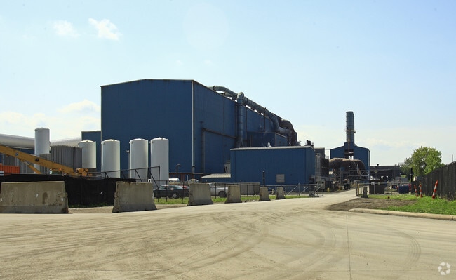
4300 E 49Th St
521-12-001
291 293 308 000C
Heavyindustrial
Cuyahoga
X
Ohio
39035C0183E
c
2024
94.46 AC
2024
Brooklyn Hts
196100
Cleveland
194,257 SF
Cleveland-Elyria, OH
DEMOGRAPHICS near 4300 E 49Th St
1 Mile
3 Mile
5 Mile
2024 Total Population
3,155
87,742
306,986
2029 Population
2,985
84,853
299,081
Pop Growth 2024-2029
(5.39%)
(3.29%)
(2.58%)
Average Age
41
38
39
2024 Total Households
1,440
37,482
136,633
HH Growth 2024-2029
(5.83%)
(3.54%)
(2.57%)
Median Household Inc
$43,739
$38,908
$42,003
Avg Household Size
2.20
2.20
2.10
2024 Avg HH Vehicles
2.00
1.00
1.00
Median Home Value
$90,259
$91,438
$108,859
Median Year Built
1949
1947
1949
Nearby Places
Map Layers
Map Styles
 Street
 Aerial
- Restaurants
- Banks
- Shops
- Fitness
- Groceries
PUBLIC TRANSPORTATION
COMMUTER RAIL
Rockside (National Park Scenic Railway - Cuyahoga Valley Scenic Railroad)
DRIVE
WALK
Distance
Rockside (National Park Scenic Railway - Cuyahoga Valley Scenic Railroad)
12 min
4.9 mi
Cleveland Lakefront Station (Blue Line - Greater Cleveland Regional Transit Authority Rapid Transit (The Rapid), Green Line - Greater Cleveland Regional Transit Authority Rapid Transit (The Rapid))
DRIVE
WALK
Distance
Cleveland Lakefront Station (Blue Line - Greater Cleveland Regional Transit Authority Rapid Transit (The Rapid), Green Line - Greater Cleveland Regional Transit Authority Rapid Transit (The Rapid))
17 min
7.1 mi
AIRPORT
Cleveland-Hopkins International
DRIVE
WALK
Distance
Cleveland-Hopkins International
26 min
14.6 mi
Freight Ports
Port of Toledo
DRIVE
WALK
Distance
Port of Toledo
140 min
115.6 mi
Nearby Properties
Address
Land Use
TOTAL SIZE
Lot Size
Zoning
Address
Land Use
TOTAL SIZE
Lot Size
Zoning
3,491,901 SF
34.32 AC
Address
Land Use
TOTAL SIZE
Lot Size
Zoning
162,711 SF
192.04 AC
IG
Address
Land Use
TOTAL SIZE
Lot Size
Zoning
230,820 SF
41.47 AC
UI
Address
Land Use
TOTAL SIZE
Lot Size
Zoning
257,857 SF
8.03 AC
GR
Address
Land Use
TOTAL SIZE
Lot Size
Zoning
279,200 SF
37.19 AC
IG
Address
Land Use
TOTAL SIZE
Lot Size
Zoning
595.30 AC
UI
Address
Land Use
TOTAL SIZE
Lot Size
Zoning
248,498 SF
14.31 AC
U-8
Address
Land Use
TOTAL SIZE
Lot Size
Zoning
228,134 SF
40.65 AC
UI
Address
Land Use
TOTAL SIZE
Lot Size
Zoning
46,250 SF
16.36 AC
U-5
Address
Land Use
TOTAL SIZE
Lot Size
Zoning
239,000 SF
6.29 AC
U-6A
Address
Land Use
TOTAL SIZE
Lot Size
Zoning
372,486 SF
3.98 AC
GR
Address
Land Use
TOTAL SIZE
Lot Size
Zoning
361,287 SF
86.50 AC
2F
Address
Land Use
TOTAL SIZE
Lot Size
Zoning
205,724 SF
6.54 AC
U-8
Address
Land Use
TOTAL SIZE
Lot Size
Zoning
500,398 SF
24.49 AC
IG
Address
Land Use
TOTAL SIZE
Lot Size
Zoning
180,175 SF
111.96 AC
IG
Address
Land Use
TOTAL SIZE
Lot Size
Zoning
209,068 SF
23.10 AC
IG
Address
Land Use
TOTAL SIZE
Lot Size
Zoning
277,049 SF
24.15 AC
2F
Address
Land Use
TOTAL SIZE
Lot Size
Zoning
19.48 AC
U5-A
Address
Land Use
TOTAL SIZE
Lot Size
Zoning
133,913 SF
18.36 AC
U-11B
Address
Land Use
TOTAL SIZE
Lot Size
Zoning
116,373 SF
13.28 AC
U-3
Address
Land Use
TOTAL SIZE
Lot Size
Zoning
232,763 SF
21.37 AC
UI
Address
Land Use
TOTAL SIZE
Lot Size
Zoning
17,158 SF
20.86 AC
MF-1
Address
Land Use
TOTAL SIZE
Lot Size
Zoning
197,916 SF
9.10 AC
MF-1
Address
Land Use
TOTAL SIZE
Lot Size
Zoning
172,448 SF
13.95 AC
Address
Land Use
TOTAL SIZE
Lot Size
Zoning
83,925 SF
3.09 AC
U5HRMU
Address
Land Use
TOTAL SIZE
Lot Size
Zoning
156,790 SF
11.28 AC
GR
Address
Land Use
TOTAL SIZE
Lot Size
Zoning
149,468 SF
16.42 AC
U.5
Address
Land Use
TOTAL SIZE
Lot Size
Zoning
73,764 SF
6.39 AC
2F
Address
Land Use
TOTAL SIZE
Lot Size
Zoning
82,534 SF
4.51 AC
U5HRMU
The World's #1 Commercial Real Estate Marketplace
Connect with us
© 2025 CoStar Group
The information above has been obtained from sources believed reliable. While we do not doubt its accuracy we have not verified it and make no guarantee, warranty or representation about it. It is your responsibility to independently confirm its accuracy and completeness. Any projections, opinions, assumptions, or estimates used are for example only and do not represent the current or future performance of the property. The value of this transaction to you depends on tax and other factors which should be evaluated by your tax, financial, and legal advisors. You and your advisors should conduct a careful, independent investigation of the property to determine to your satisfaction the suitability of the property for your needs.