Property Record
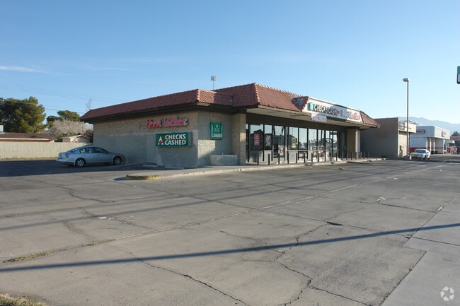
4300 E Charleston Blvd, Las Vegas, NV 89104


Current Lease Availabilities
NEARBY LISTINGS FOR SALE OR LEASE
Property Detail
4300 E Charleston Blvd
Las Vegas-Henderson-Paradise, NV
Parcel Map File 34 Page 63
140-31-803-001
PARCEL MAP FILE 34 PAGE 63 LOT 1 & VAC RD
Storebuilding
Clark
X
Nevada
32003C2187F
1
2024
0.41 AC
2025
Northeast Las Vegas
000518
Las Vegas
4,434 SF
DEMOGRAPHICS near 4300 E Charleston Blvd
1 Mile
3 Mile
5 Mile
2024 Total Population
28,591
246,241
511,995
2029 Population
30,409
262,828
547,944
Pop Growth 2024-2029
+ 6.36%
+ 6.74%
+ 7.02%
Average Age
36
37
37
2024 Total Households
8,640
83,003
180,830
HH Growth 2024-2029
+ 6.46%
+ 6.72%
+ 7.07%
Median Household Inc
$43,639
$40,253
$41,535
Avg Household Size
3.20
2.90
2.70
2024 Avg HH Vehicles
2.00
2.00
2.00
Median Home Value
$240,032
$236,947
$256,464
Median Year Built
1979
1983
1983
Nearby Places
Map Layers
Map Styles
 Street
 Aerial
- Restaurants
- Banks
- Shops
- Fitness
- Groceries
PUBLIC TRANSPORTATION
AIRPORT
Harry Reid International
DRIVE
WALK
Distance
Harry Reid International
16 min
9.9 mi
Boulder City Municipal
DRIVE
WALK
Distance
Boulder City Municipal
31 min
23.3 mi
Nearby Properties
Address
Land Use
TOTAL SIZE
Lot Size
Zoning
Address
Land Use
TOTAL SIZE
Lot Size
Zoning
345,133 SF
27.01 AC
H1
Address
Land Use
TOTAL SIZE
Lot Size
Zoning
6,396 SF
15.06 AC
Address
Land Use
TOTAL SIZE
Lot Size
Zoning
35.95 AC
PF
Address
Land Use
TOTAL SIZE
Lot Size
Zoning
137.65 AC
Address
Land Use
TOTAL SIZE
Lot Size
Zoning
67,649 SF
13.42 AC
CV
Address
Land Use
TOTAL SIZE
Lot Size
Zoning
29.35 AC
CV
Address
Land Use
TOTAL SIZE
Lot Size
Zoning
15.95 AC
PF
Address
Land Use
TOTAL SIZE
Lot Size
Zoning
20.91 AC
PF
Address
Land Use
TOTAL SIZE
Lot Size
Zoning
1,008 SF
31.47 AC
PF
Address
Land Use
TOTAL SIZE
Lot Size
Zoning
58,188 SF
20.04 AC
L:C-V
Address
Land Use
TOTAL SIZE
Lot Size
Zoning
4.34 AC
RE
Address
Land Use
TOTAL SIZE
Lot Size
Zoning
19.30 AC
RE
Address
Land Use
TOTAL SIZE
Lot Size
Zoning
5,649 SF
15.32 AC
R4
Address
Land Use
TOTAL SIZE
Lot Size
Zoning
6,659 SF
6.05 AC
H1
Address
Land Use
TOTAL SIZE
Lot Size
Zoning
7,908 SF
24.13 AC
R4
Address
Land Use
TOTAL SIZE
Lot Size
Zoning
223,422 SF
18.21 AC
R3
Address
Land Use
TOTAL SIZE
Lot Size
Zoning
9,044 SF
8.62 AC
Address
Land Use
TOTAL SIZE
Lot Size
Zoning
2,926 SF
19.73 AC
R3
Address
Land Use
TOTAL SIZE
Lot Size
Zoning
3,183 SF
18.35 AC
R3
Address
Land Use
TOTAL SIZE
Lot Size
Zoning
3,424 SF
14.53 AC
R3
Address
Land Use
TOTAL SIZE
Lot Size
Zoning
9.11 AC
PF
Address
Land Use
TOTAL SIZE
Lot Size
Zoning
11.69 AC
CV
Address
Land Use
TOTAL SIZE
Lot Size
Zoning
36.86 AC
PF
Address
Land Use
TOTAL SIZE
Lot Size
Zoning
40.07 AC
PF
Address
Land Use
TOTAL SIZE
Lot Size
Zoning
4,564 SF
15.71 AC
R4
Address
Land Use
TOTAL SIZE
Lot Size
Zoning
9,154 SF
8.94 AC
CV
Address
Land Use
TOTAL SIZE
Lot Size
Zoning
321,292 SF
16.67 AC
R3
Address
Land Use
TOTAL SIZE
Lot Size
Zoning
231,434 SF
20.31 AC
M
Address
Land Use
TOTAL SIZE
Lot Size
Zoning
8.39 AC
CV
Address
Land Use
TOTAL SIZE
Lot Size
Zoning
5,425 SF
14.38 AC
C:R-4
The World's #1 Commercial Real Estate Marketplace
Connect with us
© 2025 CoStar Group
The information above has been obtained from sources believed reliable. While we do not doubt its accuracy we have not verified it and make no guarantee, warranty or representation about it. It is your responsibility to independently confirm its accuracy and completeness. Any projections, opinions, assumptions, or estimates used are for example only and do not represent the current or future performance of the property. The value of this transaction to you depends on tax and other factors which should be evaluated by your tax, financial, and legal advisors. You and your advisors should conduct a careful, independent investigation of the property to determine to your satisfaction the suitability of the property for your needs.