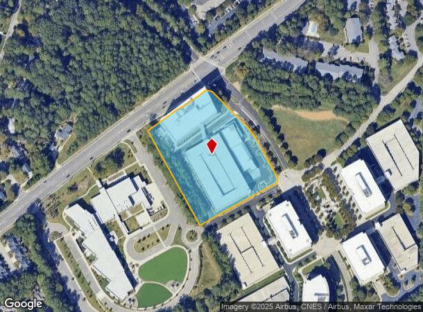
Property Record
4251 Parklake Ave, Raleigh, NC 27612

NEARBY LISTINGS FOR SALE OR LEASE
Property Detail
4251 Parklake Ave
Raleigh, NC
Glenlake Ph 02
0795.05-19-7505-000
LO4 HIGHWOODS PROP INC BM2002-323
Officebuilding
Wake
X
North Carolina
3720079500K
4
2025
4.70 AC
2025
Glenwood/Creedmoor
052507
Raleigh/Durham
377,443 SF
DEMOGRAPHICS near 4251 Parklake Ave
1 Mile
3 Mile
5 Mile
2024 Total Population
9,877
74,713
228,637
2029 Population
10,739
81,253
248,386
Pop Growth 2024-2029
+ 8.73%
+ 8.75%
+ 8.64%
Average Age
42
40
38
2024 Total Households
5,337
35,704
104,743
HH Growth 2024-2029
+ 8.75%
+ 8.83%
+ 8.95%
Median Household Inc
$81,403
$91,652
$81,197
Avg Household Size
1.80
2.10
2.00
2024 Avg HH Vehicles
2.00
2.00
2.00
Median Home Value
$516,718
$518,262
$445,806
Median Year Built
1995
1989
1988
Nearby Places
- Restaurants
- Banks
- Shops
- Fitness
- Groceries
PUBLIC TRANSPORTATION
COMMUTER RAIL
Raleigh Union Station (Piedmont - North Carolina by Train (NC Train))
DRIVE
WALK
Distance
Raleigh Union Station (Piedmont - North Carolina by Train (NC Train))
12 min
6.4 mi
Cary Station (Piedmont - North Carolina by Train (NC Train))
DRIVE
WALK
Distance
Cary Station (Piedmont - North Carolina by Train (NC Train))
14 min
7.8 mi
AIRPORT
Raleigh-Durham International
DRIVE
WALK
Distance
Raleigh-Durham International
18 min
10.6 mi
Freight Ports
Port of Wilmington
DRIVE
WALK
Distance
Port of Wilmington
162 min
140.5 mi
Nearby Properties
Address
Land Use
TOTAL SIZE
Lot Size
Zoning
Address
Land Use
TOTAL SIZE
Lot Size
Zoning
1,801,169 SF
59.60 AC
OX-12
Address
Land Use
TOTAL SIZE
Lot Size
Zoning
770,311 SF
80.70 AC
PD
Address
Land Use
TOTAL SIZE
Lot Size
Zoning
854,180 SF
210.81 AC
OX-4
Address
Land Use
TOTAL SIZE
Lot Size
Zoning
294,812 SF
999.47 AC
AP
Address
Land Use
TOTAL SIZE
Lot Size
Zoning
613,087 SF
266.85 AC
PD
Address
Land Use
TOTAL SIZE
Lot Size
Zoning
12,850 SF
96.80 AC
OX-12
Address
Land Use
TOTAL SIZE
Lot Size
Zoning
2,804,942 SF
57.23 AC
CX-12
Address
Land Use
TOTAL SIZE
Lot Size
Zoning
1,039,527 SF
22.85 AC
OX-7
Address
Land Use
TOTAL SIZE
Lot Size
Zoning
747,658 SF
11.12 AC
CX-12
Address
Land Use
TOTAL SIZE
Lot Size
Zoning
465,052 SF
2.65 AC
PD
Address
Land Use
TOTAL SIZE
Lot Size
Zoning
548,356 SF
49.77 AC
R-10
Address
Land Use
TOTAL SIZE
Lot Size
Zoning
539,902 SF
1.28 AC
O&I-1
Address
Land Use
TOTAL SIZE
Lot Size
Zoning
482,597 SF
36.39 AC
RX-4
Address
Land Use
TOTAL SIZE
Lot Size
Zoning
495,697 SF
9.11 AC
OX-5
Address
Land Use
TOTAL SIZE
Lot Size
Zoning
355,931 SF
2.60 AC
PD
Address
Land Use
TOTAL SIZE
Lot Size
Zoning
390,365 SF
3.70 AC
OX-5
Address
Land Use
TOTAL SIZE
Lot Size
Zoning
278,041 SF
9.98 AC
NX-4
Address
Land Use
TOTAL SIZE
Lot Size
Zoning
366,905 SF
11.24 AC
OX-5
Address
Land Use
TOTAL SIZE
Lot Size
Zoning
350,189 SF
15.77 AC
PD
Address
Land Use
TOTAL SIZE
Lot Size
Zoning
233,771 SF
6.09 AC
RX-4
Address
Land Use
TOTAL SIZE
Lot Size
Zoning
404,712 SF
24.95 AC
RX-3
Address
Land Use
TOTAL SIZE
Lot Size
Zoning
403,782 SF
5.32 AC
RX-7
Address
Land Use
TOTAL SIZE
Lot Size
Zoning
309,372 SF
17.18 AC
RX-5
Address
Land Use
TOTAL SIZE
Lot Size
Zoning
349,485 SF
4.61 AC
OX-7
Address
Land Use
TOTAL SIZE
Lot Size
Zoning
525,558 SF
7.11 AC
CX-12
Address
Land Use
TOTAL SIZE
Lot Size
Zoning
286,686 SF
9.53 AC
PD
Address
Land Use
TOTAL SIZE
Lot Size
Zoning
193,990 SF
7.16 AC
RX-5
Address
Land Use
TOTAL SIZE
Lot Size
Zoning
456,603 SF
24.48 AC
RX-5
Address
Land Use
TOTAL SIZE
Lot Size
Zoning
246,311 SF
16.07 AC
RX-3
Address
Land Use
TOTAL SIZE
Lot Size
Zoning
186,221 SF
7.10 AC
RX-5
The World's #1 Commercial Real Estate Marketplace
Connect with us
© 2025 CoStar Group
The information above has been obtained from sources believed reliable. While we do not doubt its accuracy we have not verified it and make no guarantee, warranty or representation about it. It is your responsibility to independently confirm its accuracy and completeness. Any projections, opinions, assumptions, or estimates used are for example only and do not represent the current or future performance of the property. The value of this transaction to you depends on tax and other factors which should be evaluated by your tax, financial, and legal advisors. You and your advisors should conduct a careful, independent investigation of the property to determine to your satisfaction the suitability of the property for your needs.