Property Record
4301 Mandrake Rd, Madison, WI 53704
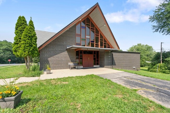
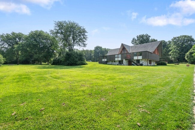
This Property Is For Sale
NEARBY LISTINGS FOR SALE OR LEASE
-
-
View all Madison listings for sale on LoopNet.com
Property Detail
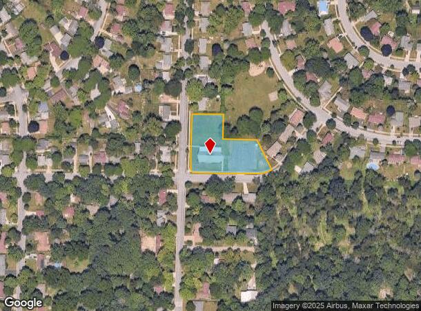
4301 Mandrake Rd
Milwaukee/Madison
Wheeler Heights
Madison, WI
Dane
0809-252-1612-2
Wisconsin
Residentialnec
1.29 AC
X
Northeast Madison
55025C0244H
DEMOGRAPHICS near 4301 Mandrake Rd
1 Mile
3 Mile
5 Mile
2024 Total Population
10,525
28,918
127,697
2029 Population
11,246
31,210
136,609
Pop Growth 2024-2029
+ 6.85%
+ 7.93%
+ 6.98%
Average Age
43
42
36
2024 Total Households
4,518
12,804
56,826
HH Growth 2024-2029
+ 7.37%
+ 8.47%
+ 7.83%
Median Household Inc
$78,657
$69,819
$65,371
Avg Household Size
2.20
2.10
2.00
2024 Avg HH Vehicles
2.00
2.00
1.00
Median Home Value
$314,863
$314,336
$348,065
Median Year Built
1972
1973
1976
Nearby Places
Map Layers
Map Styles
 Street
 Aerial
- Restaurants
- Banks
- Shops
- Fitness
- Groceries
PUBLIC TRANSPORTATION
AIRPORT
Dane County Regional/Truax Field
DRIVE
WALK
Distance
Dane County Regional/Truax Field
7 min
2.7 mi
Nearby Properties
Address
Land Use
TOTAL SIZE
Lot Size
Zoning
Address
Land Use
TOTAL SIZE
Lot Size
Zoning
509,946 SF
40.17 AC
IL
Address
Land Use
TOTAL SIZE
Lot Size
Zoning
83,769 SF
1.10 AC
NMX
Address
Land Use
TOTAL SIZE
Lot Size
Zoning
52.10 AC
PMHP
Address
Land Use
TOTAL SIZE
Lot Size
Zoning
8 AC
PD
Address
Land Use
TOTAL SIZE
Lot Size
Zoning
1.47 AC
CC-T
Address
Land Use
TOTAL SIZE
Lot Size
Zoning
31,326 SF
3.18 AC
SR-V2
Address
Land Use
TOTAL SIZE
Lot Size
Zoning
136,457 SF
10.20 AC
IL
Address
Land Use
TOTAL SIZE
Lot Size
Zoning
96,365 SF
1.01 AC
CC-T
Address
Land Use
TOTAL SIZE
Lot Size
Zoning
40,046 SF
4.10 AC
SR-V2
Address
Land Use
TOTAL SIZE
Lot Size
Zoning
25,676 SF
5.17 AC
SR-V2
Address
Land Use
TOTAL SIZE
Lot Size
Zoning
1.77 AC
CC-T
Address
Land Use
TOTAL SIZE
Lot Size
Zoning
67,473 SF
6.72 AC
PD
Address
Land Use
TOTAL SIZE
Lot Size
Zoning
8,652 SF
0.01 AC
IL
Address
Land Use
TOTAL SIZE
Lot Size
Zoning
172,636 SF
7.13 AC
SR-V2
Address
Land Use
TOTAL SIZE
Lot Size
Zoning
47,424 SF
2.54 AC
PD
Address
Land Use
TOTAL SIZE
Lot Size
Zoning
87,289 SF
1.33 AC
CC-T
Address
Land Use
TOTAL SIZE
Lot Size
Zoning
27.60 AC
ETZ
Address
Land Use
TOTAL SIZE
Lot Size
Zoning
22,866 SF
1.46 AC
SR-V2
Address
Land Use
TOTAL SIZE
Lot Size
Zoning
25,632 SF
2.37 AC
SR-V2
Address
Land Use
TOTAL SIZE
Lot Size
Zoning
0.90 AC
Address
Land Use
TOTAL SIZE
Lot Size
Zoning
90,159 SF
0.01 AC
SE
Address
Land Use
TOTAL SIZE
Lot Size
Zoning
55,833 SF
7.87 AC
SR-V2
Address
Land Use
TOTAL SIZE
Lot Size
Zoning
84,638 SF
3.24 AC
SR-V2
Address
Land Use
TOTAL SIZE
Lot Size
Zoning
127,118 SF
7.42 AC
IL
Address
Land Use
TOTAL SIZE
Lot Size
Zoning
22,328 SF
2.45 AC
PD
Address
Land Use
TOTAL SIZE
Lot Size
Zoning
4.56 AC
R-4
Address
Land Use
TOTAL SIZE
Lot Size
Zoning
77,785 SF
12.08 AC
IL
Address
Land Use
TOTAL SIZE
Lot Size
Zoning
84,192 SF
2.63 AC
PD
Address
Land Use
TOTAL SIZE
Lot Size
Zoning
49,920 SF
0.75 AC
CC-T
Address
Land Use
TOTAL SIZE
Lot Size
Zoning
315,034 SF
5.60 AC
CC-T
The World's #1 Commercial Real Estate Marketplace
Connect with us
© 2026 CoStar Group
The information above has been obtained from sources believed reliable. While we do not doubt its accuracy we have not verified it and make no guarantee, warranty or representation about it. It is your responsibility to independently confirm its accuracy and completeness. Any projections, opinions, assumptions, or estimates used are for example only and do not represent the current or future performance of the property. The value of this transaction to you depends on tax and other factors which should be evaluated by your tax, financial, and legal advisors. You and your advisors should conduct a careful, independent investigation of the property to determine to your satisfaction the suitability of the property for your needs.