Property Record
4301 S Beaumont Ave, Kansasville, WI 53139


NEARBY LISTINGS FOR SALE OR LEASE
-
-
View all Kansasville listings for sale on LoopNet.com
Property Detail
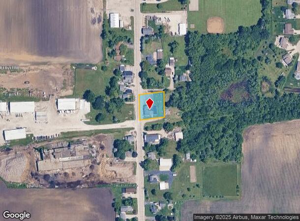
4301 S Beaumont Ave
006-032035021000
-PT NW1/4 NW1/4 COM CEN HWY ON N LN RR N148 E146 S148 W146 TO POB PT FROM 006032035022000 IN 2019 FOR 2020 ROLL **TOTAL ACRES
Commercialnec
Racine
X
Wisconsin
55059C0036D
0.50 AC
2024
Racine West
2024
Milwaukee/Madison
002100
Racine, WI
DEMOGRAPHICS near 4301 S Beaumont Ave
1 Mile
3 Mile
5 Mile
2024 Total Population
477
5,456
10,898
2029 Population
475
5,447
10,891
Pop Growth 2024-2029
(0.42%)
(0.16%)
(0.06%)
Average Age
43
44
42
2024 Total Households
193
1,929
4,051
HH Growth 2024-2029
(0.52%)
(0.16%)
(0.05%)
Median Household Inc
$97,684
$85,932
$91,282
Avg Household Size
2.50
2.40
2.50
2024 Avg HH Vehicles
2.00
2.00
2.00
Median Home Value
$310,606
$333,919
$315,274
Median Year Built
1977
1970
1973
Nearby Places
Map Layers
Map Styles
 Street
 Aerial
- Restaurants
- Banks
- Shops
- Fitness
- Groceries
PUBLIC TRANSPORTATION
AIRPORT
General Mitchell International
DRIVE
WALK
Distance
General Mitchell International
37 min
28.2 mi
Freight Ports
Port Milwaukee
DRIVE
WALK
Distance
Port Milwaukee
42 min
32.1 mi
SALE & LEASE HISTORY
LISTING DATE
SALE/LEASE

Nov 18, 2019
For Sale
Nov 05, 2021
For Sale
Jul 23, 2018
For Sale
Jul 19, 2019
For Sale
Jul 12, 2018
For Sale
Nearby Properties
Address
Land Use
TOTAL SIZE
Lot Size
Zoning
Address
Land Use
TOTAL SIZE
Lot Size
Zoning
0.05 AC
RM
Address
Land Use
TOTAL SIZE
Lot Size
Zoning
6.23 AC
I2
Address
Land Use
TOTAL SIZE
Lot Size
Zoning
20.02 AC
C1
Address
Land Use
TOTAL SIZE
Lot Size
Zoning
5.03 AC
P1
Address
Land Use
TOTAL SIZE
Lot Size
Zoning
4.55 AC
Address
Land Use
TOTAL SIZE
Lot Size
Zoning
4.61 AC
I2
Address
Land Use
TOTAL SIZE
Lot Size
Zoning
2.73 AC
C2
Address
Land Use
TOTAL SIZE
Lot Size
Zoning
30.53 AC
Address
Land Use
TOTAL SIZE
Lot Size
Zoning
151.16 AC
Address
Land Use
TOTAL SIZE
Lot Size
Zoning
0.07 AC
RM
Address
Land Use
TOTAL SIZE
Lot Size
Zoning
4.33 AC
I2
Address
Land Use
TOTAL SIZE
Lot Size
Zoning
4.65 AC
MH
Address
Land Use
TOTAL SIZE
Lot Size
Zoning
2.32 AC
Address
Land Use
TOTAL SIZE
Lot Size
Zoning
3.91 AC
Address
Land Use
TOTAL SIZE
Lot Size
Zoning
Address
Land Use
TOTAL SIZE
Lot Size
Zoning
4.12 AC
I2
Address
Land Use
TOTAL SIZE
Lot Size
Zoning
Address
Land Use
TOTAL SIZE
Lot Size
Zoning
11.35 AC
Address
Land Use
TOTAL SIZE
Lot Size
Zoning
Address
Land Use
TOTAL SIZE
Lot Size
Zoning
1.59 AC
I2
Address
Land Use
TOTAL SIZE
Lot Size
Zoning
0.20 AC
C3
Address
Land Use
TOTAL SIZE
Lot Size
Zoning
7.38 AC
Address
Land Use
TOTAL SIZE
Lot Size
Zoning
Address
Land Use
TOTAL SIZE
Lot Size
Zoning
1,008 SF
27.87 AC
Address
Land Use
TOTAL SIZE
Lot Size
Zoning
2.92 AC
Address
Land Use
TOTAL SIZE
Lot Size
Zoning
4.71 AC
Address
Land Use
TOTAL SIZE
Lot Size
Zoning
2.63 AC
Address
Land Use
TOTAL SIZE
Lot Size
Zoning
0.14 AC
MH
Address
Land Use
TOTAL SIZE
Lot Size
Zoning
1.92 AC
C2
Address
Land Use
TOTAL SIZE
Lot Size
Zoning
2.45 AC
C1
The World's #1 Commercial Real Estate Marketplace
Connect with us
© 2025 CoStar Group
The information above has been obtained from sources believed reliable. While we do not doubt its accuracy we have not verified it and make no guarantee, warranty or representation about it. It is your responsibility to independently confirm its accuracy and completeness. Any projections, opinions, assumptions, or estimates used are for example only and do not represent the current or future performance of the property. The value of this transaction to you depends on tax and other factors which should be evaluated by your tax, financial, and legal advisors. You and your advisors should conduct a careful, independent investigation of the property to determine to your satisfaction the suitability of the property for your needs.