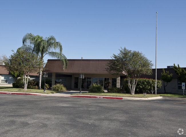
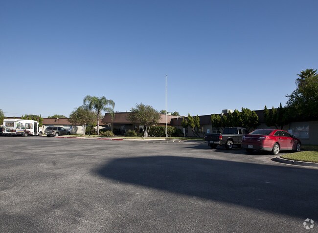
Property Record
4301 S Expressway 83, Harlingen, TX 78550

NEARBY LISTINGS FOR SALE OR LEASE
Property Detail
4301 S Expressway 83
Brownsville-Harlingen, TX
Muniz Subdivision
209660-0000-001000
HARLINGEN- MUNIZ LOT 1
Commercialnec
Cameron
X
Texas
48061C0270F
1
2024
2.78 AC
2025
Greater Harlingen
011801
Brownsville/Harlingen
30,009 SF
DEMOGRAPHICS near 4301 S Expressway 83
1 mile
3 mile
5 mile
2024 Total Population
6,368
49,484
100,872
2029 Population
6,488
50,703
103,388
Pop Growth 2024-2029
+ 1.88%
+ 2.46%
+ 2.49%
Average Age
37
37
37
2024 Total Households
2,238
17,045
34,124
HH Growth 2024-2029
+ 1.83%
+ 2.41%
+ 2.42%
Median Household Inc
$38,063
$44,899
$46,651
Avg Household Size
2.70
2.80
2.80
2024 Avg HH Vehicles
2.00
2.00
2.00
Median Home Value
$127,039
$87,215
$91,640
Median Year Built
1988
1982
1985
Nearby Places
Map Layers
Map Styles
 Street
 Aerial
Transit
 Traffic
 Biking
Places
Listings with unknown addresses are not visible on the map
- Restaurants
- Banks
- Shops
- Fitness
- Groceries
PUBLIC TRANSPORTATION
AIRPORT
Valley International
Drive
Walk
Distance
Valley International
19 min
6.6 mi
Brownsville/South Padre Island International
Drive
Walk
Distance
Brownsville/South Padre Island International
35 min
26.0 mi
McAllen International
Drive
Walk
Distance
McAllen International
46 min
37.8 mi
Freight Ports
Port of Brownsville
Drive
Walk
Distance
Port of Brownsville
28 min
23.6 mi
Nearby Properties
Address
Land Use
TOTAL SIZE
Lot Size
Zoning
Address
Land Use
TOTAL SIZE
Lot Size
Zoning
758,640 SF
11.31 AC
Address
Land Use
TOTAL SIZE
Lot Size
Zoning
427,448 SF
6.94 AC
Address
Land Use
TOTAL SIZE
Lot Size
Zoning
89,797 SF
7.90 AC
Address
Land Use
TOTAL SIZE
Lot Size
Zoning
186,716 SF
13.31 AC
C
Address
Land Use
TOTAL SIZE
Lot Size
Zoning
293,886 SF
23.57 AC
Address
Land Use
TOTAL SIZE
Lot Size
Zoning
171,714 SF
16.03 AC
C
Address
Land Use
TOTAL SIZE
Lot Size
Zoning
391,617 SF
23.20 AC
C
Address
Land Use
TOTAL SIZE
Lot Size
Zoning
159,787 SF
10.66 AC
Address
Land Use
TOTAL SIZE
Lot Size
Zoning
176,365 SF
14.65 AC
Address
Land Use
TOTAL SIZE
Lot Size
Zoning
135,258 SF
4.26 AC
C
Address
Land Use
TOTAL SIZE
Lot Size
Zoning
148,596 SF
1 AC
Address
Land Use
TOTAL SIZE
Lot Size
Zoning
72,063 SF
2.29 AC
Address
Land Use
TOTAL SIZE
Lot Size
Zoning
118,561 SF
6.32 AC
C
Address
Land Use
TOTAL SIZE
Lot Size
Zoning
77,189 SF
3.28 AC
Address
Land Use
TOTAL SIZE
Lot Size
Zoning
177,812 SF
21.40 AC
C
Address
Land Use
TOTAL SIZE
Lot Size
Zoning
62,764 SF
10 AC
Address
Land Use
TOTAL SIZE
Lot Size
Zoning
61,920 SF
5.60 AC
C
Address
Land Use
TOTAL SIZE
Lot Size
Zoning
63,381 SF
3.15 AC
Address
Land Use
TOTAL SIZE
Lot Size
Zoning
89,508 SF
9.90 AC
Address
Land Use
TOTAL SIZE
Lot Size
Zoning
1,152 SF
44.60 AC
C
Address
Land Use
TOTAL SIZE
Lot Size
Zoning
138,862 SF
15.82 AC
Address
Land Use
TOTAL SIZE
Lot Size
Zoning
206,973 SF
12.77 AC
Address
Land Use
TOTAL SIZE
Lot Size
Zoning
230,267 SF
7.85 AC
C
Address
Land Use
TOTAL SIZE
Lot Size
Zoning
180,838 SF
12.56 AC
C
Address
Land Use
TOTAL SIZE
Lot Size
Zoning
79,466 SF
6.23 AC
C
Address
Land Use
TOTAL SIZE
Lot Size
Zoning
68,826 SF
6.27 AC
Address
Land Use
TOTAL SIZE
Lot Size
Zoning
116,913 SF
8.44 AC
C
Address
Land Use
TOTAL SIZE
Lot Size
Zoning
47,558 SF
7 AC
Address
Land Use
TOTAL SIZE
Lot Size
Zoning
90,376 SF
1.93 AC
Address
Land Use
TOTAL SIZE
Lot Size
Zoning
176,627 SF
12.45 AC
A-C
The World's #1 Commercial Real Estate Marketplace
Connect with us
© 2026 CoStar Group
The information above has been obtained from sources believed reliable. While we do not doubt its accuracy we have not verified it and make no guarantee, warranty or representation about it. It is your responsibility to independently confirm its accuracy and completeness. Any projections, opinions, assumptions, or estimates used are for example only and do not represent the current or future performance of the property. The value of this transaction to you depends on tax and other factors which should be evaluated by your tax, financial, and legal advisors. You and your advisors should conduct a careful, independent investigation of the property to determine to your satisfaction the suitability of the property for your needs.