Property Record
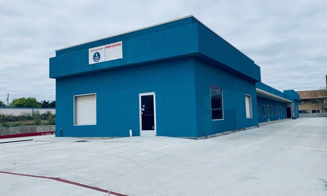
4302 E Saunders St, Laredo, TX 78041


Property Detail
4302 E Saunders St
220055
LOT 9 BLK 9 COUNTRY CLUB COMMERCIAL
Commercialnec
Webb
B3
Texas
B and X Area of moderate flood hazard, usually the area between the limits of the 100-year and 500-year floods.
9
2024
0.63 AC
2025
Texas South Area
001714
Other Market Areas
4,931 SF
Laredo, TX
NEARBY LISTINGS FOR SALE OR LEASE
-
-
View all Laredo listings for lease on LoopNet.com
DEMOGRAPHICS near 4302 E Saunders St
1 mile
3 mile
5 mile
2025 Total Population
23,680
101,292
193,915
2030 Population
24,076
103,221
197,779
Pop Growth 2025-2030
+ 1.67%
+ 1.90%
+ 1.99%
Average Age
38
37
36
2025 Total Households
7,858
32,977
59,907
HH Growth 2025-2030
+ 1.83%
+ 2.08%
+ 2.20%
Median Household Inc
$41,010
$47,148
$59,432
Avg Household Size
2.90
3.00
3.20
2025 Avg HH Vehicles
2.00
2.00
2.00
Median Home Value
$168,068
$182,962
$208,305
Median Year Built
1976
1981
1992
Nearby Places
Map Layers
Map Styles
 Street
 Aerial
Transit
 Traffic
 Biking
Places
Listings with unknown addresses are not visible on the map
- Restaurants
- Banks
- Shops
- Fitness
- Groceries
PUBLIC TRANSPORTATION
AIRPORT
Laredo International
Drive
Walk
Distance
Laredo International
7 min
2.8 mi
SALE & LEASE HISTORY
LISTING DATE
SALE/LEASE

Jul 24, 2019
For Lease
Nearby Properties
Address
Land Use
TOTAL SIZE
Lot Size
Zoning
Address
Land Use
TOTAL SIZE
Lot Size
Zoning
1,443,608 SF
116.27 AC
Address
Land Use
TOTAL SIZE
Lot Size
Zoning
668,900 SF
38.32 AC
B4
Address
Land Use
TOTAL SIZE
Lot Size
Zoning
497,463 SF
1.77 AC
R1
Address
Land Use
TOTAL SIZE
Lot Size
Zoning
178,000 SF
23.50 AC
B4
Address
Land Use
TOTAL SIZE
Lot Size
Zoning
310,346 SF
87.65 AC
R1A
Address
Land Use
TOTAL SIZE
Lot Size
Zoning
152.08 AC
M1
Address
Land Use
TOTAL SIZE
Lot Size
Zoning
231,146 SF
1.77 AC
R1
Address
Land Use
TOTAL SIZE
Lot Size
Zoning
380,420 SF
9.18 AC
B3
Address
Land Use
TOTAL SIZE
Lot Size
Zoning
192,176 SF
34.94 AC
Address
Land Use
TOTAL SIZE
Lot Size
Zoning
158,728 SF
7.89 AC
Address
Land Use
TOTAL SIZE
Lot Size
Zoning
183,795 SF
10.36 AC
R2
Address
Land Use
TOTAL SIZE
Lot Size
Zoning
50,765 SF
39.73 AC
Address
Land Use
TOTAL SIZE
Lot Size
Zoning
66,567 SF
3.81 AC
M1
Address
Land Use
TOTAL SIZE
Lot Size
Zoning
10,712 SF
745.84 AC
AG
Address
Land Use
TOTAL SIZE
Lot Size
Zoning
113,687 SF
5.58 AC
R3
Address
Land Use
TOTAL SIZE
Lot Size
Zoning
93,414 SF
8.57 AC
R1
Address
Land Use
TOTAL SIZE
Lot Size
Zoning
96,665 SF
12.03 AC
R1A
Address
Land Use
TOTAL SIZE
Lot Size
Zoning
102,815 SF
2.23 AC
Address
Land Use
TOTAL SIZE
Lot Size
Zoning
97,580 SF
3.89 AC
B1
Address
Land Use
TOTAL SIZE
Lot Size
Zoning
94,056 SF
1.77 AC
Address
Land Use
TOTAL SIZE
Lot Size
Zoning
95,612 SF
10 AC
R1A
Address
Land Use
TOTAL SIZE
Lot Size
Zoning
92,559 SF
5.70 AC
R1
Address
Land Use
TOTAL SIZE
Lot Size
Zoning
72,087 SF
3.91 AC
M1
Address
Land Use
TOTAL SIZE
Lot Size
Zoning
86,973 SF
8.57 AC
R1
Address
Land Use
TOTAL SIZE
Lot Size
Zoning
82,328 SF
5.12 AC
R3
Address
Land Use
TOTAL SIZE
Lot Size
Zoning
150,657 SF
39.35 AC
M1
Address
Land Use
TOTAL SIZE
Lot Size
Zoning
79,772 SF
1.77 AC
R3
Address
Land Use
TOTAL SIZE
Lot Size
Zoning
83,300 SF
3 AC
B4
Address
Land Use
TOTAL SIZE
Lot Size
Zoning
237,044 SF
10.67 AC
M1
Address
Land Use
TOTAL SIZE
Lot Size
Zoning
46,955 SF
6.80 AC
M1
The World's #1 Commercial Real Estate Marketplace
Connect with us
© 2026 CoStar Group
The information above has been obtained from sources believed reliable. While we do not doubt its accuracy we have not verified it and make no guarantee, warranty or representation about it. It is your responsibility to independently confirm its accuracy and completeness. Any projections, opinions, assumptions, or estimates used are for example only and do not represent the current or future performance of the property. The value of this transaction to you depends on tax and other factors which should be evaluated by your tax, financial, and legal advisors. You and your advisors should conduct a careful, independent investigation of the property to determine to your satisfaction the suitability of the property for your needs.