Property Record
4303 County Ave, Texarkana, AR 71854
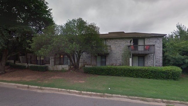


Property Detail
4303 County Ave
Texarkana, TX-AR
ALL LOTS 1 & 6
1070130
Miller
Officebuilding
Arkansas
B and X Area of moderate flood hazard, usually the area between the limits of the 100-year and 500-year floods.
1,6
2025
7.47 AC
2025
Arkansas South Area
020100
Other Market Areas
16,399 SF
NEARBY LISTINGS FOR SALE OR LEASE
DEMOGRAPHICS near 4303 County Ave
1 mile
3 mile
5 mile
2025 Total Population
6,427
36,955
62,660
2030 Population
6,230
36,484
62,217
Pop Growth 2025-2030
(3.07%)
(1.27%)
(0.71%)
Average Age
40
40
39
2025 Total Households
2,696
15,078
25,101
HH Growth 2025-2030
(3.04%)
(1.32%)
(0.72%)
Median Household Inc
$51,646
$47,943
$46,596
Avg Household Size
2.20
2.30
2.30
2025 Avg HH Vehicles
2.00
2.00
2.00
Median Home Value
$159,008
$149,743
$152,260
Median Year Built
1982
1977
1978
Nearby Places
Map Layers
Map Styles
 Street
 Aerial
Layers
 Traffic
 Biking
Places
Listings with unknown addresses are not visible on the map
- Restaurants
- Banks
- Shops
- Fitness
- Groceries
PUBLIC TRANSPORTATION
COMMUTER RAIL
Texarkana Amtrak Station (Texas Eagle - Amtrak)
Drive
Walk
Distance
Texarkana Amtrak Station (Texas Eagle - Amtrak)
8 min
3.7 mi
AIRPORT
Texarkana Regional-Webb Field
Drive
Walk
Distance
Texarkana Regional-Webb Field
13 min
5.4 mi
Freight Ports
Port of Shreveport
Drive
Walk
Distance
Port of Shreveport
111 min
96.6 mi
Nearby Properties
Address
Land Use
TOTAL SIZE
Lot Size
Zoning
Address
Land Use
TOTAL SIZE
Lot Size
Zoning
37.76 AC
Address
Land Use
TOTAL SIZE
Lot Size
Zoning
594,669 SF
26.19 AC
Address
Land Use
TOTAL SIZE
Lot Size
Zoning
22.35 AC
Address
Land Use
TOTAL SIZE
Lot Size
Zoning
Address
Land Use
TOTAL SIZE
Lot Size
Zoning
162,169 SF
19.18 AC
Address
Land Use
TOTAL SIZE
Lot Size
Zoning
133,136 SF
5.80 AC
Address
Land Use
TOTAL SIZE
Lot Size
Zoning
3,642 SF
24.74 AC
Address
Land Use
TOTAL SIZE
Lot Size
Zoning
11,320 SF
142 AC
Address
Land Use
TOTAL SIZE
Lot Size
Zoning
97,914 SF
3.01 AC
Address
Land Use
TOTAL SIZE
Lot Size
Zoning
73,675 SF
4.44 AC
Address
Land Use
TOTAL SIZE
Lot Size
Zoning
8.19 AC
Address
Land Use
TOTAL SIZE
Lot Size
Zoning
533,299 SF
50.60 AC
Address
Land Use
TOTAL SIZE
Lot Size
Zoning
51,587 SF
6.44 AC
Address
Land Use
TOTAL SIZE
Lot Size
Zoning
133,067 SF
11.20 AC
Address
Land Use
TOTAL SIZE
Lot Size
Zoning
18.64 AC
Address
Land Use
TOTAL SIZE
Lot Size
Zoning
51,049 SF
1.78 AC
Address
Land Use
TOTAL SIZE
Lot Size
Zoning
109,855 SF
6.24 AC
Address
Land Use
TOTAL SIZE
Lot Size
Zoning
18,105 SF
2.50 AC
Address
Land Use
TOTAL SIZE
Lot Size
Zoning
175,650 SF
15.56 AC
Address
Land Use
TOTAL SIZE
Lot Size
Zoning
25,006 SF
3.93 AC
Address
Land Use
TOTAL SIZE
Lot Size
Zoning
49,330 SF
2.26 AC
Address
Land Use
TOTAL SIZE
Lot Size
Zoning
160,484 SF
10.01 AC
Address
Land Use
TOTAL SIZE
Lot Size
Zoning
42,117 SF
0.86 AC
Address
Land Use
TOTAL SIZE
Lot Size
Zoning
22,103 SF
3.43 AC
Address
Land Use
TOTAL SIZE
Lot Size
Zoning
100,000 SF
5.92 AC
Address
Land Use
TOTAL SIZE
Lot Size
Zoning
108,928 SF
6.26 AC
Address
Land Use
TOTAL SIZE
Lot Size
Zoning
94,536 SF
3.84 AC
Address
Land Use
TOTAL SIZE
Lot Size
Zoning
55,000 SF
6.36 AC
Address
Land Use
TOTAL SIZE
Lot Size
Zoning
41,627 SF
6.12 AC
Address
Land Use
TOTAL SIZE
Lot Size
Zoning
50,355 SF
18.21 AC
The World's #1 Commercial Real Estate Marketplace
Connect with us
© 2026 CoStar Group
The information above has been obtained from sources believed reliable. While we do not doubt its accuracy we have not verified it and make no guarantee, warranty or representation about it. It is your responsibility to independently confirm its accuracy and completeness. Any projections, opinions, assumptions, or estimates used are for example only and do not represent the current or future performance of the property. The value of this transaction to you depends on tax and other factors which should be evaluated by your tax, financial, and legal advisors. You and your advisors should conduct a careful, independent investigation of the property to determine to your satisfaction the suitability of the property for your needs.