Property Record
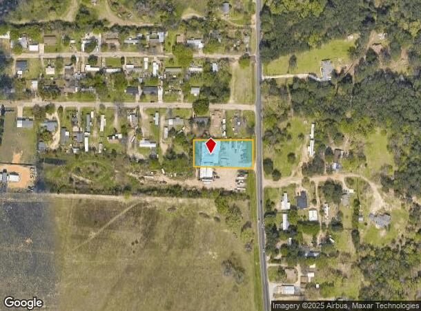
4305 State Highway 110 N, Tyler, TX 75704


NEARBY LISTINGS FOR SALE OR LEASE
Property Detail
4305 State Highway 110 N
Tyler, TX
A0602 S Ledbetter
1-00000-0602-00-038010
ABST A0602 S LEDBETTERTRACT 38A (PT OF 4.82AC SEE TR 39.2 & 39.1)
Commercialnec
Smith
X
Texas
48423C0240D
0.90 AC
2024
Tyler & Longview
2025
Other Market Areas
001606
DEMOGRAPHICS near 4305 State Highway 110 N
1 Mile
3 Mile
5 Mile
2024 Total Population
1,796
19,367
57,358
2029 Population
1,962
21,107
62,532
Pop Growth 2024-2029
+ 9.24%
+ 8.98%
+ 9.02%
Average Age
36
36
36
2024 Total Households
609
6,556
20,101
HH Growth 2024-2029
+ 8.37%
+ 8.45%
+ 8.48%
Median Household Inc
$48,863
$51,100
$48,460
Avg Household Size
2.90
2.80
2.70
2024 Avg HH Vehicles
2.00
2.00
2.00
Median Home Value
$115,926
$91,871
$122,705
Median Year Built
1974
1970
1968
Nearby Places
Map Layers
Map Styles
 Street
 Aerial
- Restaurants
- Banks
- Shops
- Fitness
- Groceries
PUBLIC TRANSPORTATION
AIRPORT
Tyler Pounds Regional
DRIVE
WALK
Distance
Tyler Pounds Regional
15 min
7.7 mi
SALE & LEASE HISTORY
LISTING DATE
SALE/LEASE

Oct 17, 2016
For Lease
Oct 17, 2016
For Sale
Nearby Properties
Address
Land Use
TOTAL SIZE
Lot Size
Zoning
Address
Land Use
TOTAL SIZE
Lot Size
Zoning
31.74 AC
Address
Land Use
TOTAL SIZE
Lot Size
Zoning
Address
Land Use
TOTAL SIZE
Lot Size
Zoning
187.64 AC
R1A
Address
Land Use
TOTAL SIZE
Lot Size
Zoning
311.96 AC
Address
Land Use
TOTAL SIZE
Lot Size
Zoning
63 AC
R1A
Address
Land Use
TOTAL SIZE
Lot Size
Zoning
22.85 AC
Address
Land Use
TOTAL SIZE
Lot Size
Zoning
2,802 SF
14 AC
RMF
Address
Land Use
TOTAL SIZE
Lot Size
Zoning
25.54 AC
INT
Address
Land Use
TOTAL SIZE
Lot Size
Zoning
14.16 AC
Address
Land Use
TOTAL SIZE
Lot Size
Zoning
205,196 SF
25.19 AC
C2
Address
Land Use
TOTAL SIZE
Lot Size
Zoning
3,222 SF
7.43 AC
RMF
Address
Land Use
TOTAL SIZE
Lot Size
Zoning
111,048 SF
10 AC
RMF
Address
Land Use
TOTAL SIZE
Lot Size
Zoning
171,588 SF
16.21 AC
Address
Land Use
TOTAL SIZE
Lot Size
Zoning
49,110 SF
2.19 AC
C2
Address
Land Use
TOTAL SIZE
Lot Size
Zoning
34,637 SF
149.75 AC
R1A
Address
Land Use
TOTAL SIZE
Lot Size
Zoning
135,792 SF
12.05 AC
C1
Address
Land Use
TOTAL SIZE
Lot Size
Zoning
92,268 SF
8.48 AC
C2
Address
Land Use
TOTAL SIZE
Lot Size
Zoning
64,882 SF
6.07 AC
C1
Address
Land Use
TOTAL SIZE
Lot Size
Zoning
18,577 SF
8.60 AC
M1
Address
Land Use
TOTAL SIZE
Lot Size
Zoning
2,162 SF
19.54 AC
Address
Land Use
TOTAL SIZE
Lot Size
Zoning
32,175 SF
3.48 AC
C2
Address
Land Use
TOTAL SIZE
Lot Size
Zoning
57,576 SF
5.96 AC
M1
Address
Land Use
TOTAL SIZE
Lot Size
Zoning
4,747 SF
42.83 AC
Address
Land Use
TOTAL SIZE
Lot Size
Zoning
78,957 SF
13.58 AC
M1
Address
Land Use
TOTAL SIZE
Lot Size
Zoning
23,327 SF
46.48 AC
Address
Land Use
TOTAL SIZE
Lot Size
Zoning
8,195 SF
3.13 AC
Address
Land Use
TOTAL SIZE
Lot Size
Zoning
16,700 SF
1.05 AC
R1B
Address
Land Use
TOTAL SIZE
Lot Size
Zoning
55,840 SF
6.39 AC
Address
Land Use
TOTAL SIZE
Lot Size
Zoning
29,659 SF
11.02 AC
R1A
Address
Land Use
TOTAL SIZE
Lot Size
Zoning
60,000 SF
88.29 AC
The World's #1 Commercial Real Estate Marketplace
Connect with us
© 2026 CoStar Group
The information above has been obtained from sources believed reliable. While we do not doubt its accuracy we have not verified it and make no guarantee, warranty or representation about it. It is your responsibility to independently confirm its accuracy and completeness. Any projections, opinions, assumptions, or estimates used are for example only and do not represent the current or future performance of the property. The value of this transaction to you depends on tax and other factors which should be evaluated by your tax, financial, and legal advisors. You and your advisors should conduct a careful, independent investigation of the property to determine to your satisfaction the suitability of the property for your needs.