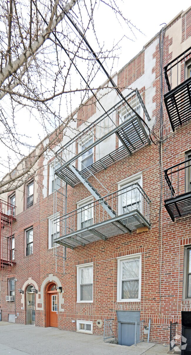
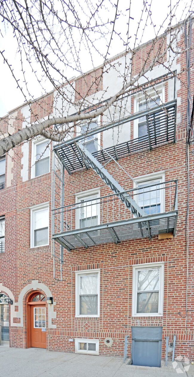
Property Record
4307 Ditmars Blvd, Astoria, NY 11105
NEARBY LISTINGS FOR SALE OR LEASE
Property Detail
4307 Ditmars Blvd
00784-0103
Queens
Multifamilydwelling
New York
X
103
3604970094F
0.05 AC
2024
Ditmars Steinway
2025
Long Island (New York)
012100
New York-Jersey City-White Plains, NY-NJ
4,380 SF
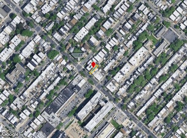
DEMOGRAPHICS near 4307 Ditmars Blvd
1 mile
3 mile
5 mile
2024 Total Population
81,065
927,571
2,796,390
2029 Population
75,644
864,981
2,606,151
Pop Growth 2024-2029
(6.69%)
(6.75%)
(6.80%)
Average Age
40
40
40
2024 Total Households
34,934
371,169
1,155,381
HH Growth 2024-2029
(7.03%)
(6.90%)
(7.09%)
Median Household Inc
$87,813
$73,077
$71,075
Avg Household Size
2.30
2.40
2.30
2024 Avg HH Vehicles
1.00
.00
.00
Median Home Value
$832,351
$785,137
$802,345
Median Year Built
1948
1956
1955
Nearby Places
Map Layers
Map Styles
 Street
 Aerial
Transit
 Traffic
 Biking
Places
Listings with unknown addresses are not visible on the map
- Restaurants
- Banks
- Shops
- Fitness
- Groceries
PUBLIC TRANSPORTATION
TRANSIT/SUBWAY
Astoria Boulevard (N - New York MTA Subway (The Subway), Q - New York MTA Subway (The Subway))
Drive
Walk
Distance
Astoria Boulevard (N - New York MTA Subway (The Subway), Q - New York MTA Subway (The Subway))
2 min
8 min
0.4 mi
COMMUTER RAIL
Woodside Station (Babylon Branch - Long Island Rail Road, Far Rockaway Branch - Long Island Rail Road, Hempstead Branch - Long Island Rail Road, Long Beach Branch - Long Island Rail Road, Montauk Branch - Long Island Rail Road, Port Jefferson Branch - Long Island Rail Road, Port Washington Branch - Long Island Rail Road, Ronkonkoma Branch - Long Island Rail Road)
Drive
Walk
Distance
Woodside Station (Babylon Branch - Long Island Rail Road, Far Rockaway Branch - Long Island Rail Road, Hempstead Branch - Long Island Rail Road, Long Beach Branch - Long Island Rail Road, Montauk Branch - Long Island Rail Road, Port Jefferson Branch - Long Island Rail Road, Port Washington Branch - Long Island Rail Road, Ronkonkoma Branch - Long Island Rail Road)
6 min
2.4 mi
Harlem-125th Street Station (Harlem Line - Metro-North Commuter Railroad Company (Metro-North), Hudson Line - Metro-North Commuter Railroad Company (Metro-North), New Haven Line - Metro-North Commuter Railroad Company (Metro-North))
Drive
Walk
Distance
Harlem-125th Street Station (Harlem Line - Metro-North Commuter Railroad Company (Metro-North), Hudson Line - Metro-North Commuter Railroad Company (Metro-North), New Haven Line - Metro-North Commuter Railroad Company (Metro-North))
12 min
4.8 mi
AIRPORT
LaGuardia
Drive
Walk
Distance
LaGuardia
5 min
2.4 mi
John F Kennedy International
Drive
Walk
Distance
John F Kennedy International
16 min
12.4 mi
Newark Liberty International
Drive
Walk
Distance
Newark Liberty International
35 min
22.5 mi
Freight Ports
NY - Red Hook Container Terminal
Drive
Walk
Distance
NY - Red Hook Container Terminal
1 min
8.0 mi
Nearby Properties
Address
Land Use
TOTAL SIZE
Lot Size
Zoning
Address
Land Use
TOTAL SIZE
Lot Size
Zoning
97.14 AC
R7-2
Address
Land Use
TOTAL SIZE
Lot Size
Zoning
1.22 AC
R7-2
Address
Land Use
TOTAL SIZE
Lot Size
Zoning
0.92 AC
R7-2
Address
Land Use
TOTAL SIZE
Lot Size
Zoning
97.14 AC
R7-2
Address
Land Use
TOTAL SIZE
Lot Size
Zoning
4,380,201 SF
97.06 AC
R7-2
Address
Land Use
TOTAL SIZE
Lot Size
Zoning
5,519,372 SF
409.21 AC
C8-2
Address
Land Use
TOTAL SIZE
Lot Size
Zoning
2,215,000 SF
6.43 AC
R9
Address
Land Use
TOTAL SIZE
Lot Size
Zoning
2,230,742 SF
6.33 AC
R9
Address
Land Use
TOTAL SIZE
Lot Size
Zoning
1,200,000 SF
10.24 AC
R9
Address
Land Use
TOTAL SIZE
Lot Size
Zoning
755,000 SF
1.85 AC
R7-2
Address
Land Use
TOTAL SIZE
Lot Size
Zoning
1,065,915 SF
2.13 AC
M16R10
Address
Land Use
TOTAL SIZE
Lot Size
Zoning
700,000 SF
2.25 AC
R7-2
Address
Land Use
TOTAL SIZE
Lot Size
Zoning
700,000 SF
2.25 AC
R7-2
Address
Land Use
TOTAL SIZE
Lot Size
Zoning
700,000 SF
2.25 AC
R7-2
Address
Land Use
TOTAL SIZE
Lot Size
Zoning
700,000 SF
2.25 AC
R7-2
Address
Land Use
TOTAL SIZE
Lot Size
Zoning
700,000 SF
2.25 AC
R7-2
Address
Land Use
TOTAL SIZE
Lot Size
Zoning
700,000 SF
2.25 AC
R7-2
Address
Land Use
TOTAL SIZE
Lot Size
Zoning
700,000 SF
2.25 AC
R7-2
Address
Land Use
TOTAL SIZE
Lot Size
Zoning
700,000 SF
2.25 AC
R7-2
Address
Land Use
TOTAL SIZE
Lot Size
Zoning
700,000 SF
2.25 AC
R7-2
Address
Land Use
TOTAL SIZE
Lot Size
Zoning
700,000 SF
2.25 AC
R7-2
Address
Land Use
TOTAL SIZE
Lot Size
Zoning
11.92 AC
R7-2
Address
Land Use
TOTAL SIZE
Lot Size
Zoning
11.92 AC
R7-2
Address
Land Use
TOTAL SIZE
Lot Size
Zoning
11.92 AC
R7-2
Address
Land Use
TOTAL SIZE
Lot Size
Zoning
11.92 AC
R7-2
Address
Land Use
TOTAL SIZE
Lot Size
Zoning
11.92 AC
R7-2
Address
Land Use
TOTAL SIZE
Lot Size
Zoning
11.92 AC
R7-2
Address
Land Use
TOTAL SIZE
Lot Size
Zoning
11.92 AC
R7-2
Address
Land Use
TOTAL SIZE
Lot Size
Zoning
11.92 AC
R7-2
Address
Land Use
TOTAL SIZE
Lot Size
Zoning
11.92 AC
R7-2
The World's #1 Commercial Real Estate Marketplace
Connect with us
© 2026 CoStar Group
The information above has been obtained from sources believed reliable. While we do not doubt its accuracy we have not verified it and make no guarantee, warranty or representation about it. It is your responsibility to independently confirm its accuracy and completeness. Any projections, opinions, assumptions, or estimates used are for example only and do not represent the current or future performance of the property. The value of this transaction to you depends on tax and other factors which should be evaluated by your tax, financial, and legal advisors. You and your advisors should conduct a careful, independent investigation of the property to determine to your satisfaction the suitability of the property for your needs.