Property Record
431 Deep Run Rd, Perkasie, PA 18944

Current Lease Availabilities
NEARBY LISTINGS FOR SALE OR LEASE
Property Detail
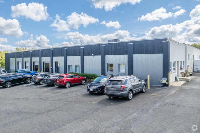
431 Deep Run Rd
01-011-128-002
41.98AC S S LR09092 222 6 FT E T376
Warehouse
Bucks
AE
Pennsylvania
42017C0164J
41.98 AC
2024
Bucks
2025
Philadelphia
104000
Philadelphia-Camden-Wilmington, PA-NJ-DE-MD
94,838 SF
DEMOGRAPHICS near 431 Deep Run Rd
1 mile
3 mile
5 mile
2024 Total Population
3,624
13,906
38,319
2029 Population
3,637
13,921
38,091
Pop Growth 2024-2029
+ 0.36%
+ 0.11%
(0.60%)
Average Age
39
41
42
2024 Total Households
1,327
5,139
14,067
HH Growth 2024-2029
+ 0.45%
+ 0.18%
(0.57%)
Median Household Inc
$115,587
$111,332
$118,902
Avg Household Size
2.70
2.70
2.70
2024 Avg HH Vehicles
2.00
2.00
2.00
Median Home Value
$431,538
$437,562
$455,871
Median Year Built
2000
1985
1986
Nearby Places
Map Layers
Map Styles
 Street
 Aerial
Transit
 Traffic
 Biking
Places
Listings with unknown addresses are not visible on the map
- Restaurants
- Banks
- Shops
- Fitness
- Groceries
PUBLIC TRANSPORTATION
COMMUTER RAIL
Doylestown (R5 - Southeastern Pennsylvania Transportation Authority Regional Rail (SEPTA Regional Rail))
Drive
Walk
Distance
Doylestown (R5 - Southeastern Pennsylvania Transportation Authority Regional Rail (SEPTA Regional Rail))
16 min
7.8 mi
Chalfont (R5 - Southeastern Pennsylvania Transportation Authority Regional Rail (SEPTA Regional Rail))
Drive
Walk
Distance
Chalfont (R5 - Southeastern Pennsylvania Transportation Authority Regional Rail (SEPTA Regional Rail))
16 min
8.6 mi
AIRPORT
Trenton Mercer
Drive
Walk
Distance
Trenton Mercer
49 min
28.0 mi
Lehigh Valley International
Drive
Walk
Distance
Lehigh Valley International
52 min
28.6 mi
Freight Ports
Port of Philadelphia
Drive
Walk
Distance
Port of Philadelphia
60 min
34.4 mi
Nearby Properties
Address
Land Use
TOTAL SIZE
Lot Size
Zoning
Address
Land Use
TOTAL SIZE
Lot Size
Zoning
61,589 SF
10.81 AC
C2
Address
Land Use
TOTAL SIZE
Lot Size
Zoning
13,858 SF
9.62 AC
R1
Address
Land Use
TOTAL SIZE
Lot Size
Zoning
66,008 SF
13.28 AC
C3
Address
Land Use
TOTAL SIZE
Lot Size
Zoning
234,274 SF
24.12 AC
C4
Address
Land Use
TOTAL SIZE
Lot Size
Zoning
1,400 SF
30.14 AC
MHP
Address
Land Use
TOTAL SIZE
Lot Size
Zoning
72,320 SF
17.82 AC
I
Address
Land Use
TOTAL SIZE
Lot Size
Zoning
45,960 SF
0.36 AC
C2
Address
Land Use
TOTAL SIZE
Lot Size
Zoning
55,077 SF
7.22 AC
C2
Address
Land Use
TOTAL SIZE
Lot Size
Zoning
12,994 SF
3.89 AC
R2
Address
Land Use
TOTAL SIZE
Lot Size
Zoning
13,600 SF
3.95 AC
R1
Address
Land Use
TOTAL SIZE
Lot Size
Zoning
61,059 SF
11.43 AC
I
Address
Land Use
TOTAL SIZE
Lot Size
Zoning
25,008 SF
4.05 AC
I
Address
Land Use
TOTAL SIZE
Lot Size
Zoning
41,460 SF
4.90 AC
R1
Address
Land Use
TOTAL SIZE
Lot Size
Zoning
78,057 SF
10.50 AC
I
Address
Land Use
TOTAL SIZE
Lot Size
Zoning
1,703 SF
1.24 AC
I
Address
Land Use
TOTAL SIZE
Lot Size
Zoning
35,200 SF
2.54 AC
C2
Address
Land Use
TOTAL SIZE
Lot Size
Zoning
36,664 SF
5.10 AC
I
Address
Land Use
TOTAL SIZE
Lot Size
Zoning
9,680 SF
57.74 AC
Q
Address
Land Use
TOTAL SIZE
Lot Size
Zoning
49,383 SF
4.45 AC
I
Address
Land Use
TOTAL SIZE
Lot Size
Zoning
1,808 SF
3 AC
I
Address
Land Use
TOTAL SIZE
Lot Size
Zoning
32,754 SF
8.03 AC
C2
Address
Land Use
TOTAL SIZE
Lot Size
Zoning
39,541 SF
12.96 AC
I
Address
Land Use
TOTAL SIZE
Lot Size
Zoning
39,797 SF
10.38 AC
C2
Address
Land Use
TOTAL SIZE
Lot Size
Zoning
5,525 SF
2.57 AC
PC2
Address
Land Use
TOTAL SIZE
Lot Size
Zoning
14,601 SF
1.84 AC
C2
Address
Land Use
TOTAL SIZE
Lot Size
Zoning
30,295 SF
4.11 AC
I
Address
Land Use
TOTAL SIZE
Lot Size
Zoning
4,980 SF
3.36 AC
C2
Address
Land Use
TOTAL SIZE
Lot Size
Zoning
16,520 SF
3.38 AC
R1
Address
Land Use
TOTAL SIZE
Lot Size
Zoning
12,859 SF
2.19 AC
PC2
Address
Land Use
TOTAL SIZE
Lot Size
Zoning
19,120 SF
5.13 AC
C2
The World's #1 Commercial Real Estate Marketplace
Connect with us
© 2026 CoStar Group
The information above has been obtained from sources believed reliable. While we do not doubt its accuracy we have not verified it and make no guarantee, warranty or representation about it. It is your responsibility to independently confirm its accuracy and completeness. Any projections, opinions, assumptions, or estimates used are for example only and do not represent the current or future performance of the property. The value of this transaction to you depends on tax and other factors which should be evaluated by your tax, financial, and legal advisors. You and your advisors should conduct a careful, independent investigation of the property to determine to your satisfaction the suitability of the property for your needs.