Property Record
431 Net Zero Dr, Henderson, NV 89012


Property Detail
431 Net Zero Dr
Las Vegas
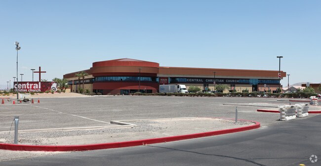
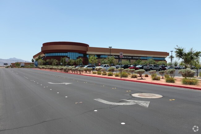
ACADEMICA OFFICE BDG CHURCH CHRISTIAN CENTRAL SITE PLAT BOOK 170 PAGE 79 PT LOT 1
Las Vegas-Henderson-North Las Vegas, NV
CLARK
161-34-211-002
Nevada
Religious
1
0
38.36 AC
2026
SE Las Vegas/Henderson
005356
NEARBY LISTINGS FOR SALE OR LEASE
DEMOGRAPHICS near 431 Net Zero Dr
1 mile
3 mile
5 mile
2025 Total Population
22,768
131,264
348,993
2030 Population
23,807
137,045
366,145
Pop Growth 2025-2030
+ 4.56%
+ 4.40%
+ 4.91%
Average Age
37
39
41
2025 Total Households
8,876
50,544
134,373
HH Growth 2025-2030
+ 4.61%
+ 4.44%
+ 4.95%
Median Household Inc
$70,977
$69,534
$74,389
Avg Household Size
2.50
2.50
2.50
2025 Avg HH Vehicles
2.00
2.00
2.00
Median Home Value
$340,773
$375,835
$408,850
Median Year Built
2001
1994
1994
Nearby Places
Map Layers
Map Styles
 Street
 Aerial
Layers
 Traffic
 Biking
Places
Listings with unknown addresses are not visible on the map
- Restaurants
- Banks
- Shops
- Fitness
- Groceries
PUBLIC TRANSPORTATION
AIRPORT
Harry Reid International
Drive
Walk
Distance
Harry Reid International
16 min
8.4 mi
Boulder City Municipal
Drive
Walk
Distance
Boulder City Municipal
26 min
17.4 mi
Nearby Properties
Address
Land Use
TOTAL SIZE
Lot Size
Zoning
Address
Land Use
TOTAL SIZE
Lot Size
Zoning
678,168 SF
69.69 AC
Address
Land Use
TOTAL SIZE
Lot Size
Zoning
726,941 SF
74.75 AC
CT
Address
Land Use
TOTAL SIZE
Lot Size
Zoning
62,258 SF
59.95 AC
Address
Land Use
TOTAL SIZE
Lot Size
Zoning
251,075 SF
24.28 AC
Address
Land Use
TOTAL SIZE
Lot Size
Zoning
265,609 SF
47.36 AC
H1
Address
Land Use
TOTAL SIZE
Lot Size
Zoning
14,840 SF
38.54 AC
CC
Address
Land Use
TOTAL SIZE
Lot Size
Zoning
31,463 SF
191.46 AC
PS
Address
Land Use
TOTAL SIZE
Lot Size
Zoning
21,257 SF
12.72 AC
Address
Land Use
TOTAL SIZE
Lot Size
Zoning
20,727 SF
319.86 AC
PF
Address
Land Use
TOTAL SIZE
Lot Size
Zoning
502,625 SF
45.92 AC
Address
Land Use
TOTAL SIZE
Lot Size
Zoning
280 AC
PF
Address
Land Use
TOTAL SIZE
Lot Size
Zoning
8,047 SF
17.42 AC
Address
Land Use
TOTAL SIZE
Lot Size
Zoning
358,212 SF
9.06 AC
CC
Address
Land Use
TOTAL SIZE
Lot Size
Zoning
410,084 SF
16.74 AC
RH24
Address
Land Use
TOTAL SIZE
Lot Size
Zoning
8,168 SF
15.22 AC
Address
Land Use
TOTAL SIZE
Lot Size
Zoning
404,030 SF
20.17 AC
RE
Address
Land Use
TOTAL SIZE
Lot Size
Zoning
100.25 AC
RS1
Address
Land Use
TOTAL SIZE
Lot Size
Zoning
387,990 SF
22.04 AC
Address
Land Use
TOTAL SIZE
Lot Size
Zoning
12.48 AC
Address
Land Use
TOTAL SIZE
Lot Size
Zoning
8,891 SF
11.59 AC
Address
Land Use
TOTAL SIZE
Lot Size
Zoning
9,000 SF
96.81 AC
RE
Address
Land Use
TOTAL SIZE
Lot Size
Zoning
3,289 SF
22.36 AC
R3
Address
Land Use
TOTAL SIZE
Lot Size
Zoning
198.15 AC
PF
Address
Land Use
TOTAL SIZE
Lot Size
Zoning
383,889 SF
31.11 AC
Address
Land Use
TOTAL SIZE
Lot Size
Zoning
38,764 SF
12.66 AC
H1
Address
Land Use
TOTAL SIZE
Lot Size
Zoning
4,141 SF
9.15 AC
C2
Address
Land Use
TOTAL SIZE
Lot Size
Zoning
6,670 SF
14.18 AC
C2
Address
Land Use
TOTAL SIZE
Lot Size
Zoning
314,454 SF
22.94 AC
CC
Address
Land Use
TOTAL SIZE
Lot Size
Zoning
35.42 AC
PS
The World's #1 Commercial Real Estate Marketplace
Connect with us
© 2026 CoStar Group
The information above has been obtained from sources believed reliable. While we do not doubt its accuracy we have not verified it and make no guarantee, warranty or representation about it. It is your responsibility to independently confirm its accuracy and completeness. Any projections, opinions, assumptions, or estimates used are for example only and do not represent the current or future performance of the property. The value of this transaction to you depends on tax and other factors which should be evaluated by your tax, financial, and legal advisors. You and your advisors should conduct a careful, independent investigation of the property to determine to your satisfaction the suitability of the property for your needs.