Property Record
431 Veal Rd, Covington, GA 30016


Save to a Folder
{{folder.Name}}
{{folder.ListingIds.length}} Properties
{{folder.ListingIds.length}} Property
Create a New Folder
Property Detail
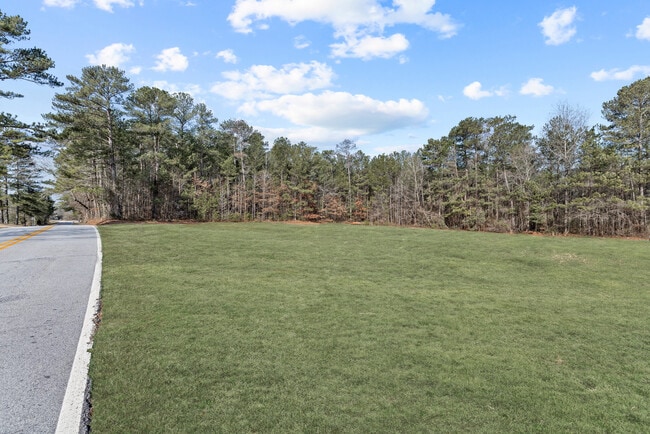
431 Veal Rd
Atlanta-Sandy Springs-Roswell, GA
LTA-15 VEALS LANDING LD10
0007C00000017000
NEWTON
Residentialacreage
Georgia
AR
a-15
B and X Area of moderate flood hazard, usually the area between the limits of the 100-year and 500-year floods.
3.50 AC
2025
Newton County
2025
Atlanta
100905
NEARBY LISTINGS FOR SALE OR LEASE
DEMOGRAPHICS near 431 Veal Rd
1 mile
3 mile
5 mile
2025 Total Population
1,988
21,837
66,442
2030 Population
2,143
23,441
71,034
Pop Growth 2025-2030
+ 7.80%
+ 7.35%
+ 6.91%
Average Age
39
39
39
2025 Total Households
691
7,543
22,666
HH Growth 2025-2030
+ 7.96%
+ 7.49%
+ 7.05%
Median Household Inc
$94,504
$87,200
$85,974
Avg Household Size
2.90
2.90
2.90
2025 Avg HH Vehicles
2.00
2.00
2.00
Median Home Value
$318,265
$259,253
$279,243
Median Year Built
1999
1995
1997
Nearby Places
Map Layers
Map Styles
 Street
 Aerial
Layers
 Traffic
 Biking
Places
Listings with unknown addresses are not visible on the map
- Restaurants
- Banks
- Shops
- Fitness
- Groceries
PUBLIC TRANSPORTATION
AIRPORT
Hartsfield - Jackson Atlanta International
Drive
Walk
Distance
Hartsfield - Jackson Atlanta International
53 min
33.2 mi
Freight Ports
Georgia Ports - Savannah
Drive
Walk
Distance
Georgia Ports - Savannah
269 min
233.5 mi
SALE & LEASE HISTORY
LISTING DATE
SALE/LEASE

Apr 01, 2025
For Sale
Nearby Properties
Address
Land Use
TOTAL SIZE
Lot Size
Zoning
Address
Land Use
TOTAL SIZE
Lot Size
Zoning
1,158,095 SF
161.26 AC
Address
Land Use
TOTAL SIZE
Lot Size
Zoning
1,158,095 SF
0.01 AC
Address
Land Use
TOTAL SIZE
Lot Size
Zoning
65,360 SF
75.51 AC
E6
Address
Land Use
TOTAL SIZE
Lot Size
Zoning
81,730 SF
17.98 AC
C1
Address
Land Use
TOTAL SIZE
Lot Size
Zoning
65,360 SF
30.63 AC
E6
Address
Land Use
TOTAL SIZE
Lot Size
Zoning
50,096 SF
4.19 AC
C1
Address
Land Use
TOTAL SIZE
Lot Size
Zoning
63,328 SF
10.67 AC
C2
Address
Land Use
TOTAL SIZE
Lot Size
Zoning
58,892 SF
17.52 AC
E6
Address
Land Use
TOTAL SIZE
Lot Size
Zoning
18,751 SF
4.14 AC
C2/OI
Address
Land Use
TOTAL SIZE
Lot Size
Zoning
6,000 SF
2.61 AC
C1
Address
Land Use
TOTAL SIZE
Lot Size
Zoning
19,363 SF
4 AC
AR
Address
Land Use
TOTAL SIZE
Lot Size
Zoning
17,558 SF
5.08 AC
AR/C1
Address
Land Use
TOTAL SIZE
Lot Size
Zoning
3,500 SF
0.85 AC
C1
Address
Land Use
TOTAL SIZE
Lot Size
Zoning
13,182 SF
1.89 AC
CN
Address
Land Use
TOTAL SIZE
Lot Size
Zoning
12,600 SF
1.33 AC
C2
Address
Land Use
TOTAL SIZE
Lot Size
Zoning
12,934 SF
2.37 AC
E3
Address
Land Use
TOTAL SIZE
Lot Size
Zoning
2,065 SF
15 AC
E2
Address
Land Use
TOTAL SIZE
Lot Size
Zoning
16,620 SF
10.86 AC
AR
Address
Land Use
TOTAL SIZE
Lot Size
Zoning
7,200 SF
1.07 AC
C2/C
Address
Land Use
TOTAL SIZE
Lot Size
Zoning
359.47 AC
A
Address
Land Use
TOTAL SIZE
Lot Size
Zoning
3,780 SF
78.28 AC
E2
Address
Land Use
TOTAL SIZE
Lot Size
Zoning
8,400 SF
6.03 AC
AR
Address
Land Use
TOTAL SIZE
Lot Size
Zoning
1,754 SF
1.14 AC
C2
Address
Land Use
TOTAL SIZE
Lot Size
Zoning
218.14 AC
Address
Land Use
TOTAL SIZE
Lot Size
Zoning
4,745 SF
0.63 AC
C1
Address
Land Use
TOTAL SIZE
Lot Size
Zoning
4,800 SF
1.41 AC
C1
Address
Land Use
TOTAL SIZE
Lot Size
Zoning
7,980 SF
5 AC
AR
Address
Land Use
TOTAL SIZE
Lot Size
Zoning
6,000 SF
15.13 AC
AR
Address
Land Use
TOTAL SIZE
Lot Size
Zoning
8,400 SF
0.82 AC
C1
Address
Land Use
TOTAL SIZE
Lot Size
Zoning
4,200 SF
2.15 AC
C1
The World's #1 Commercial Real Estate Marketplace
Connect with us
© 2026 CoStar Group
The information above has been obtained from sources believed reliable. While we do not doubt its accuracy we have not verified it and make no guarantee, warranty or representation about it. It is your responsibility to independently confirm its accuracy and completeness. Any projections, opinions, assumptions, or estimates used are for example only and do not represent the current or future performance of the property. The value of this transaction to you depends on tax and other factors which should be evaluated by your tax, financial, and legal advisors. You and your advisors should conduct a careful, independent investigation of the property to determine to your satisfaction the suitability of the property for your needs.