Property Record
4310 E Pine St, Tulsa, OK 74115


This Property Is For Sale
NEARBY LISTINGS FOR SALE OR LEASE
Property Detail
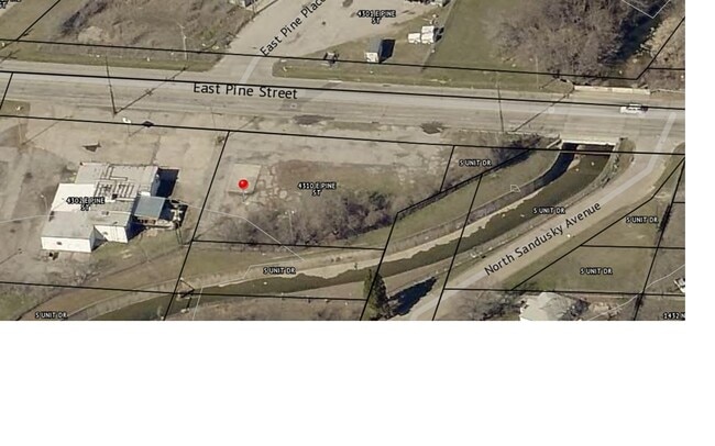
4310 E Pine St
Tulsa, OK
C A Reese
34450-03-33-16250
LTS 9 & 10 & PRT VAC ST BEG NEC LT 10 TH S82 NE TO PT CL ST TH N TO SL PINE ST W25 POB BLK 1
Parkinglot
Tulsa
AE
Oklahoma
40143C0241L
9
2025
0.36 AC
2025
Northeast
011300
Tulsa
1 SF
DEMOGRAPHICS near 4310 E Pine St
1 Mile
3 Mile
5 Mile
2024 Total Population
12,493
73,605
174,916
2029 Population
13,010
76,909
182,241
Pop Growth 2024-2029
+ 4.14%
+ 4.49%
+ 4.19%
Average Age
35
36
38
2024 Total Households
4,391
27,789
72,083
HH Growth 2024-2029
+ 4.19%
+ 4.69%
+ 4.36%
Median Household Inc
$41,975
$47,755
$52,605
Avg Household Size
2.70
2.50
2.30
2024 Avg HH Vehicles
2.00
2.00
2.00
Median Home Value
$61,386
$101,423
$161,458
Median Year Built
1955
1953
1957
Nearby Places
Map Layers
Map Styles
 Street
 Aerial
- Restaurants
- Banks
- Shops
- Fitness
- Groceries
PUBLIC TRANSPORTATION
AIRPORT
Tulsa International
DRIVE
WALK
Distance
Tulsa International
10 min
4.9 mi
Freight Ports
Tulsa Port Of Catoosa
DRIVE
WALK
Distance
Tulsa Port Of Catoosa
20 min
13.1 mi
Nearby Properties
Address
Land Use
TOTAL SIZE
Lot Size
Zoning
Address
Land Use
TOTAL SIZE
Lot Size
Zoning
1,604,892 SF
208.96 AC
AG
Address
Land Use
TOTAL SIZE
Lot Size
Zoning
1,673,798 SF
90.26 AC
NCU
Address
Land Use
TOTAL SIZE
Lot Size
Zoning
353.75 AC
IL
Address
Land Use
TOTAL SIZE
Lot Size
Zoning
175,176 SF
1.57 AC
RM2
Address
Land Use
TOTAL SIZE
Lot Size
Zoning
230,620 SF
16.72 AC
RM2
Address
Land Use
TOTAL SIZE
Lot Size
Zoning
94,115 SF
15.18 AC
IM
Address
Land Use
TOTAL SIZE
Lot Size
Zoning
106,579 SF
6.76 AC
RM1
Address
Land Use
TOTAL SIZE
Lot Size
Zoning
60,320 SF
5.23 AC
NCU
Address
Land Use
TOTAL SIZE
Lot Size
Zoning
163,321 SF
10.74 AC
RS3
Address
Land Use
TOTAL SIZE
Lot Size
Zoning
195,492 SF
17.11 AC
RM1
Address
Land Use
TOTAL SIZE
Lot Size
Zoning
51,539 SF
0.96 AC
RM2
Address
Land Use
TOTAL SIZE
Lot Size
Zoning
42,665 SF
493.63 AC
RS3
Address
Land Use
TOTAL SIZE
Lot Size
Zoning
56,476 SF
2.89 AC
RM2
Address
Land Use
TOTAL SIZE
Lot Size
Zoning
118,824 SF
38.79 AC
IM
Address
Land Use
TOTAL SIZE
Lot Size
Zoning
194,615 SF
18.68 AC
RS3
Address
Land Use
TOTAL SIZE
Lot Size
Zoning
67,334 SF
0.84 AC
IL
Address
Land Use
TOTAL SIZE
Lot Size
Zoning
110.77 AC
IL
Address
Land Use
TOTAL SIZE
Lot Size
Zoning
121,518 SF
8.52 AC
IM
Address
Land Use
TOTAL SIZE
Lot Size
Zoning
40,433 SF
2.92 AC
IL
Address
Land Use
TOTAL SIZE
Lot Size
Zoning
109,438 SF
1.77 AC
RM3
Address
Land Use
TOTAL SIZE
Lot Size
Zoning
103,248 SF
8.87 AC
IL
Address
Land Use
TOTAL SIZE
Lot Size
Zoning
36,962 SF
1.23 AC
CH
Address
Land Use
TOTAL SIZE
Lot Size
Zoning
97.68 AC
CH
Address
Land Use
TOTAL SIZE
Lot Size
Zoning
29,584 SF
2.99 AC
IM
Address
Land Use
TOTAL SIZE
Lot Size
Zoning
41,874 SF
35.70 AC
RS3
Address
Land Use
TOTAL SIZE
Lot Size
Zoning
592,475 SF
4.38 AC
CH
Address
Land Use
TOTAL SIZE
Lot Size
Zoning
29,110 SF
3.96 AC
IL
Address
Land Use
TOTAL SIZE
Lot Size
Zoning
117,204 SF
9.79 AC
IM
Address
Land Use
TOTAL SIZE
Lot Size
Zoning
34,356 SF
35.67 AC
RS3
Address
Land Use
TOTAL SIZE
Lot Size
Zoning
44,010 SF
1.78 AC
CH
The World's #1 Commercial Real Estate Marketplace
Connect with us
© 2026 CoStar Group
The information above has been obtained from sources believed reliable. While we do not doubt its accuracy we have not verified it and make no guarantee, warranty or representation about it. It is your responsibility to independently confirm its accuracy and completeness. Any projections, opinions, assumptions, or estimates used are for example only and do not represent the current or future performance of the property. The value of this transaction to you depends on tax and other factors which should be evaluated by your tax, financial, and legal advisors. You and your advisors should conduct a careful, independent investigation of the property to determine to your satisfaction the suitability of the property for your needs.