Property Record
4310 Malcolm X Blvd, Dallas, TX 75215
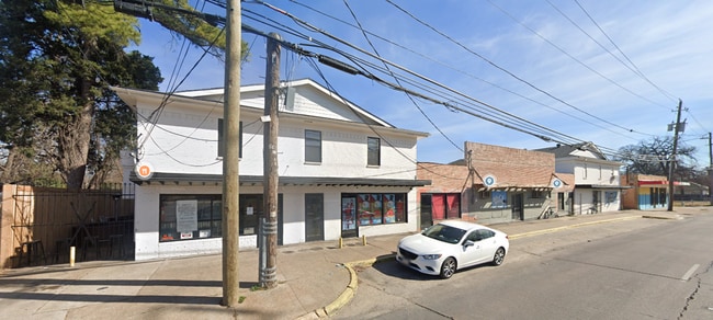


Property Detail
4310 Malcolm X Blvd
00000174595000000
WOODLAWN PLACE REV BLK A/1769 PT LOTS 2,3, & 4 67.63X99.63X140.83X166.5X135 INT202100120907 DD04232021 CO-DC 1769 00A 00200 1001769 00A
Stripcommercialcenter
DALLAS
Z239
Texas
C and X Area of minimal flood hazard, usually depicted on FIRMs as above the 500-year flood level.
2,3
2025
0.53 AC
2025
Pleasant Gr/SE Dallas
020800
Dallas/Ft Worth
13,160 SF
Dallas-Fort Worth-Arlington, TX
NEARBY LISTINGS FOR SALE OR LEASE
DEMOGRAPHICS near 4310 Malcolm X Blvd
1 mile
3 mile
5 mile
2025 Total Population
16,636
84,800
367,111
2030 Population
17,655
89,224
382,849
Pop Growth 2025-2030
+ 6.13%
+ 5.22%
+ 4.29%
Average Age
39
37
36
2025 Total Households
5,933
34,985
158,469
HH Growth 2025-2030
+ 6.15%
+ 5.78%
+ 4.66%
Median Household Inc
$49,638
$61,737
$74,095
Avg Household Size
2.60
2.30
2.20
2025 Avg HH Vehicles
1.00
1.00
2.00
Median Home Value
$182,972
$233,622
$340,294
Median Year Built
1964
1975
1984
Nearby Places
Map Layers
Map Styles
 Street
 Aerial
Layers
 Traffic
 Biking
Places
Listings with unknown addresses are not visible on the map
- Restaurants
- Banks
- Shops
- Fitness
- Groceries
PUBLIC TRANSPORTATION
TRANSIT/SUBWAY
Hatcher Station (DART LIGHT RAIL - GREEN LINE - Dallas Area Rapid Transit (DART))
Drive
Walk
Distance
Hatcher Station (DART LIGHT RAIL - GREEN LINE - Dallas Area Rapid Transit (DART))
3 min
19 min
1.0 mi
COMMUTER RAIL
Victory Station (DART LIGHT RAIL - GREEN LINE - Dallas Area Rapid Transit (DART), DART LIGHT RAIL - ORANGE LINE - Dallas Area Rapid Transit (DART), TRINITY RAILWAY - Dallas Area Rapid Transit (DART))
Drive
Walk
Distance
Victory Station (DART LIGHT RAIL - GREEN LINE - Dallas Area Rapid Transit (DART), DART LIGHT RAIL - ORANGE LINE - Dallas Area Rapid Transit (DART), TRINITY RAILWAY - Dallas Area Rapid Transit (DART))
11 min
5.6 mi
Medical/Market Ctr Station (TRINITY RAILWAY - Dallas Area Rapid Transit (DART))
Drive
Walk
Distance
Medical/Market Ctr Station (TRINITY RAILWAY - Dallas Area Rapid Transit (DART))
15 min
7.5 mi
AIRPORT
Dallas Love Field
Drive
Walk
Distance
Dallas Love Field
19 min
9.6 mi
Dallas-Fort Worth International
Drive
Walk
Distance
Dallas-Fort Worth International
35 min
25.5 mi
Freight Ports
Port of Shreveport
Drive
Walk
Distance
Port of Shreveport
211 min
195.3 mi
SALE & LEASE HISTORY
LISTING DATE
SALE/LEASE

Oct 24, 2023
For Lease
Jan 11, 2023
For Sale
Nearby Properties
Address
Land Use
TOTAL SIZE
Lot Size
Zoning
Address
Land Use
TOTAL SIZE
Lot Size
Zoning
1,848,034 SF
2.29 AC
Z21
Address
Land Use
TOTAL SIZE
Lot Size
Zoning
1,003,243 SF
2.07 AC
Z21
Address
Land Use
TOTAL SIZE
Lot Size
Zoning
3,398,834 SF
13.45 AC
Z151
Address
Land Use
TOTAL SIZE
Lot Size
Zoning
659,884 SF
5.77 AC
Z151
Address
Land Use
TOTAL SIZE
Lot Size
Zoning
432,919 SF
0.69 AC
Z21
Address
Land Use
TOTAL SIZE
Lot Size
Zoning
593,031 SF
1 AC
Address
Land Use
TOTAL SIZE
Lot Size
Zoning
1,979,594 SF
1.81 AC
Z21
Address
Land Use
TOTAL SIZE
Lot Size
Zoning
644,416 SF
1.26 AC
Z239
Address
Land Use
TOTAL SIZE
Lot Size
Zoning
741,673 SF
1.30 AC
Z21
Address
Land Use
TOTAL SIZE
Lot Size
Zoning
668,282 SF
1.94 AC
Z22
Address
Land Use
TOTAL SIZE
Lot Size
Zoning
357,160 SF
0.70 AC
Z21
Address
Land Use
TOTAL SIZE
Lot Size
Zoning
661,775 SF
12.55 AC
Z151
Address
Land Use
TOTAL SIZE
Lot Size
Zoning
529,666 SF
1.21 AC
Z239
Address
Land Use
TOTAL SIZE
Lot Size
Zoning
608,242 SF
1.29 AC
Z239
Address
Land Use
TOTAL SIZE
Lot Size
Zoning
479,689 SF
0.78 AC
Z239
Address
Land Use
TOTAL SIZE
Lot Size
Zoning
671,580 SF
3.87 AC
Z239
Address
Land Use
TOTAL SIZE
Lot Size
Zoning
1,137,345 SF
0.83 AC
Z21
Address
Land Use
TOTAL SIZE
Lot Size
Zoning
307,756 SF
0.11 AC
Z151
Address
Land Use
TOTAL SIZE
Lot Size
Zoning
458,874 SF
4.71 AC
Z239
Address
Land Use
TOTAL SIZE
Lot Size
Zoning
512,824 SF
0.47 AC
Z21
Address
Land Use
TOTAL SIZE
Lot Size
Zoning
521,757 SF
3.85 AC
Z239
Address
Land Use
TOTAL SIZE
Lot Size
Zoning
339,086 SF
4.35 AC
Z163
Address
Land Use
TOTAL SIZE
Lot Size
Zoning
452,834 SF
2.76 AC
Z21
Address
Land Use
TOTAL SIZE
Lot Size
Zoning
539,635 SF
1 AC
Address
Land Use
TOTAL SIZE
Lot Size
Zoning
213,616 SF
16.31 AC
Z239
Address
Land Use
TOTAL SIZE
Lot Size
Zoning
356,540 SF
2.89 AC
Z21
Address
Land Use
TOTAL SIZE
Lot Size
Zoning
467,743 SF
2.56 AC
Z239
Address
Land Use
TOTAL SIZE
Lot Size
Zoning
380,000 SF
6.52 AC
Z21
Address
Land Use
TOTAL SIZE
Lot Size
Zoning
563,339 SF
7.10 AC
Z21
Address
Land Use
TOTAL SIZE
Lot Size
Zoning
505,910 SF
6.30 AC
Z21
The World's #1 Commercial Real Estate Marketplace
Connect with us
© 2026 CoStar Group
The information above has been obtained from sources believed reliable. While we do not doubt its accuracy we have not verified it and make no guarantee, warranty or representation about it. It is your responsibility to independently confirm its accuracy and completeness. Any projections, opinions, assumptions, or estimates used are for example only and do not represent the current or future performance of the property. The value of this transaction to you depends on tax and other factors which should be evaluated by your tax, financial, and legal advisors. You and your advisors should conduct a careful, independent investigation of the property to determine to your satisfaction the suitability of the property for your needs.