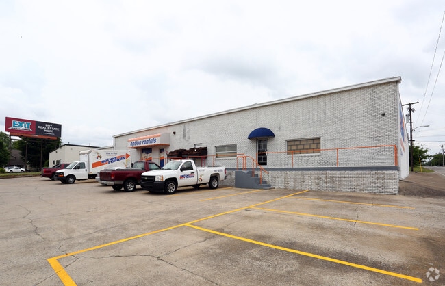
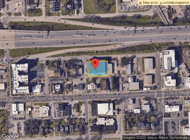
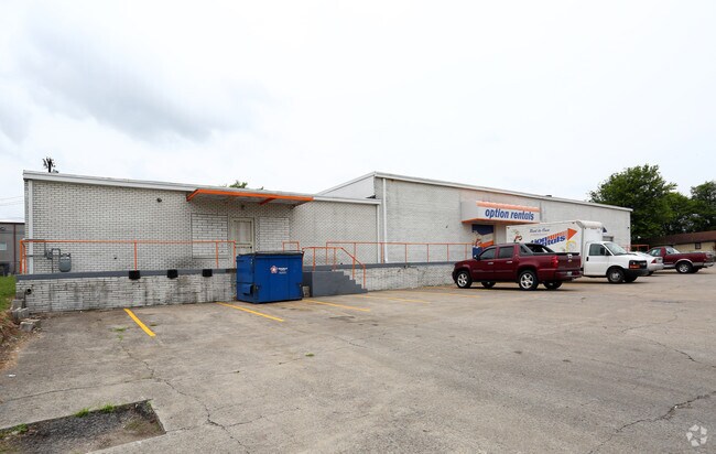
Property Record
4311 Alabama Ave, Nashville, TN 37209
NEARBY LISTINGS FOR SALE OR LEASE
Property Detail
4311 Alabama Ave
Nashville-Davidson--Murfreesboro--Franklin, TN
West Nashville
091-12-0-174
LOTS 210-212-214-216-218-220-222 & PT LT 224 BLK 20 W NASH PLAN NO. 1
Publicstorage
Davidson
X
Tennessee
47037C0239J
214-216
2025
0.70 AC
2025
West
013400
Nashville
86,964 SF
DEMOGRAPHICS near 4311 Alabama Ave
1 Mile
3 Mile
5 Mile
2024 Total Population
13,818
104,291
218,407
2029 Population
13,993
105,420
221,788
Pop Growth 2024-2029
+ 1.27%
+ 1.08%
+ 1.55%
Average Age
34
36
37
2024 Total Households
6,305
47,023
99,462
HH Growth 2024-2029
+ 1.00%
+ 1.17%
+ 1.81%
Median Household Inc
$75,101
$65,343
$68,917
Avg Household Size
2.10
1.90
2.00
2024 Avg HH Vehicles
2.00
1.00
1.00
Median Home Value
$557,848
$494,569
$529,098
Median Year Built
1999
1993
1998
Nearby Places
Map Layers
Map Styles
 Street
 Aerial
- Restaurants
- Banks
- Shops
- Fitness
- Groceries
PUBLIC TRANSPORTATION
COMMUTER RAIL
Riverfront (East Corridor Line - Tennessee Regional Transportation Authority Music City Star (Music City Star))
DRIVE
WALK
Distance
Riverfront (East Corridor Line - Tennessee Regional Transportation Authority Music City Star (Music City Star))
8 min
4.1 mi
AIRPORT
Nashville International
DRIVE
WALK
Distance
Nashville International
21 min
12.9 mi
Nearby Properties
Address
Land Use
TOTAL SIZE
Lot Size
Zoning
Address
Land Use
TOTAL SIZE
Lot Size
Zoning
6,216 SF
131.92 AC
MULTI-ZONE
Address
Land Use
TOTAL SIZE
Lot Size
Zoning
289,697 SF
10.18 AC
MUI-A
Address
Land Use
TOTAL SIZE
Lot Size
Zoning
30,648 SF
37.73 AC
ORI
Address
Land Use
TOTAL SIZE
Lot Size
Zoning
5,397 SF
36.19 AC
MULTI-ZONE
Address
Land Use
TOTAL SIZE
Lot Size
Zoning
1,339,972 SF
16.18 AC
ORI
Address
Land Use
TOTAL SIZE
Lot Size
Zoning
17.48 AC
MUG
Address
Land Use
TOTAL SIZE
Lot Size
Zoning
57,264 SF
7.80 AC
MUI
Address
Land Use
TOTAL SIZE
Lot Size
Zoning
24.42 AC
ORI
Address
Land Use
TOTAL SIZE
Lot Size
Zoning
18,446 SF
5.97 AC
DTC
Address
Land Use
TOTAL SIZE
Lot Size
Zoning
148,222 SF
25.86 AC
MULTI-ZONE
Address
Land Use
TOTAL SIZE
Lot Size
Zoning
15.48 AC
MUI
Address
Land Use
TOTAL SIZE
Lot Size
Zoning
208,992 SF
6.09 AC
MUG
Address
Land Use
TOTAL SIZE
Lot Size
Zoning
17.03 AC
ORI
Address
Land Use
TOTAL SIZE
Lot Size
Zoning
207,950 SF
3.47 AC
RM20
Address
Land Use
TOTAL SIZE
Lot Size
Zoning
4.23 AC
DTC
Address
Land Use
TOTAL SIZE
Lot Size
Zoning
304,445 SF
X
Address
Land Use
TOTAL SIZE
Lot Size
Zoning
545,321 SF
5.34 AC
DTC
Address
Land Use
TOTAL SIZE
Lot Size
Zoning
489,992 SF
1.50 AC
DTC
Address
Land Use
TOTAL SIZE
Lot Size
Zoning
556,277 SF
1.85 AC
SP
Address
Land Use
TOTAL SIZE
Lot Size
Zoning
576,252 SF
29,096 AC
DTC
Address
Land Use
TOTAL SIZE
Lot Size
Zoning
76,787 SF
3.86 AC
3ZZ
Address
Land Use
TOTAL SIZE
Lot Size
Zoning
515,541 SF
4.83 AC
DTC
Address
Land Use
TOTAL SIZE
Lot Size
Zoning
3.48 AC
Address
Land Use
TOTAL SIZE
Lot Size
Zoning
499,187 SF
1.54 AC
MULTI-ZONE
Address
Land Use
TOTAL SIZE
Lot Size
Zoning
184,700 SF
14.20 AC
RM40
Address
Land Use
TOTAL SIZE
Lot Size
Zoning
538,947 SF
32,148 AC
DTC
Address
Land Use
TOTAL SIZE
Lot Size
Zoning
535,185 SF
1.05 AC
SP
Address
Land Use
TOTAL SIZE
Lot Size
Zoning
9.31 AC
MULTI-ZONE
Address
Land Use
TOTAL SIZE
Lot Size
Zoning
153,434 SF
3.08 AC
ORI
Address
Land Use
TOTAL SIZE
Lot Size
Zoning
80,280 SF
2.20 AC
OVUDO
The World's #1 Commercial Real Estate Marketplace
Connect with us
© 2026 CoStar Group
The information above has been obtained from sources believed reliable. While we do not doubt its accuracy we have not verified it and make no guarantee, warranty or representation about it. It is your responsibility to independently confirm its accuracy and completeness. Any projections, opinions, assumptions, or estimates used are for example only and do not represent the current or future performance of the property. The value of this transaction to you depends on tax and other factors which should be evaluated by your tax, financial, and legal advisors. You and your advisors should conduct a careful, independent investigation of the property to determine to your satisfaction the suitability of the property for your needs.