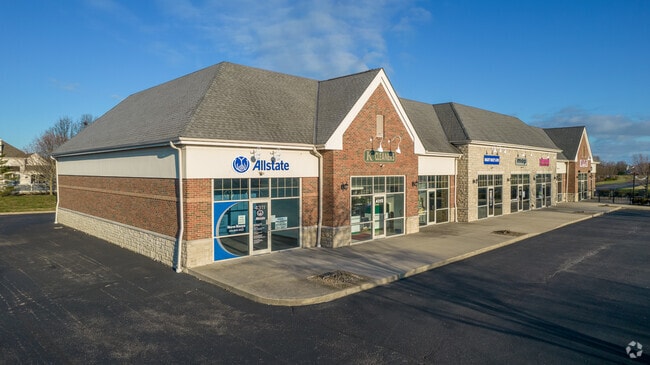
Property Record
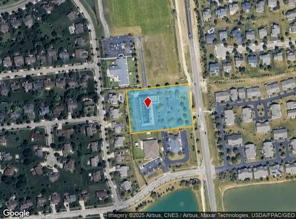
4311 Cosgray Rd, Hilliard, OH 43026
NEARBY LISTINGS FOR SALE OR LEASE
Property Detail
4311 Cosgray Rd
Columbus, OH
Virginia Military Surveys 6366
050-007624
BALDWIN PIKE OQ 1067 ENTRY 6366 2.375 ACRES
Regionalshoppingcenterormallwithanchorstore
Franklin
X
Ohio
39097C0100D
2
2024
2.38 AC
2024
Hilliard
007961
Columbus
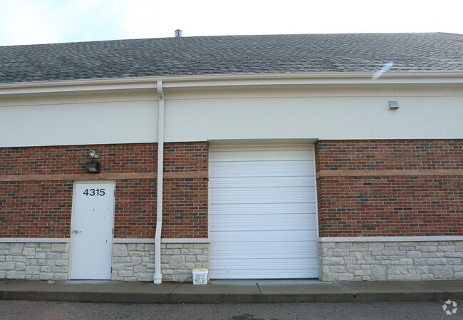
11,152 SF
DEMOGRAPHICS near 4311 Cosgray Rd
1 Mile
3 Mile
5 Mile
2024 Total Population
5,722
57,034
120,358
2029 Population
5,696
56,511
119,515
Pop Growth 2024-2029
(0.45%)
(0.92%)
(0.70%)
Average Age
39
37
38
2024 Total Households
2,054
22,679
49,186
HH Growth 2024-2029
(0.44%)
(0.91%)
(0.75%)
Median Household Inc
$109,945
$94,295
$93,862
Avg Household Size
2.80
2.50
2.40
2024 Avg HH Vehicles
2.00
2.00
2.00
Median Home Value
$356,329
$278,773
$292,945
Median Year Built
2002
1997
1995
Nearby Places
Map Layers
Map Styles
 Street
 Aerial
- Restaurants
- Banks
- Shops
- Fitness
- Groceries
PUBLIC TRANSPORTATION
AIRPORT
John Glenn Columbus International
DRIVE
WALK
Distance
John Glenn Columbus International
32 min
20.9 mi
Rickenbacker International
DRIVE
WALK
Distance
Rickenbacker International
37 min
25.9 mi
Freight Ports
Port of Toledo
DRIVE
WALK
Distance
Port of Toledo
175 min
127.6 mi
SALE & LEASE HISTORY
LISTING DATE
SALE/LEASE

Nov 03, 2023
For Lease
Jan 09, 2017
For Lease
Nearby Properties
Address
Land Use
TOTAL SIZE
Lot Size
Zoning
Address
Land Use
TOTAL SIZE
Lot Size
Zoning
768,498 SF
55.17 AC
Address
Land Use
TOTAL SIZE
Lot Size
Zoning
880,352 SF
94.89 AC
Address
Land Use
TOTAL SIZE
Lot Size
Zoning
417,762 SF
119.53 AC
Address
Land Use
TOTAL SIZE
Lot Size
Zoning
327,525 SF
70.58 AC
Address
Land Use
TOTAL SIZE
Lot Size
Zoning
529,001 SF
28.39 AC
Address
Land Use
TOTAL SIZE
Lot Size
Zoning
133,910 SF
14.48 AC
Address
Land Use
TOTAL SIZE
Lot Size
Zoning
158,471 SF
19.11 AC
Address
Land Use
TOTAL SIZE
Lot Size
Zoning
46,231 SF
27.42 AC
Address
Land Use
TOTAL SIZE
Lot Size
Zoning
91,413 SF
0.14 AC
Address
Land Use
TOTAL SIZE
Lot Size
Zoning
47,334 SF
29.34 AC
Address
Land Use
TOTAL SIZE
Lot Size
Zoning
110,180 SF
29.07 AC
Address
Land Use
TOTAL SIZE
Lot Size
Zoning
446,488 SF
45.12 AC
Address
Land Use
TOTAL SIZE
Lot Size
Zoning
163,895 SF
36.52 AC
Address
Land Use
TOTAL SIZE
Lot Size
Zoning
271,295 SF
14.75 AC
Address
Land Use
TOTAL SIZE
Lot Size
Zoning
67,186 SF
21.51 AC
Address
Land Use
TOTAL SIZE
Lot Size
Zoning
105,351 SF
9.88 AC
Address
Land Use
TOTAL SIZE
Lot Size
Zoning
40,500 SF
20.91 AC
Address
Land Use
TOTAL SIZE
Lot Size
Zoning
156,030 SF
31.29 AC
Address
Land Use
TOTAL SIZE
Lot Size
Zoning
14.06 AC
Address
Land Use
TOTAL SIZE
Lot Size
Zoning
21,238 SF
14.67 AC
Address
Land Use
TOTAL SIZE
Lot Size
Zoning
86,067 SF
14.79 AC
Address
Land Use
TOTAL SIZE
Lot Size
Zoning
149,424 SF
39.15 AC
Address
Land Use
TOTAL SIZE
Lot Size
Zoning
103,881 SF
11.78 AC
Address
Land Use
TOTAL SIZE
Lot Size
Zoning
33,512 SF
12.27 AC
Address
Land Use
TOTAL SIZE
Lot Size
Zoning
137,350 SF
11.01 AC
Address
Land Use
TOTAL SIZE
Lot Size
Zoning
39,053 SF
6.57 AC
Address
Land Use
TOTAL SIZE
Lot Size
Zoning
38,612 SF
21.48 AC
Address
Land Use
TOTAL SIZE
Lot Size
Zoning
70,778 SF
12.13 AC
Address
Land Use
TOTAL SIZE
Lot Size
Zoning
138,467 SF
2.77 AC
Address
Land Use
TOTAL SIZE
Lot Size
Zoning
76,526 SF
6.38 AC
The World's #1 Commercial Real Estate Marketplace
Connect with us
© 2026 CoStar Group
The information above has been obtained from sources believed reliable. While we do not doubt its accuracy we have not verified it and make no guarantee, warranty or representation about it. It is your responsibility to independently confirm its accuracy and completeness. Any projections, opinions, assumptions, or estimates used are for example only and do not represent the current or future performance of the property. The value of this transaction to you depends on tax and other factors which should be evaluated by your tax, financial, and legal advisors. You and your advisors should conduct a careful, independent investigation of the property to determine to your satisfaction the suitability of the property for your needs.