Property Record
4312 20Th St, Rockford, IL 61109
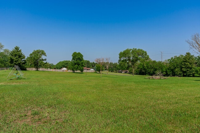


This Property Is For Sale
NEARBY LISTINGS FOR SALE OR LEASE
Property Detail
4312 20Th St
16-07-151-003
(EXC W PT TO STATE) & (EXC W 272 FT THEREOF) S 400 FT OF N 2224.32 FT OF W 1089 FT PT NW 1/4 SEC SEC: 7 TWP: 43 RANGE: 2 ACRES: 8.78
Religious
Winnebago
X
Illinois
17201C0383E
8.78 AC
0
I-39 Corr/Winnebago Cnty
2024
Chicago
003706
Rockford, IL
DEMOGRAPHICS near 4312 20Th St
1 Mile
3 Mile
5 Mile
2024 Total Population
7,127
50,358
111,297
2029 Population
7,137
50,241
111,511
Pop Growth 2024-2029
+ 0.14%
(0.23%)
+ 0.19%
Average Age
38
38
39
2024 Total Households
2,705
20,045
45,176
HH Growth 2024-2029
+ 0.18%
(0.20%)
+ 0.22%
Median Household Inc
$65,820
$56,208
$56,808
Avg Household Size
2.60
2.40
2.40
2024 Avg HH Vehicles
2.00
2.00
2.00
Median Home Value
$129,113
$124,151
$139,464
Median Year Built
1975
1965
1962
Nearby Places
Map Layers
Map Styles
 Street
 Aerial
- Restaurants
- Banks
- Shops
- Fitness
- Groceries
PUBLIC TRANSPORTATION
AIRPORT
Chicago/Rockford International
DRIVE
WALK
Distance
Chicago/Rockford International
15 min
5.9 mi
Freight Ports
Port Milwaukee
DRIVE
WALK
Distance
Port Milwaukee
116 min
97.3 mi
Nearby Properties
Address
Land Use
TOTAL SIZE
Lot Size
Zoning
Address
Land Use
TOTAL SIZE
Lot Size
Zoning
680,704 SF
43.11 AC
R3
Address
Land Use
TOTAL SIZE
Lot Size
Zoning
920,723 SF
82.07 AC
Address
Land Use
TOTAL SIZE
Lot Size
Zoning
555,920 SF
37.99 AC
I2
Address
Land Use
TOTAL SIZE
Lot Size
Zoning
551,795 SF
36 AC
R3
Address
Land Use
TOTAL SIZE
Lot Size
Zoning
13,308 SF
19.30 AC
I2
Address
Land Use
TOTAL SIZE
Lot Size
Zoning
369,006 SF
15.24 AC
I2
Address
Land Use
TOTAL SIZE
Lot Size
Zoning
291,074 SF
10.97 AC
I3
Address
Land Use
TOTAL SIZE
Lot Size
Zoning
189,455 SF
10.99 AC
I3
Address
Land Use
TOTAL SIZE
Lot Size
Zoning
147,900 SF
7.78 AC
Address
Land Use
TOTAL SIZE
Lot Size
Zoning
173,193 SF
5.97 AC
I3
Address
Land Use
TOTAL SIZE
Lot Size
Zoning
77,718 SF
11.12 AC
C2
Address
Land Use
TOTAL SIZE
Lot Size
Zoning
192,575 SF
46.19 AC
I1
Address
Land Use
TOTAL SIZE
Lot Size
Zoning
623,379 SF
35.15 AC
I3
Address
Land Use
TOTAL SIZE
Lot Size
Zoning
174,318 SF
17.97 AC
Address
Land Use
TOTAL SIZE
Lot Size
Zoning
133,394 SF
14.08 AC
C3
Address
Land Use
TOTAL SIZE
Lot Size
Zoning
2,975 SF
5.42 AC
I2
Address
Land Use
TOTAL SIZE
Lot Size
Zoning
212,574 SF
9.57 AC
I3
Address
Land Use
TOTAL SIZE
Lot Size
Zoning
86,720 SF
3.91 AC
R4
Address
Land Use
TOTAL SIZE
Lot Size
Zoning
150,351 SF
22.95 AC
I3
Address
Land Use
TOTAL SIZE
Lot Size
Zoning
10,970 SF
26.80 AC
R2
Address
Land Use
TOTAL SIZE
Lot Size
Zoning
584,794 SF
34.40 AC
I3
Address
Land Use
TOTAL SIZE
Lot Size
Zoning
111,311 SF
7.85 AC
I1
Address
Land Use
TOTAL SIZE
Lot Size
Zoning
152,100 SF
4.19 AC
I2
Address
Land Use
TOTAL SIZE
Lot Size
Zoning
10.92 AC
Address
Land Use
TOTAL SIZE
Lot Size
Zoning
216,549 SF
9.18 AC
I2
Address
Land Use
TOTAL SIZE
Lot Size
Zoning
85,575 SF
10.29 AC
C2
Address
Land Use
TOTAL SIZE
Lot Size
Zoning
6,869 SF
93.78 AC
RMH
Address
Land Use
TOTAL SIZE
Lot Size
Zoning
52,340 SF
14.36 AC
Address
Land Use
TOTAL SIZE
Lot Size
Zoning
187,025 SF
12.82 AC
I3
Address
Land Use
TOTAL SIZE
Lot Size
Zoning
92,245 SF
5.67 AC
I3
The World's #1 Commercial Real Estate Marketplace
Connect with us
© 2025 CoStar Group
The information above has been obtained from sources believed reliable. While we do not doubt its accuracy we have not verified it and make no guarantee, warranty or representation about it. It is your responsibility to independently confirm its accuracy and completeness. Any projections, opinions, assumptions, or estimates used are for example only and do not represent the current or future performance of the property. The value of this transaction to you depends on tax and other factors which should be evaluated by your tax, financial, and legal advisors. You and your advisors should conduct a careful, independent investigation of the property to determine to your satisfaction the suitability of the property for your needs.