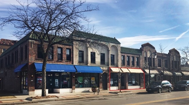
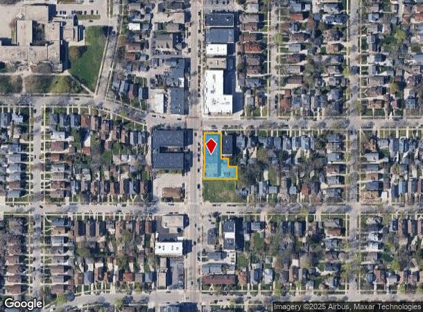
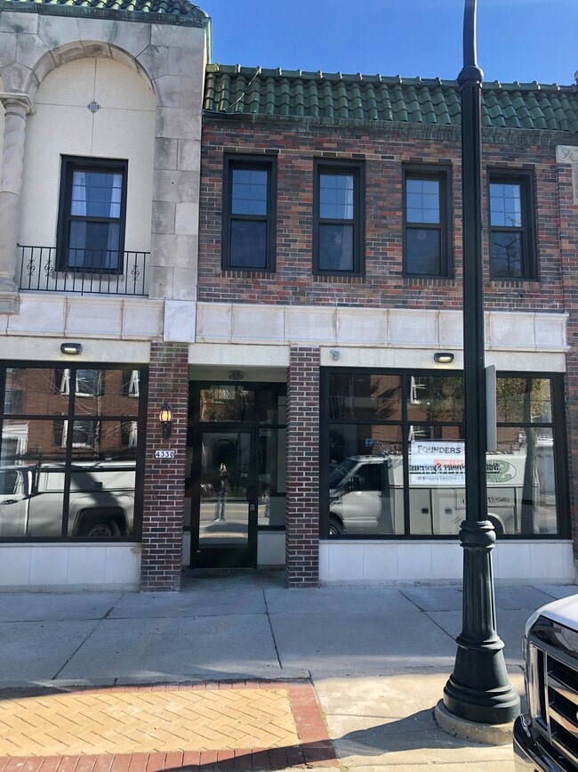
Property Record
4312 N Oakland Ave, Milwaukee, WI 53211
NEARBY LISTINGS FOR SALE OR LEASE
Property Detail
4312 N Oakland Ave
Milwaukee-Waukesha-West Allis, WI
Oakland Ave Hts
239-0292-001
OAKLAND AVE HTS SW 1/4 SEC 3-7-22 LOT 11 EXC W 7FT TAKEN FOR STREET BLK 2 ALSO LANDS IN SW 1/4 SEC 3-7-22 DESCR AS FOLLOWS COM AT INTERSECTION OF S LI........
Commercialnec
Milwaukee
X
Wisconsin
55079C0082E
11
2024
0.41 AC
2024
Milwaukee East
080200
Milwaukee/Madison
17,224 SF
DEMOGRAPHICS near 4312 N Oakland Ave
1 Mile
3 Mile
5 Mile
2024 Total Population
17,240
113,463
269,614
2029 Population
16,636
111,517
266,308
Pop Growth 2024-2029
(3.50%)
(1.72%)
(1.23%)
Average Age
40
36
36
2024 Total Households
7,936
50,116
116,503
HH Growth 2024-2029
(3.53%)
(1.86%)
(1.28%)
Median Household Inc
$92,596
$52,384
$44,656
Avg Household Size
2.10
2.10
2.20
2024 Avg HH Vehicles
1.00
1.00
1.00
Median Home Value
$392,931
$268,732
$207,315
Median Year Built
1947
1947
1949
Nearby Places
Map Layers
Map Styles
 Street
 Aerial
- Restaurants
- Banks
- Shops
- Fitness
- Groceries
PUBLIC TRANSPORTATION
COMMUTER RAIL
Milwaukee (Empire Builder - Amtrak)
DRIVE
WALK
Distance
Milwaukee (Empire Builder - Amtrak)
15 min
7.0 mi
AIRPORT
General Mitchell International
DRIVE
WALK
Distance
General Mitchell International
26 min
13.5 mi
Freight Ports
Port Milwaukee
DRIVE
WALK
Distance
Port Milwaukee
18 min
9.4 mi
SALE & LEASE HISTORY
LISTING DATE
SALE/LEASE

Nov 23, 2020
For Lease
Jan 23, 2019
For Lease
Nearby Properties
Address
Land Use
TOTAL SIZE
Lot Size
Zoning
Address
Land Use
TOTAL SIZE
Lot Size
Zoning
237,850 SF
5.02 AC
RM7
Address
Land Use
TOTAL SIZE
Lot Size
Zoning
26.11 AC
TL
Address
Land Use
TOTAL SIZE
Lot Size
Zoning
417,704 SF
0.81 AC
PD
Address
Land Use
TOTAL SIZE
Lot Size
Zoning
382,921 SF
2.81 AC
PD
Address
Land Use
TOTAL SIZE
Lot Size
Zoning
42.90 AC
TL
Address
Land Use
TOTAL SIZE
Lot Size
Zoning
162,000 SF
0.83 AC
PD
Address
Land Use
TOTAL SIZE
Lot Size
Zoning
305,573 SF
3.20 AC
Address
Land Use
TOTAL SIZE
Lot Size
Zoning
66,245 SF
10.21 AC
Address
Land Use
TOTAL SIZE
Lot Size
Zoning
0.09 AC
LB2
Address
Land Use
TOTAL SIZE
Lot Size
Zoning
12.97 AC
TL
Address
Land Use
TOTAL SIZE
Lot Size
Zoning
85,000 SF
1.13 AC
Address
Land Use
TOTAL SIZE
Lot Size
Zoning
685,390 SF
26.20 AC
Address
Land Use
TOTAL SIZE
Lot Size
Zoning
1 SF
5.12 AC
PD
Address
Land Use
TOTAL SIZE
Lot Size
Zoning
152,640 SF
10.50 AC
Address
Land Use
TOTAL SIZE
Lot Size
Zoning
171,170 SF
25.88 AC
Address
Land Use
TOTAL SIZE
Lot Size
Zoning
12.74 AC
TL
Address
Land Use
TOTAL SIZE
Lot Size
Zoning
214,461 SF
0.49 AC
PD
Address
Land Use
TOTAL SIZE
Lot Size
Zoning
224,756 SF
12 AC
RESIDENTIA
Address
Land Use
TOTAL SIZE
Lot Size
Zoning
145,605 SF
2.64 AC
Address
Land Use
TOTAL SIZE
Lot Size
Zoning
241,520 SF
6.60 AC
Address
Land Use
TOTAL SIZE
Lot Size
Zoning
110,011 SF
0.59 AC
PD
Address
Land Use
TOTAL SIZE
Lot Size
Zoning
27.05 AC
PK
Address
Land Use
TOTAL SIZE
Lot Size
Zoning
165,296 SF
1.04 AC
Address
Land Use
TOTAL SIZE
Lot Size
Zoning
294,553 SF
6.19 AC
Address
Land Use
TOTAL SIZE
Lot Size
Zoning
113,542 SF
2.31 AC
Address
Land Use
TOTAL SIZE
Lot Size
Zoning
213,218 SF
11 AC
Address
Land Use
TOTAL SIZE
Lot Size
Zoning
154,494 SF
0.83 AC
PD
Address
Land Use
TOTAL SIZE
Lot Size
Zoning
90,714 SF
4.18 AC
Address
Land Use
TOTAL SIZE
Lot Size
Zoning
72,121 SF
10.93 AC
TL
Address
Land Use
TOTAL SIZE
Lot Size
Zoning
148,694 SF
0.68 AC
LB3
The World's #1 Commercial Real Estate Marketplace
Connect with us
© 2025 CoStar Group
The information above has been obtained from sources believed reliable. While we do not doubt its accuracy we have not verified it and make no guarantee, warranty or representation about it. It is your responsibility to independently confirm its accuracy and completeness. Any projections, opinions, assumptions, or estimates used are for example only and do not represent the current or future performance of the property. The value of this transaction to you depends on tax and other factors which should be evaluated by your tax, financial, and legal advisors. You and your advisors should conduct a careful, independent investigation of the property to determine to your satisfaction the suitability of the property for your needs.