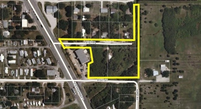
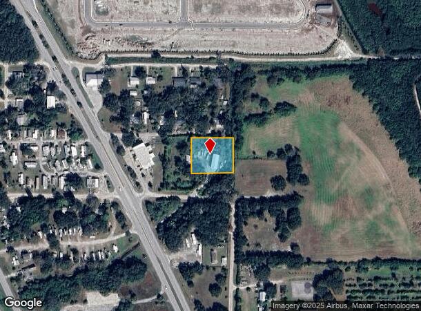
Property Record
4315 81St Pl, Vero Beach, FL 32967
NEARBY LISTINGS FOR SALE OR LEASE
Property Detail
4315 81St Pl
31-39-33-00000-1000-00012.0
Null
Residentialacreage
SEC 33 TWP 31 RNG 39 FROM THE E QTR COR OF SEC 33 RUN N00-18-00W FOR A DIST OF 134.97 TO THE POB TH CONT ALONG SAID SAME LINE A DIST OF 172.20 FT TH RUN S89-24-47E FOR A DIST OF 211.53 FT TH RUN S00-17-42E FOR A DIST OF 174.91 FT TH RUN N88-40-40E A
AE
Indian River
12061C0231J
Florida
2025
0.85 AC
2025
Fort Pierce/Port St Lucie
050812
Other Market Areas
720 SF
Sebastian-Vero Beach, FL
DEMOGRAPHICS near 4315 81St Pl
1 Mile
3 Mile
5 Mile
2024 Total Population
513
14,891
45,294
2029 Population
583
16,854
50,897
Pop Growth 2024-2029
+ 13.65%
+ 13.18%
+ 12.37%
Average Age
54
58
54
2024 Total Households
242
6,907
20,401
HH Growth 2024-2029
+ 13.22%
+ 12.74%
+ 12.04%
Median Household Inc
$55,555
$80,426
$66,323
Avg Household Size
2.10
2.10
2.20
2024 Avg HH Vehicles
2.00
2.00
2.00
Median Home Value
$418,269
$426,177
$343,848
Median Year Built
2002
1999
1996
Nearby Places
Map Layers
Map Styles
 Street
 Aerial
- Restaurants
- Banks
- Shops
- Fitness
- Groceries
PUBLIC TRANSPORTATION
AIRPORT
Melbourne Orlando International
DRIVE
WALK
Distance
Melbourne Orlando International
50 min
29.7 mi
Freight Ports
Port Canaveral
DRIVE
WALK
Distance
Port Canaveral
84 min
68.1 mi
Nearby Properties
Address
Land Use
TOTAL SIZE
Lot Size
Zoning
Address
Land Use
TOTAL SIZE
Lot Size
Zoning
88,643 SF
19.01 AC
PDTND
Address
Land Use
TOTAL SIZE
Lot Size
Zoning
1.85 AC
R-1A
Address
Land Use
TOTAL SIZE
Lot Size
Zoning
1.74 AC
R-1A
Address
Land Use
TOTAL SIZE
Lot Size
Zoning
4.04 AC
PRD
Address
Land Use
TOTAL SIZE
Lot Size
Zoning
9,118 SF
1.48 AC
R-1A
Address
Land Use
TOTAL SIZE
Lot Size
Zoning
4,764 SF
5.23 AC
RM-6
Address
Land Use
TOTAL SIZE
Lot Size
Zoning
1,530 SF
4.50 AC
RS-3
Address
Land Use
TOTAL SIZE
Lot Size
Zoning
1.03 AC
R-1A
Address
Land Use
TOTAL SIZE
Lot Size
Zoning
61,088 SF
9.92 AC
CG
Address
Land Use
TOTAL SIZE
Lot Size
Zoning
7,569 SF
1.24 AC
R-1A
Address
Land Use
TOTAL SIZE
Lot Size
Zoning
3,922 SF
309.08 AC
PD
Address
Land Use
TOTAL SIZE
Lot Size
Zoning
25,938 SF
350.65 AC
A-1
Address
Land Use
TOTAL SIZE
Lot Size
Zoning
49,817 SF
18.57 AC
A-1
Address
Land Use
TOTAL SIZE
Lot Size
Zoning
65,936 SF
32.77 AC
PS
Address
Land Use
TOTAL SIZE
Lot Size
Zoning
26,157 SF
9.77 AC
RS-3
Address
Land Use
TOTAL SIZE
Lot Size
Zoning
20,576 SF
139.18 AC
A-1
Address
Land Use
TOTAL SIZE
Lot Size
Zoning
19.60 AC
RS-3
Address
Land Use
TOTAL SIZE
Lot Size
Zoning
292 SF
179.65 AC
RM-4
Address
Land Use
TOTAL SIZE
Lot Size
Zoning
3,530 SF
50.26 AC
RS-1
Address
Land Use
TOTAL SIZE
Lot Size
Zoning
12,828 SF
150.17 AC
RM-4
Address
Land Use
TOTAL SIZE
Lot Size
Zoning
1,722 SF
196.63 AC
RM-6
Address
Land Use
TOTAL SIZE
Lot Size
Zoning
9,168 SF
0.10 AC
CG
Address
Land Use
TOTAL SIZE
Lot Size
Zoning
35,679 SF
4.12 AC
CL
Address
Land Use
TOTAL SIZE
Lot Size
Zoning
4,696 SF
84.52 AC
A-1
Address
Land Use
TOTAL SIZE
Lot Size
Zoning
1.60 AC
RS-6
Address
Land Use
TOTAL SIZE
Lot Size
Zoning
1.56 AC
R-2A
Address
Land Use
TOTAL SIZE
Lot Size
Zoning
300 SF
10.72 AC
IL
Address
Land Use
TOTAL SIZE
Lot Size
Zoning
1.56 AC
RS-6
Address
Land Use
TOTAL SIZE
Lot Size
Zoning
23,805 SF
40.17 AC
A-1
Address
Land Use
TOTAL SIZE
Lot Size
Zoning
23 AC
RM-6
The World's #1 Commercial Real Estate Marketplace
Connect with us
© 2025 CoStar Group
The information above has been obtained from sources believed reliable. While we do not doubt its accuracy we have not verified it and make no guarantee, warranty or representation about it. It is your responsibility to independently confirm its accuracy and completeness. Any projections, opinions, assumptions, or estimates used are for example only and do not represent the current or future performance of the property. The value of this transaction to you depends on tax and other factors which should be evaluated by your tax, financial, and legal advisors. You and your advisors should conduct a careful, independent investigation of the property to determine to your satisfaction the suitability of the property for your needs.