Property Record
4316 28Th Pl, Mount Rainier, MD 20712
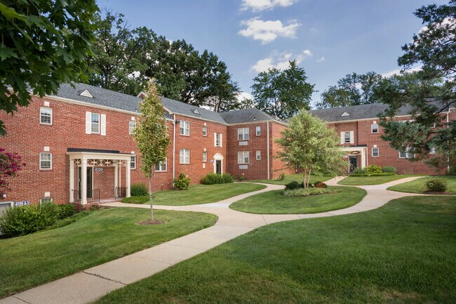
Property Detail
4316 28Th Pl
17-1902436
KAYWOOD GARDENS
Apartment
PRINCE GEORGE'S
RMF20
Maryland
B and X Area of moderate flood hazard, usually the area between the limits of the 100-year and 500-year floods.
3.46 AC
2024
Mount Rainier
2025
Washington, DC
804801
Washington-Arlington-Alexandria, DC-VA-MD-WV
NEARBY LISTINGS FOR SALE OR LEASE
DEMOGRAPHICS near 4316 28Th Pl
1 mile
3 mile
5 mile
2025 Total Population
25,937
240,998
794,281
2030 Population
26,527
250,597
829,309
Pop Growth 2025-2030
+ 2.27%
+ 3.98%
+ 4.41%
Average Age
40
38
37
2025 Total Households
9,770
92,295
335,101
HH Growth 2025-2030
+ 2.47%
+ 4.89%
+ 5.38%
Median Household Inc
$83,028
$93,445
$104,735
Avg Household Size
2.50
2.50
2.20
2025 Avg HH Vehicles
1.00
1.00
1.00
Median Home Value
$428,354
$403,096
$387,165
Median Year Built
1948
1955
1959
Nearby Places
Map Layers
Map Styles
 Street
 Aerial
Layers
 Traffic
 Biking
Places
Listings with unknown addresses are not visible on the map
- Restaurants
- Banks
- Shops
- Fitness
- Groceries
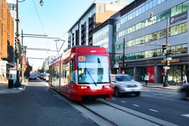
PUBLIC TRANSPORTATION
TRANSIT/SUBWAY
West Hyattsville, Green/Yellow Line Track 1 Platform (Metrorail Green Line - WMATA)
Drive
Walk
Distance
West Hyattsville, Green/Yellow Line Track 1 Platform (Metrorail Green Line - WMATA)
3 min
18 min
1.0 mi
West Hyattsville, Green/Yellow Line Track 2 Platform (Metrorail Green Line - WMATA)
Drive
Walk
Distance
West Hyattsville, Green/Yellow Line Track 2 Platform (Metrorail Green Line - WMATA)
3 min
20 min
1.0 mi
COMMUTER RAIL
Riverdale Marc Sb (CAMDEN - WASHINGTON - Maryland Transit Administration)
Drive
Walk
Distance
Riverdale Marc Sb (CAMDEN - WASHINGTON - Maryland Transit Administration)
6 min
2.7 mi
College Park Marc Sb (CAMDEN - WASHINGTON - Maryland Transit Administration)
Drive
Walk
Distance
College Park Marc Sb (CAMDEN - WASHINGTON - Maryland Transit Administration)
10 min
4.0 mi
AIRPORT
Ronald Reagan Washington Ntl
Drive
Walk
Distance
Ronald Reagan Washington Ntl
19 min
10.4 mi
Baltimore/Washington International Thurgood Marshall
Drive
Walk
Distance
Baltimore/Washington International Thurgood Marshall
43 min
26.9 mi
Washington Dulles International
Drive
Walk
Distance
Washington Dulles International
53 min
33.2 mi
Freight Ports
Port of Baltimore
Drive
Walk
Distance
Port of Baltimore
52 min
35.0 mi
Nearby Properties
Address
Land Use
TOTAL SIZE
Lot Size
Zoning
Address
Land Use
TOTAL SIZE
Lot Size
Zoning
58,289 SF
418.97 AC
MU-4;PDR-1
Address
Land Use
TOTAL SIZE
Lot Size
Zoning
1,583,364 SF
276.66 AC
UNZONED
Address
Land Use
TOTAL SIZE
Lot Size
Zoning
95.32 AC
RA-1
Address
Land Use
TOTAL SIZE
Lot Size
Zoning
1,835,827 SF
34.66 AC
UNZONED
Address
Land Use
TOTAL SIZE
Lot Size
Zoning
791,730 SF
37.44 AC
RA-1
Address
Land Use
TOTAL SIZE
Lot Size
Zoning
823,802 SF
7.30 AC
MU-2
Address
Land Use
TOTAL SIZE
Lot Size
Zoning
2,985,682 SF
4.33 AC
RSF65
Address
Land Use
TOTAL SIZE
Lot Size
Zoning
248,643 SF
8.66 AC
RA-1
Address
Land Use
TOTAL SIZE
Lot Size
Zoning
281,204 SF
PDR-1;PDR-
Address
Land Use
TOTAL SIZE
Lot Size
Zoning
1,201,133 SF
41.56 AC
RTOHC
Address
Land Use
TOTAL SIZE
Lot Size
Zoning
869,190 SF
4.97 AC
RA-1
Address
Land Use
TOTAL SIZE
Lot Size
Zoning
74,664 SF
1.83 AC
RTOLE
Address
Land Use
TOTAL SIZE
Lot Size
Zoning
41.12 AC
RA-1
Address
Land Use
TOTAL SIZE
Lot Size
Zoning
327,745 SF
9.39 AC
RF-1
Address
Land Use
TOTAL SIZE
Lot Size
Zoning
944,105 SF
23.09 AC
CGO
Address
Land Use
TOTAL SIZE
Lot Size
Zoning
330,003 SF
1.74 AC
RTOLE
Address
Land Use
TOTAL SIZE
Lot Size
Zoning
326,985 SF
1.13 AC
MU-6B
Address
Land Use
TOTAL SIZE
Lot Size
Zoning
169,500 SF
9.14 AC
RA-1
Address
Land Use
TOTAL SIZE
Lot Size
Zoning
492,835 SF
21.61 AC
RA-1
Address
Land Use
TOTAL SIZE
Lot Size
Zoning
4,924 SF
53.06 AC
R-3
Address
Land Use
TOTAL SIZE
Lot Size
Zoning
102,968 SF
18.08 AC
RF-1
Address
Land Use
TOTAL SIZE
Lot Size
Zoning
62.03 AC
UNZONED
Address
Land Use
TOTAL SIZE
Lot Size
Zoning
248,768 SF
PDR-1
Address
Land Use
TOTAL SIZE
Lot Size
Zoning
1.02 AC
PDR-1
Address
Land Use
TOTAL SIZE
Lot Size
Zoning
259,000 SF
1.91 AC
MU-7B
Address
Land Use
TOTAL SIZE
Lot Size
Zoning
288,480 SF
16.95 AC
MU-2;RA-2
Address
Land Use
TOTAL SIZE
Lot Size
Zoning
236,828 SF
1.90 AC
PDR-4
Address
Land Use
TOTAL SIZE
Lot Size
Zoning
267,249 SF
PDR-2;PDR-
Address
Land Use
TOTAL SIZE
Lot Size
Zoning
3.64 AC
RTOHC
Address
Land Use
TOTAL SIZE
Lot Size
Zoning
0.30 AC
PDR-2
The World's #1 Commercial Real Estate Marketplace
Connect with us
© 2026 CoStar Group
The information above has been obtained from sources believed reliable. While we do not doubt its accuracy we have not verified it and make no guarantee, warranty or representation about it. It is your responsibility to independently confirm its accuracy and completeness. Any projections, opinions, assumptions, or estimates used are for example only and do not represent the current or future performance of the property. The value of this transaction to you depends on tax and other factors which should be evaluated by your tax, financial, and legal advisors. You and your advisors should conduct a careful, independent investigation of the property to determine to your satisfaction the suitability of the property for your needs.