Property Record
4319 Nw Yeon Ave, Portland, OR 97210


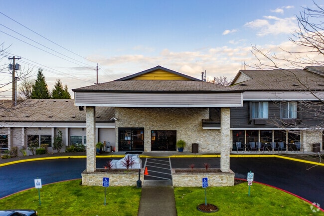

Property Detail
4319 Nw Yeon Ave
R236900
PARTITION PLAT 1990-78, LOT 2
Commercialnec
Multnomah
IH
Oregon
B and X Area of moderate flood hazard, usually the area between the limits of the 100-year and 500-year floods.
2
2025
1.94 AC
2025
Beaverton/Sunset Hwy West
004300
Portland
27,198 SF
Portland-Vancouver-Hillsboro, OR-WA
NEARBY LISTINGS FOR SALE OR LEASE
-
-
View all Portland listings for sale on LoopNet.com
DEMOGRAPHICS near 4319 Nw Yeon Ave
1 mile
3 mile
5 mile
2025 Total Population
108
105,902
312,077
2030 Population
107
105,806
312,257
Pop Growth 2025-2030
(0.93%)
(0.09%)
+ 0.06%
Average Age
43
40
40
2025 Total Households
46
49,926
145,356
HH Growth 2025-2030
(2.17%)
(0.20%)
+ 0.01%
Median Household Inc
$118,749
$99,344
$97,235
Avg Household Size
2.20
2.00
2.00
2025 Avg HH Vehicles
2.00
1.00
1.00
Median Home Value
$857,142
$692,020
$722,817
Median Year Built
1967
1974
1975
Nearby Places
Map Layers
Map Styles
 Street
 Aerial
Layers
 Traffic
 Biking
Places
Listings with unknown addresses are not visible on the map
- Restaurants
- Banks
- Shops
- Fitness
- Groceries
PUBLIC TRANSPORTATION
COMMUTER RAIL
Portland (Amtrak Cascades - Amtrak, Coast Starlight - Amtrak, Empire Builder - Amtrak)
Drive
Walk
Distance
Portland (Amtrak Cascades - Amtrak, Coast Starlight - Amtrak, Empire Builder - Amtrak)
9 min
3.5 mi
AIRPORT
Portland International
Drive
Walk
Distance
Portland International
25 min
13.1 mi
Freight Ports
Port of Portland
Drive
Walk
Distance
Port of Portland
4 min
1.9 mi
Nearby Properties
Address
Land Use
TOTAL SIZE
Lot Size
Zoning
Address
Land Use
TOTAL SIZE
Lot Size
Zoning
395,815 SF
2.66 AC
IRD
Address
Land Use
TOTAL SIZE
Lot Size
Zoning
882,480 SF
80.73 AC
CI1
Address
Land Use
TOTAL SIZE
Lot Size
Zoning
20.71 AC
OS
Address
Land Use
TOTAL SIZE
Lot Size
Zoning
326,547 SF
2.42 AC
RH
Address
Land Use
TOTAL SIZE
Lot Size
Zoning
128,500 SF
6.95 AC
OS
Address
Land Use
TOTAL SIZE
Lot Size
Zoning
Address
Land Use
TOTAL SIZE
Lot Size
Zoning
243,371 SF
0.67 AC
CI2
Address
Land Use
TOTAL SIZE
Lot Size
Zoning
262,045 SF
17.10 AC
R5
Address
Land Use
TOTAL SIZE
Lot Size
Zoning
645,294 SF
5.64 AC
CO2D
Address
Land Use
TOTAL SIZE
Lot Size
Zoning
456,760 SF
0.53 AC
EX
Address
Land Use
TOTAL SIZE
Lot Size
Zoning
193,898 SF
2.50 AC
IRD
Address
Land Use
TOTAL SIZE
Lot Size
Zoning
191,506 SF
10.43 AC
IH
Address
Land Use
TOTAL SIZE
Lot Size
Zoning
265,110 SF
1.32 AC
EX
Address
Land Use
TOTAL SIZE
Lot Size
Zoning
537,280 SF
NULL
Address
Land Use
TOTAL SIZE
Lot Size
Zoning
265,300 SF
0.92 AC
EX
Address
Land Use
TOTAL SIZE
Lot Size
Zoning
85,000 SF
1.65 AC
CI2
Address
Land Use
TOTAL SIZE
Lot Size
Zoning
318,562 SF
33.59 AC
CI1
Address
Land Use
TOTAL SIZE
Lot Size
Zoning
222,942 SF
0.80 AC
EX
Address
Land Use
TOTAL SIZE
Lot Size
Zoning
308,619 SF
0.92 AC
EX
Address
Land Use
TOTAL SIZE
Lot Size
Zoning
Address
Land Use
TOTAL SIZE
Lot Size
Zoning
264,842 SF
0.92 AC
EX
Address
Land Use
TOTAL SIZE
Lot Size
Zoning
220,000 SF
0.92 AC
EXD
Address
Land Use
TOTAL SIZE
Lot Size
Zoning
344,983 SF
0.68 AC
EXD
Address
Land Use
TOTAL SIZE
Lot Size
Zoning
73,657 SF
1.90 AC
CI1
Address
Land Use
TOTAL SIZE
Lot Size
Zoning
173,620 SF
2.82 AC
CX
Address
Land Use
TOTAL SIZE
Lot Size
Zoning
266,958 SF
1.65 AC
EXDG
Address
Land Use
TOTAL SIZE
Lot Size
Zoning
8.01 AC
EG2
Address
Land Use
TOTAL SIZE
Lot Size
Zoning
330,000 SF
0.92 AC
EX
Address
Land Use
TOTAL SIZE
Lot Size
Zoning
112,578 SF
2.94 AC
CI2
Address
Land Use
TOTAL SIZE
Lot Size
Zoning
963,658 SF
64.43 AC
IH
The World's #1 Commercial Real Estate Marketplace
Connect with us
© 2026 CoStar Group
The information above has been obtained from sources believed reliable. While we do not doubt its accuracy we have not verified it and make no guarantee, warranty or representation about it. It is your responsibility to independently confirm its accuracy and completeness. Any projections, opinions, assumptions, or estimates used are for example only and do not represent the current or future performance of the property. The value of this transaction to you depends on tax and other factors which should be evaluated by your tax, financial, and legal advisors. You and your advisors should conduct a careful, independent investigation of the property to determine to your satisfaction the suitability of the property for your needs.