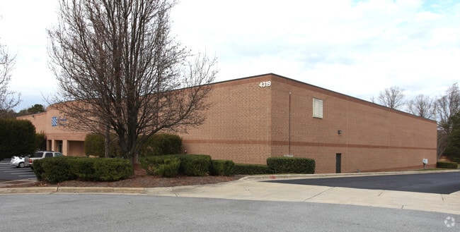
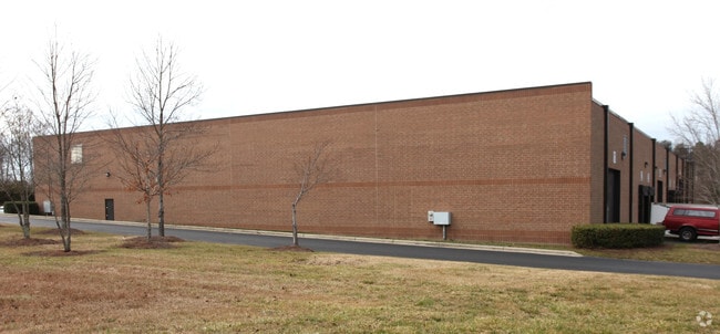
Property Record
4319 Waterleaf Ct, Greensboro, NC 27410


NEARBY LISTINGS FOR SALE OR LEASE
Property Detail
4319 Waterleaf Ct
Greensboro-High Point, NC
Piedmont Centre
0207877
6 SEC 2 PB96-140 WATERLEAF CT PL:96-140
Industrialgeneral
Guilford
X
North Carolina
3710782400J
6
2024
2.86 AC
2025
Airport/W Guilford County
016406
Greensboro/Winston-Salem
30,805 SF
DEMOGRAPHICS near 4319 Waterleaf Ct
1 Mile
3 Mile
5 Mile
2024 Total Population
1,367
39,798
111,612
2029 Population
1,365
39,732
111,419
Pop Growth 2024-2029
(0.15%)
(0.17%)
(0.17%)
Average Age
40
39
40
2024 Total Households
723
18,111
48,887
HH Growth 2024-2029
(0.14%)
(0.17%)
(0.19%)
Median Household Inc
$69,446
$67,722
$66,754
Avg Household Size
1.90
2.20
2.20
2024 Avg HH Vehicles
2.00
2.00
2.00
Median Home Value
$164,378
$224,946
$230,599
Median Year Built
2003
1996
1992
Nearby Places
Map Layers
Map Styles
 Street
 Aerial
- Restaurants
- Banks
- Shops
- Fitness
- Groceries
PUBLIC TRANSPORTATION
COMMUTER RAIL
High Point Station (Piedmont - North Carolina by Train (NC Train))
DRIVE
WALK
Distance
High Point Station (Piedmont - North Carolina by Train (NC Train))
16 min
8.8 mi
AIRPORT
Piedmont Triad International
DRIVE
WALK
Distance
Piedmont Triad International
17 min
7.4 mi
Nearby Properties
Address
Land Use
TOTAL SIZE
Lot Size
Zoning
Address
Land Use
TOTAL SIZE
Lot Size
Zoning
37,237 SF
334.45 AC
HI
Address
Land Use
TOTAL SIZE
Lot Size
Zoning
256,051 SF
37.69 AC
LI
Address
Land Use
TOTAL SIZE
Lot Size
Zoning
905,735 SF
39.66 AC
AR
Address
Land Use
TOTAL SIZE
Lot Size
Zoning
410,298 SF
33.10 AC
RM-12
Address
Land Use
TOTAL SIZE
Lot Size
Zoning
412,635 SF
37.70 AC
RM-12
Address
Land Use
TOTAL SIZE
Lot Size
Zoning
275,782 SF
27.65 AC
RM-12
Address
Land Use
TOTAL SIZE
Lot Size
Zoning
691,408 SF
58.69 AC
LI
Address
Land Use
TOTAL SIZE
Lot Size
Zoning
279,853 SF
19.80 AC
RM-18
Address
Land Use
TOTAL SIZE
Lot Size
Zoning
186,200 SF
10.58 AC
LI
Address
Land Use
TOTAL SIZE
Lot Size
Zoning
552,314 SF
38.47 AC
PDR
Address
Land Use
TOTAL SIZE
Lot Size
Zoning
230,664 SF
13.69 AC
HI
Address
Land Use
TOTAL SIZE
Lot Size
Zoning
374,522 SF
56.55 AC
HI
Address
Land Use
TOTAL SIZE
Lot Size
Zoning
367,819 SF
32.88 AC
C-H
Address
Land Use
TOTAL SIZE
Lot Size
Zoning
509,216 SF
40.85 AC
LI
Address
Land Use
TOTAL SIZE
Lot Size
Zoning
217,594 SF
20.01 AC
RM-18
Address
Land Use
TOTAL SIZE
Lot Size
Zoning
245,192 SF
15.27 AC
RM-12
Address
Land Use
TOTAL SIZE
Lot Size
Zoning
312,732 SF
14.27 AC
RM-18
Address
Land Use
TOTAL SIZE
Lot Size
Zoning
400,000 SF
46.72 AC
LI
Address
Land Use
TOTAL SIZE
Lot Size
Zoning
358,900 SF
60.50 AC
PI
Address
Land Use
TOTAL SIZE
Lot Size
Zoning
354,454 SF
20.65 AC
RM-18
Address
Land Use
TOTAL SIZE
Lot Size
Zoning
229,103 SF
18.76 AC
CZ-I
Address
Land Use
TOTAL SIZE
Lot Size
Zoning
683,263 SF
52.92 AC
HI
Address
Land Use
TOTAL SIZE
Lot Size
Zoning
291,895 SF
21.52 AC
RM-26
Address
Land Use
TOTAL SIZE
Lot Size
Zoning
145,105 SF
20.12 AC
C-M
Address
Land Use
TOTAL SIZE
Lot Size
Zoning
234,173 SF
22.14 AC
RM-12
Address
Land Use
TOTAL SIZE
Lot Size
Zoning
256,423 SF
20.64 AC
PUD
Address
Land Use
TOTAL SIZE
Lot Size
Zoning
341,118 SF
36.48 AC
LI
Address
Land Use
TOTAL SIZE
Lot Size
Zoning
309,749 SF
16.74 AC
CZ-PDM
Address
Land Use
TOTAL SIZE
Lot Size
Zoning
362,708 SF
56.81 AC
LI
Address
Land Use
TOTAL SIZE
Lot Size
Zoning
274,999 SF
21.57 AC
LI
The World's #1 Commercial Real Estate Marketplace
Connect with us
© 2025 CoStar Group
The information above has been obtained from sources believed reliable. While we do not doubt its accuracy we have not verified it and make no guarantee, warranty or representation about it. It is your responsibility to independently confirm its accuracy and completeness. Any projections, opinions, assumptions, or estimates used are for example only and do not represent the current or future performance of the property. The value of this transaction to you depends on tax and other factors which should be evaluated by your tax, financial, and legal advisors. You and your advisors should conduct a careful, independent investigation of the property to determine to your satisfaction the suitability of the property for your needs.