Property Record
432 Main St, Oxford, MA 01540


NEARBY LISTINGS FOR SALE OR LEASE
-
-
View all Oxford listings for sale on LoopNet.com
Property Detail
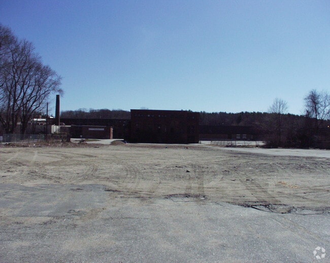
432 Main St
OXFO-000029B-000000-B000015
Worcester
Industrialgeneral
Massachusetts
X
11.92 AC
25027C0813F
Outlying Worcester
2025
Boston
2025
Worcester, MA-CT
753200
DEMOGRAPHICS near 432 Main St
1 Mile
3 Mile
5 Mile
2024 Total Population
2,429
13,064
33,447
2029 Population
2,406
13,003
33,392
Pop Growth 2024-2029
(0.95%)
(0.47%)
(0.16%)
Average Age
43
43
43
2024 Total Households
946
5,171
13,283
HH Growth 2024-2029
(1.06%)
(0.52%)
(0.21%)
Median Household Inc
$94,296
$104,184
$105,974
Avg Household Size
2.50
2.50
2.40
2024 Avg HH Vehicles
2.00
2.00
2.00
Median Home Value
$289,691
$324,267
$354,108
Median Year Built
1956
1971
1972
Nearby Places
Map Layers
Map Styles
 Street
 Aerial
- Restaurants
- Banks
- Shops
- Fitness
- Groceries
PUBLIC TRANSPORTATION
AIRPORT
Worcester Regional
DRIVE
WALK
Distance
Worcester Regional
25 min
12.9 mi
Freight Ports
Port of Davisville, RI
DRIVE
WALK
Distance
Port of Davisville, RI
81 min
59.3 mi
Nearby Properties
Address
Land Use
TOTAL SIZE
Lot Size
Zoning
Address
Land Use
TOTAL SIZE
Lot Size
Zoning
15.60 AC
R2
Address
Land Use
TOTAL SIZE
Lot Size
Zoning
199,444 SF
179.03 AC
R1
Address
Land Use
TOTAL SIZE
Lot Size
Zoning
105,657 SF
12.65 AC
HI
Address
Land Use
TOTAL SIZE
Lot Size
Zoning
81,491 SF
6.64 AC
HI
Address
Land Use
TOTAL SIZE
Lot Size
Zoning
145,401 SF
23.20 AC
GB
Address
Land Use
TOTAL SIZE
Lot Size
Zoning
109,380 SF
27.60 AC
R2
Address
Land Use
TOTAL SIZE
Lot Size
Zoning
7,000 SF
20.84 AC
I
Address
Land Use
TOTAL SIZE
Lot Size
Zoning
50,065 SF
8.65 AC
R3
Address
Land Use
TOTAL SIZE
Lot Size
Zoning
45,054 SF
6.60 AC
HI
Address
Land Use
TOTAL SIZE
Lot Size
Zoning
3,600 SF
9.52 AC
GB
Address
Land Use
TOTAL SIZE
Lot Size
Zoning
51,609 SF
10.24 AC
R3
Address
Land Use
TOTAL SIZE
Lot Size
Zoning
9,496 SF
13.25 AC
R3
Address
Land Use
TOTAL SIZE
Lot Size
Zoning
3.20 AC
Address
Land Use
TOTAL SIZE
Lot Size
Zoning
2,605 SF
11.15 AC
R1
Address
Land Use
TOTAL SIZE
Lot Size
Zoning
70,471 SF
36.41 AC
I
Address
Land Use
TOTAL SIZE
Lot Size
Zoning
69,192 SF
22.85 AC
I
Address
Land Use
TOTAL SIZE
Lot Size
Zoning
1,500 SF
4.45 AC
GB
Address
Land Use
TOTAL SIZE
Lot Size
Zoning
32,192 SF
12.90 AC
R3
Address
Land Use
TOTAL SIZE
Lot Size
Zoning
14,478 SF
1.06 AC
R2
Address
Land Use
TOTAL SIZE
Lot Size
Zoning
2.81 AC
VB
Address
Land Use
TOTAL SIZE
Lot Size
Zoning
45,920 SF
3.50 AC
I
Address
Land Use
TOTAL SIZE
Lot Size
Zoning
8.47 AC
R1
Address
Land Use
TOTAL SIZE
Lot Size
Zoning
1.70 AC
VB
Address
Land Use
TOTAL SIZE
Lot Size
Zoning
3,000 SF
31.82 AC
R1
Address
Land Use
TOTAL SIZE
Lot Size
Zoning
42,139 SF
4.54 AC
GB
Address
Land Use
TOTAL SIZE
Lot Size
Zoning
10,915 SF
6.67 AC
CB
Address
Land Use
TOTAL SIZE
Lot Size
Zoning
10,560 SF
0.87 AC
VB
Address
Land Use
TOTAL SIZE
Lot Size
Zoning
14,772 SF
0.73 AC
VB
Address
Land Use
TOTAL SIZE
Lot Size
Zoning
32,000 SF
3 AC
GB
The World's #1 Commercial Real Estate Marketplace
Connect with us
© 2025 CoStar Group
The information above has been obtained from sources believed reliable. While we do not doubt its accuracy we have not verified it and make no guarantee, warranty or representation about it. It is your responsibility to independently confirm its accuracy and completeness. Any projections, opinions, assumptions, or estimates used are for example only and do not represent the current or future performance of the property. The value of this transaction to you depends on tax and other factors which should be evaluated by your tax, financial, and legal advisors. You and your advisors should conduct a careful, independent investigation of the property to determine to your satisfaction the suitability of the property for your needs.