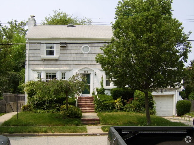
Property Record
432 Marlborough Rd, Cedarhurst, NY 11516

Save to a Folder
{{folder.Name}}
{{folder.ListingIds.length}} Properties
{{folder.ListingIds.length}} Property
Create a New Folder
Property Detail
432 Marlborough Rd
Nassau County-Suffolk County, NY
14-15
2003-39-323-00-0031-0
Nassau
Commercialnec
New York
C and X Area of minimal flood hazard, usually depicted on FIRMs as above the 500-year flood level.
14-15
2025
0.14 AC
2026
Southern Nassau
411200
Long Island (New York)
4,541 SF
NEARBY LISTINGS FOR SALE OR LEASE
-
-
View all Cedarhurst listings for sale on LoopNet.com
DEMOGRAPHICS near 432 Marlborough Rd
1 mile
3 mile
5 mile
2025 Total Population
23,533
180,240
492,138
2030 Population
23,458
178,701
485,289
Pop Growth 2025-2030
(0.32%)
(0.85%)
(1.39%)
Average Age
37
40
41
2025 Total Households
6,999
55,505
159,468
HH Growth 2025-2030
(0.34%)
(1.14%)
(1.65%)
Median Household Inc
$119,806
$101,807
$103,415
Avg Household Size
3.20
3.00
2.90
2025 Avg HH Vehicles
2.00
1.00
1.00
Median Home Value
$870,181
$772,654
$713,922
Median Year Built
1954
1957
1955
Nearby Places
Map Layers
Map Styles
 Street
 Aerial
Layers
 Traffic
 Biking
Places
Listings with unknown addresses are not visible on the map
- Restaurants
- Banks
- Shops
- Fitness
- Groceries
PUBLIC TRANSPORTATION
TRANSIT/SUBWAY
Cedarhurst Station (Far Rockaway Branch - Long Island Rail Road)
Drive
Walk
Distance
Cedarhurst Station (Far Rockaway Branch - Long Island Rail Road)
3 min
13 min
0.7 mi
COMMUTER RAIL
Cedarhurst Station (Far Rockaway Branch - Long Island Rail Road)
Drive
Walk
Distance
Cedarhurst Station (Far Rockaway Branch - Long Island Rail Road)
3 min
13 min
0.7 mi
Lawrence Station (Far Rockaway Branch - Long Island Rail Road)
Drive
Walk
Distance
Lawrence Station (Far Rockaway Branch - Long Island Rail Road)
3 min
1.1 mi
AIRPORT
John F Kennedy International
Drive
Walk
Distance
John F Kennedy International
16 min
8.2 mi
LaGuardia
Drive
Walk
Distance
LaGuardia
26 min
13.9 mi
Newark Liberty International
Drive
Walk
Distance
Newark Liberty International
52 min
33.7 mi
Freight Ports
NY - Red Hook Container Terminal
Drive
Walk
Distance
NY - Red Hook Container Terminal
36 min
18.1 mi
Nearby Properties
Address
Land Use
TOTAL SIZE
Lot Size
Zoning
Address
Land Use
TOTAL SIZE
Lot Size
Zoning
111.98 AC
PARK
Address
Land Use
TOTAL SIZE
Lot Size
Zoning
182.50 AC
M1-1
Address
Land Use
TOTAL SIZE
Lot Size
Zoning
124.60 AC
M1-1
Address
Land Use
TOTAL SIZE
Lot Size
Zoning
294.47 AC
PARK
Address
Land Use
TOTAL SIZE
Lot Size
Zoning
256,222 SF
4.64 AC
R7-1
Address
Land Use
TOTAL SIZE
Lot Size
Zoning
52.80 AC
PARK
Address
Land Use
TOTAL SIZE
Lot Size
Zoning
290,652 SF
5.78 AC
R5
Address
Land Use
TOTAL SIZE
Lot Size
Zoning
27.23 AC
PARK
Address
Land Use
TOTAL SIZE
Lot Size
Zoning
130,548 SF
0.74 AC
R6
Address
Land Use
TOTAL SIZE
Lot Size
Zoning
64,618 SF
8.04 AC
Address
Land Use
TOTAL SIZE
Lot Size
Zoning
661,319 SF
50.43 AC
R5
Address
Land Use
TOTAL SIZE
Lot Size
Zoning
93.35 AC
PARK
Address
Land Use
TOTAL SIZE
Lot Size
Zoning
178,870 SF
7.60 AC
M1-1
Address
Land Use
TOTAL SIZE
Lot Size
Zoning
154,051 SF
4.05 AC
R5
Address
Land Use
TOTAL SIZE
Lot Size
Zoning
119,788 SF
3.90 AC
R5
Address
Land Use
TOTAL SIZE
Lot Size
Zoning
5,296 SF
37.42 AC
PARK
Address
Land Use
TOTAL SIZE
Lot Size
Zoning
213,338 SF
2.91 AC
R3X
Address
Land Use
TOTAL SIZE
Lot Size
Zoning
135,273 SF
0.86 AC
C4-3A
Address
Land Use
TOTAL SIZE
Lot Size
Zoning
449,000 SF
5.15 AC
R6
Address
Land Use
TOTAL SIZE
Lot Size
Zoning
6,077 SF
19.66 AC
PARK
Address
Land Use
TOTAL SIZE
Lot Size
Zoning
97,190 SF
1.75 AC
R3X
Address
Land Use
TOTAL SIZE
Lot Size
Zoning
77,576 SF
1.38 AC
R5
Address
Land Use
TOTAL SIZE
Lot Size
Zoning
75,410 SF
5.12 AC
M1-1
Address
Land Use
TOTAL SIZE
Lot Size
Zoning
288,869 SF
1.57 AC
R7-1
Address
Land Use
TOTAL SIZE
Lot Size
Zoning
253,000 SF
7.97 AC
R5
Address
Land Use
TOTAL SIZE
Lot Size
Zoning
141,782 SF
7.39 AC
M1-1
Address
Land Use
TOTAL SIZE
Lot Size
Zoning
85,330 SF
2.91 AC
R3-2
Address
Land Use
TOTAL SIZE
Lot Size
Zoning
1,000 SF
27.14 AC
PARK
Address
Land Use
TOTAL SIZE
Lot Size
Zoning
14.58 AC
M1-1
Address
Land Use
TOTAL SIZE
Lot Size
Zoning
131,000 SF
2.43 AC
M1-1
The World's #1 Commercial Real Estate Marketplace
Connect with us
© 2026 CoStar Group
The information above has been obtained from sources believed reliable. While we do not doubt its accuracy we have not verified it and make no guarantee, warranty or representation about it. It is your responsibility to independently confirm its accuracy and completeness. Any projections, opinions, assumptions, or estimates used are for example only and do not represent the current or future performance of the property. The value of this transaction to you depends on tax and other factors which should be evaluated by your tax, financial, and legal advisors. You and your advisors should conduct a careful, independent investigation of the property to determine to your satisfaction the suitability of the property for your needs.