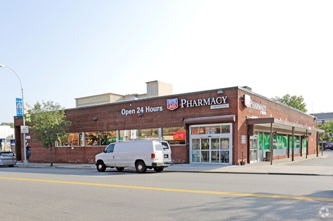
Property Record
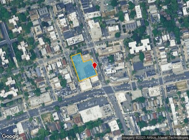
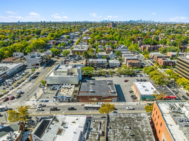
4320 Bell Blvd, Bayside, NY 11361
Current Lease Availabilities
NEARBY LISTINGS FOR SALE OR LEASE
Property Detail
4320 Bell Blvd
06287-0001
Queens
Storebuilding
New York
X
1
3604970119F
0.88 AC
2024
Northeast Queens
2025
Long Island (New York)
146700
New York-Jersey City-White Plains, NY-NJ
10,000 SF
DEMOGRAPHICS near 4320 Bell Blvd
1 mile
3 mile
5 mile
2024 Total Population
40,097
387,738
1,052,310
2029 Population
37,273
364,719
990,902
Pop Growth 2024-2029
(7.04%)
(5.94%)
(5.84%)
Average Age
44
45
43
2024 Total Households
14,257
140,393
362,404
HH Growth 2024-2029
(7.53%)
(6.27%)
(6.01%)
Median Household Inc
$91,397
$75,246
$78,002
Avg Household Size
2.70
2.70
2.80
2024 Avg HH Vehicles
1.00
1.00
1.00
Median Home Value
$828,547
$741,869
$703,643
Median Year Built
1953
1955
1954
Nearby Places
Map Layers
Map Styles
 Street
 Aerial
Transit
 Traffic
 Biking
Places
Listings with unknown addresses are not visible on the map
- Restaurants
- Banks
- Shops
- Fitness
- Groceries
PUBLIC TRANSPORTATION
COMMUTER RAIL
Bayside Station (Port Washington Branch - Long Island Rail Road)
Drive
Walk
Distance
Bayside Station (Port Washington Branch - Long Island Rail Road)
0 min
8 min
0.2 mi
Auburndale Station (Port Washington Branch - Long Island Rail Road)
Drive
Walk
Distance
Auburndale Station (Port Washington Branch - Long Island Rail Road)
3 min
1.4 mi
AIRPORT
LaGuardia
Drive
Walk
Distance
LaGuardia
15 min
6.6 mi
John F Kennedy International
Drive
Walk
Distance
John F Kennedy International
18 min
11.9 mi
Westchester County
Drive
Walk
Distance
Westchester County
42 min
28.3 mi
Freight Ports
NY - Red Hook Container Terminal
Drive
Walk
Distance
NY - Red Hook Container Terminal
26 min
16.7 mi
Nearby Properties
Address
Land Use
TOTAL SIZE
Lot Size
Zoning
Address
Land Use
TOTAL SIZE
Lot Size
Zoning
2,697,663 SF
3.46 AC
C5-3
Address
Land Use
TOTAL SIZE
Lot Size
Zoning
1,666,696 SF
1.87 AC
C52.5
Address
Land Use
TOTAL SIZE
Lot Size
Zoning
7,975 SF
133 AC
PARK
Address
Land Use
TOTAL SIZE
Lot Size
Zoning
97.07 AC
R3-2
Address
Land Use
TOTAL SIZE
Lot Size
Zoning
97.07 AC
R3-2
Address
Land Use
TOTAL SIZE
Lot Size
Zoning
97.07 AC
R3-2
Address
Land Use
TOTAL SIZE
Lot Size
Zoning
97.07 AC
R3-2
Address
Land Use
TOTAL SIZE
Lot Size
Zoning
97.07 AC
R3-2
Address
Land Use
TOTAL SIZE
Lot Size
Zoning
97.07 AC
R3-2
Address
Land Use
TOTAL SIZE
Lot Size
Zoning
97.07 AC
R3-2
Address
Land Use
TOTAL SIZE
Lot Size
Zoning
97.07 AC
R3-2
Address
Land Use
TOTAL SIZE
Lot Size
Zoning
97.07 AC
R3-2
Address
Land Use
TOTAL SIZE
Lot Size
Zoning
97.07 AC
R3-2
Address
Land Use
TOTAL SIZE
Lot Size
Zoning
97.07 AC
R3-2
Address
Land Use
TOTAL SIZE
Lot Size
Zoning
97.07 AC
R3-2
Address
Land Use
TOTAL SIZE
Lot Size
Zoning
97.07 AC
R3-2
Address
Land Use
TOTAL SIZE
Lot Size
Zoning
97.07 AC
R3-2
Address
Land Use
TOTAL SIZE
Lot Size
Zoning
97.07 AC
R3-2
Address
Land Use
TOTAL SIZE
Lot Size
Zoning
97.07 AC
R3-2
Address
Land Use
TOTAL SIZE
Lot Size
Zoning
97.07 AC
R3-2
Address
Land Use
TOTAL SIZE
Lot Size
Zoning
97.07 AC
R3-2
Address
Land Use
TOTAL SIZE
Lot Size
Zoning
97.07 AC
R3-2
Address
Land Use
TOTAL SIZE
Lot Size
Zoning
97.07 AC
R3-2
Address
Land Use
TOTAL SIZE
Lot Size
Zoning
97.07 AC
R3-2
Address
Land Use
TOTAL SIZE
Lot Size
Zoning
97.07 AC
R3-2
Address
Land Use
TOTAL SIZE
Lot Size
Zoning
97.07 AC
R3-2
Address
Land Use
TOTAL SIZE
Lot Size
Zoning
97.07 AC
R3-2
Address
Land Use
TOTAL SIZE
Lot Size
Zoning
97.07 AC
R3-2
Address
Land Use
TOTAL SIZE
Lot Size
Zoning
97.07 AC
R3-2
Address
Land Use
TOTAL SIZE
Lot Size
Zoning
97.07 AC
R3-2
The World's #1 Commercial Real Estate Marketplace
Connect with us
© 2026 CoStar Group
The information above has been obtained from sources believed reliable. While we do not doubt its accuracy we have not verified it and make no guarantee, warranty or representation about it. It is your responsibility to independently confirm its accuracy and completeness. Any projections, opinions, assumptions, or estimates used are for example only and do not represent the current or future performance of the property. The value of this transaction to you depends on tax and other factors which should be evaluated by your tax, financial, and legal advisors. You and your advisors should conduct a careful, independent investigation of the property to determine to your satisfaction the suitability of the property for your needs.