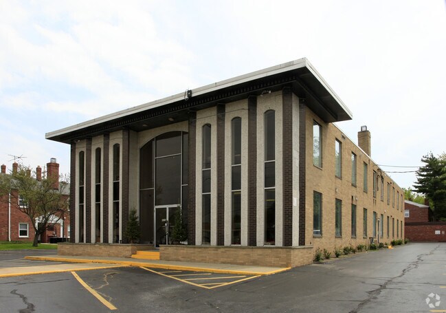
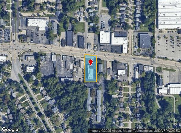
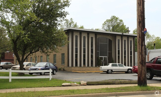
Property Record
4320 Mayfield Rd, Cleveland, OH 44121

NEARBY LISTINGS FOR SALE OR LEASE
Property Detail
4320 Mayfield Rd
703-38-037
30
Officebuilding
Cuyahoga
X
Ohio
39035C0094E
30
2024
0.73 AC
2024
East
185203
Cleveland
11,960 SF
Cleveland-Elyria, OH
DEMOGRAPHICS near 4320 Mayfield Rd
1 Mile
3 Mile
5 Mile
2024 Total Population
15,082
123,018
303,754
2029 Population
14,649
120,532
299,194
Pop Growth 2024-2029
(2.87%)
(2.02%)
(1.50%)
Average Age
40
41
42
2024 Total Households
6,189
52,326
136,231
HH Growth 2024-2029
(3.10%)
(2.12%)
(1.56%)
Median Household Inc
$65,478
$63,948
$50,132
Avg Household Size
2.30
2.20
2.10
2024 Avg HH Vehicles
2.00
2.00
1.00
Median Home Value
$134,175
$165,270
$165,548
Median Year Built
1950
1953
1953
Nearby Places
Map Layers
Map Styles
 Street
 Aerial
- Restaurants
- Banks
- Shops
- Fitness
- Groceries
PUBLIC TRANSPORTATION
AIRPORT
Cleveland-Hopkins International
DRIVE
WALK
Distance
Cleveland-Hopkins International
41 min
25.9 mi
Freight Ports
Port of Toledo
DRIVE
WALK
Distance
Port of Toledo
154 min
122.2 mi
SALE & LEASE HISTORY
LISTING DATE
SALE/LEASE

Sep 25, 2016
For Lease
Jul 05, 2019
For Lease
Aug 08, 2017
For Lease
Nearby Properties
Address
Land Use
TOTAL SIZE
Lot Size
Zoning
Address
Land Use
TOTAL SIZE
Lot Size
Zoning
964,082 SF
40.67 AC
Address
Land Use
TOTAL SIZE
Lot Size
Zoning
1,066,853 SF
42.18 AC
U-5
Address
Land Use
TOTAL SIZE
Lot Size
Zoning
650,536 SF
19.01 AC
U-3A
Address
Land Use
TOTAL SIZE
Lot Size
Zoning
379,326 SF
43.45 AC
CRG
Address
Land Use
TOTAL SIZE
Lot Size
Zoning
229,833 SF
19.04 AC
U-3
Address
Land Use
TOTAL SIZE
Lot Size
Zoning
302,009 SF
6.62 AC
U-7A
Address
Land Use
TOTAL SIZE
Lot Size
Zoning
257,048 SF
17.93 AC
S1
Address
Land Use
TOTAL SIZE
Lot Size
Zoning
106,995 SF
9.62 AC
CRG
Address
Land Use
TOTAL SIZE
Lot Size
Zoning
246,578 SF
28.60 AC
U-5
Address
Land Use
TOTAL SIZE
Lot Size
Zoning
421,649 SF
23.15 AC
U-5
Address
Land Use
TOTAL SIZE
Lot Size
Zoning
252,759 SF
27.66 AC
R-1
Address
Land Use
TOTAL SIZE
Lot Size
Zoning
413,626 SF
21.95 AC
S2
Address
Land Use
TOTAL SIZE
Lot Size
Zoning
294,215 SF
4.70 AC
U-3A
Address
Land Use
TOTAL SIZE
Lot Size
Zoning
346,762 SF
4.57 AC
U-3A
Address
Land Use
TOTAL SIZE
Lot Size
Zoning
91,540 SF
14.35 AC
CRG
Address
Land Use
TOTAL SIZE
Lot Size
Zoning
297,799 SF
4.18 AC
U-3
Address
Land Use
TOTAL SIZE
Lot Size
Zoning
108,198 SF
25.45 AC
U-5
Address
Land Use
TOTAL SIZE
Lot Size
Zoning
189,444 SF
9.71 AC
U-5
Address
Land Use
TOTAL SIZE
Lot Size
Zoning
222,426 SF
3.60 AC
U1
Address
Land Use
TOTAL SIZE
Lot Size
Zoning
59,308 SF
5.84 AC
U-1A-2
Address
Land Use
TOTAL SIZE
Lot Size
Zoning
131,846 SF
5.94 AC
U-9
Address
Land Use
TOTAL SIZE
Lot Size
Zoning
222,800 SF
2.32 AC
U-3
Address
Land Use
TOTAL SIZE
Lot Size
Zoning
100,469 SF
25.96 AC
AA
Address
Land Use
TOTAL SIZE
Lot Size
Zoning
249,712 SF
22.69 AC
I
Address
Land Use
TOTAL SIZE
Lot Size
Zoning
255,964 SF
39.41 AC
R-75
Address
Land Use
TOTAL SIZE
Lot Size
Zoning
256,546 SF
25.35 AC
U-1
Address
Land Use
TOTAL SIZE
Lot Size
Zoning
153,560 SF
32.47 AC
I
Address
Land Use
TOTAL SIZE
Lot Size
Zoning
157,761 SF
14.27 AC
R-50
Address
Land Use
TOTAL SIZE
Lot Size
Zoning
89,347 SF
1.10 AC
CRG
Address
Land Use
TOTAL SIZE
Lot Size
Zoning
186,262 SF
5.06 AC
U-4A
The World's #1 Commercial Real Estate Marketplace
Connect with us
© 2025 CoStar Group
The information above has been obtained from sources believed reliable. While we do not doubt its accuracy we have not verified it and make no guarantee, warranty or representation about it. It is your responsibility to independently confirm its accuracy and completeness. Any projections, opinions, assumptions, or estimates used are for example only and do not represent the current or future performance of the property. The value of this transaction to you depends on tax and other factors which should be evaluated by your tax, financial, and legal advisors. You and your advisors should conduct a careful, independent investigation of the property to determine to your satisfaction the suitability of the property for your needs.