Property Record
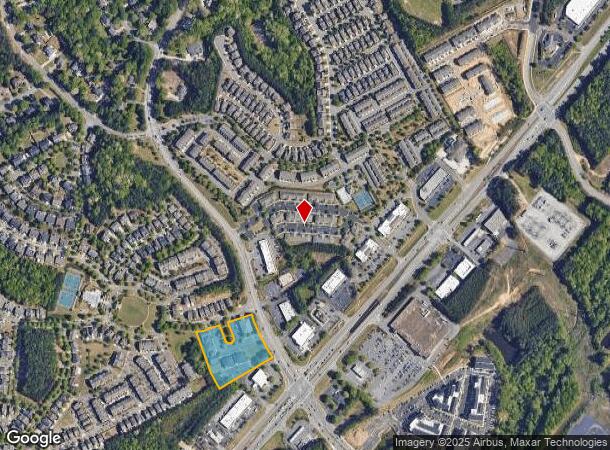
4411 Suwanee Dam Rd, Suwanee, GA 30024
This Property Is For Sale
Property Detail
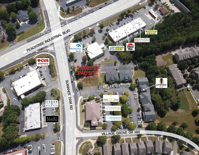
4411 Suwanee Dam Rd
Atlanta-Sandy Springs-Roswell, GA
Three Bridges
7-252-509
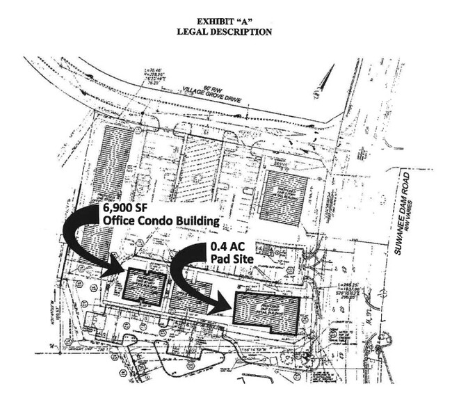
UNIT 810 BLDG 800 THE CROSSING AT THREE BRIDGES
Officecondo
Gwinnett
X
Georgia
13135C0032G
262
0
0.03 AC
2025
Duluth/Suwanee/Buford
050242
Atlanta
1,140 SF
NEARBY LISTINGS FOR SALE OR LEASE
DEMOGRAPHICS near 4411 Suwanee Dam Rd
1 mile
3 mile
5 mile
2024 Total Population
8,556
59,438
167,016
2029 Population
9,054
62,584
176,974
Pop Growth 2024-2029
+ 5.82%
+ 5.29%
+ 5.96%
Average Age
39
39
38
2024 Total Households
2,894
19,600
55,202
HH Growth 2024-2029
+ 6.15%
+ 5.59%
+ 6.05%
Median Household Inc
$126,920
$121,982
$112,474
Avg Household Size
2.90
3.00
3.00
2024 Avg HH Vehicles
3.00
2.00
2.00
Median Home Value
$392,149
$403,538
$388,284
Median Year Built
2001
1999
1999
Nearby Places
Map Layers
Map Styles
 Street
 Aerial
Transit
 Traffic
 Biking
Places
Listings with unknown addresses are not visible on the map
- Restaurants
- Banks
- Shops
- Fitness
- Groceries
PUBLIC TRANSPORTATION
AIRPORT
Hartsfield - Jackson Atlanta International
Drive
Walk
Distance
Hartsfield - Jackson Atlanta International
56 min
42.5 mi
Nearby Properties
Address
Land Use
TOTAL SIZE
Lot Size
Zoning
Address
Land Use
TOTAL SIZE
Lot Size
Zoning
509,302 SF
55.13 AC
RM8
Address
Land Use
TOTAL SIZE
Lot Size
Zoning
534,578 SF
44.21 AC
RM8
Address
Land Use
TOTAL SIZE
Lot Size
Zoning
393,939 SF
42.21 AC
RM8
Address
Land Use
TOTAL SIZE
Lot Size
Zoning
359,241 SF
21.02 AC
PMUD
Address
Land Use
TOTAL SIZE
Lot Size
Zoning
379,183 SF
6.09 AC
PMUD
Address
Land Use
TOTAL SIZE
Lot Size
Zoning
334,841 SF
28.14 AC
RM13
Address
Land Use
TOTAL SIZE
Lot Size
Zoning
253,169 SF
8.74 AC
RM24
Address
Land Use
TOTAL SIZE
Lot Size
Zoning
151,663 SF
42.77 AC
BG
Address
Land Use
TOTAL SIZE
Lot Size
Zoning
234,420 SF
10.35 AC
PMUD
Address
Land Use
TOTAL SIZE
Lot Size
Zoning
220,779 SF
7.32 AC
PMUD
Address
Land Use
TOTAL SIZE
Lot Size
Zoning
370,414 SF
14.34 AC
PMUD
Address
Land Use
TOTAL SIZE
Lot Size
Zoning
313,869 SF
12.19 AC
RM24
Address
Land Use
TOTAL SIZE
Lot Size
Zoning
447,399 SF
25.71 AC
GCA
Address
Land Use
TOTAL SIZE
Lot Size
Zoning
240,556 SF
49.13 AC
HM1
Address
Land Use
TOTAL SIZE
Lot Size
Zoning
332,011 SF
8.84 AC
PMUD
Address
Land Use
TOTAL SIZE
Lot Size
Zoning
6,552 SF
235.95 AC
R140
Address
Land Use
TOTAL SIZE
Lot Size
Zoning
379,104 SF
20 AC
OI
Address
Land Use
TOTAL SIZE
Lot Size
Zoning
327,360 SF
26.42 AC
M1
Address
Land Use
TOTAL SIZE
Lot Size
Zoning
3,232 SF
66.63 AC
OI
Address
Land Use
TOTAL SIZE
Lot Size
Zoning
184,890 SF
3 AC
PMUD
Address
Land Use
TOTAL SIZE
Lot Size
Zoning
408 SF
217.12 AC
R100
Address
Land Use
TOTAL SIZE
Lot Size
Zoning
185,524 SF
12.61 AC
M1
Address
Land Use
TOTAL SIZE
Lot Size
Zoning
168,142 SF
25.86 AC
BG
Address
Land Use
TOTAL SIZE
Lot Size
Zoning
160,021 SF
14.27 AC
PMUD
Address
Land Use
TOTAL SIZE
Lot Size
Zoning
96,165 SF
47.41 AC
PMUD
Address
Land Use
TOTAL SIZE
Lot Size
Zoning
417,876 SF
23.74 AC
M1
Address
Land Use
TOTAL SIZE
Lot Size
Zoning
1,682 SF
303.40 AC
A1
Address
Land Use
TOTAL SIZE
Lot Size
Zoning
361,000 SF
20.08 AC
M1
Address
Land Use
TOTAL SIZE
Lot Size
Zoning
300,320 SF
18.61 AC
M1
Address
Land Use
TOTAL SIZE
Lot Size
Zoning
115,555 SF
34.65 AC
R100MOD
The World's #1 Commercial Real Estate Marketplace
Connect with us
© 2026 CoStar Group
The information above has been obtained from sources believed reliable. While we do not doubt its accuracy we have not verified it and make no guarantee, warranty or representation about it. It is your responsibility to independently confirm its accuracy and completeness. Any projections, opinions, assumptions, or estimates used are for example only and do not represent the current or future performance of the property. The value of this transaction to you depends on tax and other factors which should be evaluated by your tax, financial, and legal advisors. You and your advisors should conduct a careful, independent investigation of the property to determine to your satisfaction the suitability of the property for your needs.