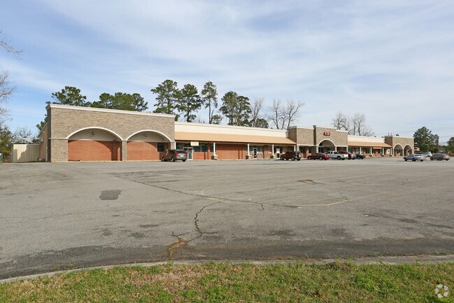
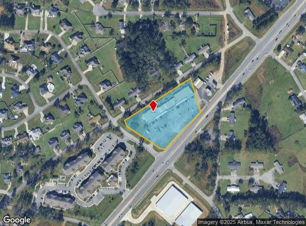
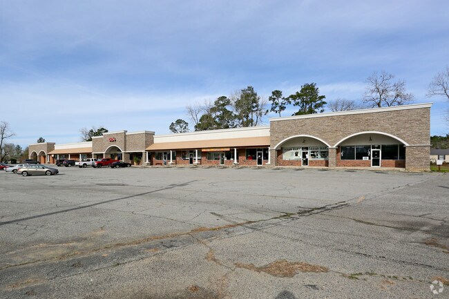
Property Record
4327 Bemiss Rd, Valdosta, GA 31605
NEARBY LISTINGS FOR SALE OR LEASE
Property Detail
4327 Bemiss Rd
Valdosta, GA
Bemiss Comm Central
0145C-083
4327, 4333 & 4351 BEMISS RD
Stripcommercialcenter
Lowndes
X
Georgia
13185C0120E
101
2024
2.78 AC
2024
Valdosta/Lake Park
010103
Other Market Areas
20,335 SF
DEMOGRAPHICS near 4327 Bemiss Rd
1 Mile
3 Mile
5 Mile
2024 Total Population
4,640
18,984
50,211
2029 Population
4,836
19,718
52,130
Pop Growth 2024-2029
+ 4.22%
+ 3.87%
+ 3.82%
Average Age
34
34
35
2024 Total Households
1,679
7,052
19,023
HH Growth 2024-2029
+ 4.35%
+ 3.96%
+ 3.93%
Median Household Inc
$61,332
$54,026
$47,330
Avg Household Size
2.70
2.70
2.50
2024 Avg HH Vehicles
2.00
2.00
2.00
Median Home Value
$178,468
$184,081
$179,336
Median Year Built
1998
2000
1994
Nearby Places
Map Layers
Map Styles
 Street
 Aerial
- Restaurants
- Banks
- Shops
- Fitness
- Groceries
PUBLIC TRANSPORTATION
AIRPORT
Valdosta Regional
DRIVE
WALK
Distance
Valdosta Regional
19 min
10.3 mi
Freight Ports
Georgia Ports - Brunswick
DRIVE
WALK
Distance
Georgia Ports - Brunswick
158 min
119.0 mi
SALE & LEASE HISTORY
LISTING DATE
SALE/LEASE

Feb 14, 2019
For Lease
Nearby Properties
Address
Land Use
TOTAL SIZE
Lot Size
Zoning
Address
Land Use
TOTAL SIZE
Lot Size
Zoning
39,024 SF
18.04 AC
P-D
Address
Land Use
TOTAL SIZE
Lot Size
Zoning
19,825 SF
16.93 AC
R-M
Address
Land Use
TOTAL SIZE
Lot Size
Zoning
13,056 SF
9.41 AC
R-M
Address
Land Use
TOTAL SIZE
Lot Size
Zoning
2,096 SF
6.98 AC
P-D
Address
Land Use
TOTAL SIZE
Lot Size
Zoning
49,546 SF
10.45 AC
R-P
Address
Land Use
TOTAL SIZE
Lot Size
Zoning
202,062 SF
7.12 AC
R-15
Address
Land Use
TOTAL SIZE
Lot Size
Zoning
25,727 SF
9.12 AC
R-A
Address
Land Use
TOTAL SIZE
Lot Size
Zoning
22,906 SF
3.25 AC
C-C
Address
Land Use
TOTAL SIZE
Lot Size
Zoning
40,343 SF
49.11 AC
R-6
Address
Land Use
TOTAL SIZE
Lot Size
Zoning
66.89 AC
C-H
Address
Land Use
TOTAL SIZE
Lot Size
Zoning
3,360 SF
7.41 AC
C-G
Address
Land Use
TOTAL SIZE
Lot Size
Zoning
40,932 SF
9.77 AC
C-H,PCD
Address
Land Use
TOTAL SIZE
Lot Size
Zoning
15,343 SF
7 AC
C-C
Address
Land Use
TOTAL SIZE
Lot Size
Zoning
1,824 SF
3.60 AC
P-D
Address
Land Use
TOTAL SIZE
Lot Size
Zoning
3,274 SF
2.63 AC
P-D
Address
Land Use
TOTAL SIZE
Lot Size
Zoning
33,695 SF
5.84 AC
C-G
Address
Land Use
TOTAL SIZE
Lot Size
Zoning
41,952 SF
1.38 AC
P-D
Address
Land Use
TOTAL SIZE
Lot Size
Zoning
41,952 SF
1.38 AC
P-D
Address
Land Use
TOTAL SIZE
Lot Size
Zoning
28,688 SF
3.03 AC
P-D
Address
Land Use
TOTAL SIZE
Lot Size
Zoning
29,194 SF
8 AC
R-P
Address
Land Use
TOTAL SIZE
Lot Size
Zoning
46,946 SF
5.57 AC
C-C
Address
Land Use
TOTAL SIZE
Lot Size
Zoning
16,775 SF
6.40 AC
C-H
Address
Land Use
TOTAL SIZE
Lot Size
Zoning
36,006 SF
17.62 AC
R-21
Address
Land Use
TOTAL SIZE
Lot Size
Zoning
8,400 SF
3.53 AC
C-H
Address
Land Use
TOTAL SIZE
Lot Size
Zoning
29,700 SF
15 AC
R-6
Address
Land Use
TOTAL SIZE
Lot Size
Zoning
9,576 SF
1.60 AC
C-C
Address
Land Use
TOTAL SIZE
Lot Size
Zoning
4,684 SF
1.71 AC
C-C
Address
Land Use
TOTAL SIZE
Lot Size
Zoning
12,600 SF
1.12 AC
C-H
Address
Land Use
TOTAL SIZE
Lot Size
Zoning
31,490 SF
8 AC
C-C
Address
Land Use
TOTAL SIZE
Lot Size
Zoning
2,250 SF
3.93 AC
C-H
The World's #1 Commercial Real Estate Marketplace
Connect with us
© 2026 CoStar Group
The information above has been obtained from sources believed reliable. While we do not doubt its accuracy we have not verified it and make no guarantee, warranty or representation about it. It is your responsibility to independently confirm its accuracy and completeness. Any projections, opinions, assumptions, or estimates used are for example only and do not represent the current or future performance of the property. The value of this transaction to you depends on tax and other factors which should be evaluated by your tax, financial, and legal advisors. You and your advisors should conduct a careful, independent investigation of the property to determine to your satisfaction the suitability of the property for your needs.