Property Record
4320 Wade Hampton Blvd, Taylors, SC 29687


NEARBY LISTINGS FOR SALE OR LEASE
Property Detail
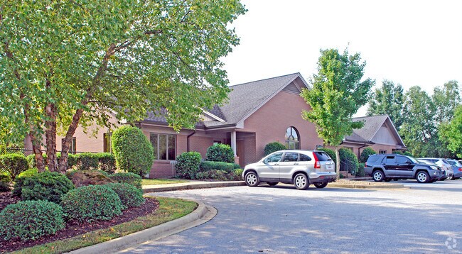
4320 Wade Hampton Blvd
Greenville-Anderson-Mauldin, SC
MAP T008.00
T008.00-04-012.00
Greenville
Officebuilding
South Carolina
AE
012.00
45045C0341E
10.80 AC
2025
Greer/Taylors
2024
Greenville/Spartanburg
002604
DEMOGRAPHICS near 4320 Wade Hampton Blvd
1 Mile
3 Mile
5 Mile
2024 Total Population
5,581
49,259
132,106
2029 Population
6,131
53,995
145,094
Pop Growth 2024-2029
+ 9.85%
+ 9.61%
+ 9.83%
Average Age
39
40
40
2024 Total Households
2,233
19,453
53,414
HH Growth 2024-2029
+ 9.94%
+ 9.71%
+ 9.90%
Median Household Inc
$63,309
$69,794
$70,445
Avg Household Size
2.50
2.50
2.40
2024 Avg HH Vehicles
2.00
2.00
2.00
Median Home Value
$186,323
$233,787
$257,667
Median Year Built
1984
1986
1986
Nearby Places
Map Layers
Map Styles
 Street
 Aerial
- Restaurants
- Banks
- Shops
- Fitness
- Groceries
PUBLIC TRANSPORTATION
COMMUTER RAIL
DRIVE
WALK
Distance
16 min
8.4 mi
AIRPORT
Greenville Spartanburg International
DRIVE
WALK
Distance
Greenville Spartanburg International
13 min
6.9 mi
SALE & LEASE HISTORY
LISTING DATE
SALE/LEASE

Sep 25, 2016
For Lease
Nearby Properties
Address
Land Use
TOTAL SIZE
Lot Size
Zoning
Address
Land Use
TOTAL SIZE
Lot Size
Zoning
13.25 AC
I1
Address
Land Use
TOTAL SIZE
Lot Size
Zoning
11.80 AC
R10
Address
Land Use
TOTAL SIZE
Lot Size
Zoning
11.30 AC
R10
Address
Land Use
TOTAL SIZE
Lot Size
Zoning
8.22 AC
I1
Address
Land Use
TOTAL SIZE
Lot Size
Zoning
1.90 AC
I1
Address
Land Use
TOTAL SIZE
Lot Size
Zoning
25.70 AC
R20
Address
Land Use
TOTAL SIZE
Lot Size
Zoning
10.20 AC
S1
Address
Land Use
TOTAL SIZE
Lot Size
Zoning
8.95 AC
OD
Address
Land Use
TOTAL SIZE
Lot Size
Zoning
41.90 AC
RMA
Address
Land Use
TOTAL SIZE
Lot Size
Zoning
14.33 AC
I1
Address
Land Use
TOTAL SIZE
Lot Size
Zoning
22.35 AC
R20
Address
Land Use
TOTAL SIZE
Lot Size
Zoning
3.40 AC
C2
Address
Land Use
TOTAL SIZE
Lot Size
Zoning
58.81 AC
R15
Address
Land Use
TOTAL SIZE
Lot Size
Zoning
3.50 AC
C2
Address
Land Use
TOTAL SIZE
Lot Size
Zoning
1.20 AC
I1
Address
Land Use
TOTAL SIZE
Lot Size
Zoning
16.40 AC
PDC
Address
Land Use
TOTAL SIZE
Lot Size
Zoning
7.12 AC
R15
Address
Land Use
TOTAL SIZE
Lot Size
Zoning
8.10 AC
I1
Address
Land Use
TOTAL SIZE
Lot Size
Zoning
21.65 AC
RM7
Address
Land Use
TOTAL SIZE
Lot Size
Zoning
37.96 AC
RS
Address
Land Use
TOTAL SIZE
Lot Size
Zoning
99.01 AC
I1
Address
Land Use
TOTAL SIZE
Lot Size
Zoning
35.70 AC
RS
Address
Land Use
TOTAL SIZE
Lot Size
Zoning
1.03 AC
RM
Address
Land Use
TOTAL SIZE
Lot Size
Zoning
82.10 AC
S1
Address
Land Use
TOTAL SIZE
Lot Size
Zoning
14.78 AC
I1
Address
Land Use
TOTAL SIZE
Lot Size
Zoning
9.14 AC
R75
Address
Land Use
TOTAL SIZE
Lot Size
Zoning
3.11 AC
I1
Address
Land Use
TOTAL SIZE
Lot Size
Zoning
12 AC
RM
Address
Land Use
TOTAL SIZE
Lot Size
Zoning
12.30 AC
I1
Address
Land Use
TOTAL SIZE
Lot Size
Zoning
2,323 SF
23.11 AC
R20
The World's #1 Commercial Real Estate Marketplace
Connect with us
© 2025 CoStar Group
The information above has been obtained from sources believed reliable. While we do not doubt its accuracy we have not verified it and make no guarantee, warranty or representation about it. It is your responsibility to independently confirm its accuracy and completeness. Any projections, opinions, assumptions, or estimates used are for example only and do not represent the current or future performance of the property. The value of this transaction to you depends on tax and other factors which should be evaluated by your tax, financial, and legal advisors. You and your advisors should conduct a careful, independent investigation of the property to determine to your satisfaction the suitability of the property for your needs.