Property Record
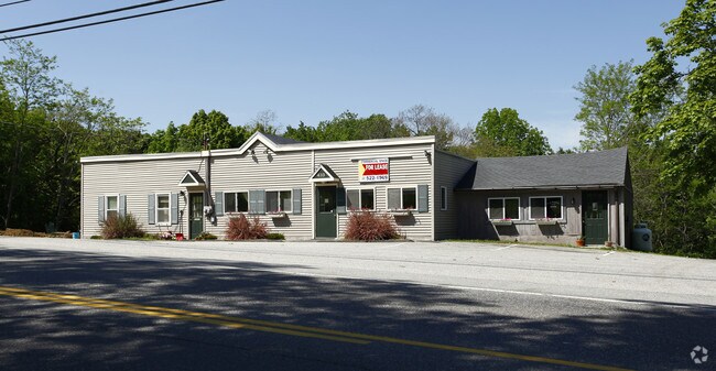
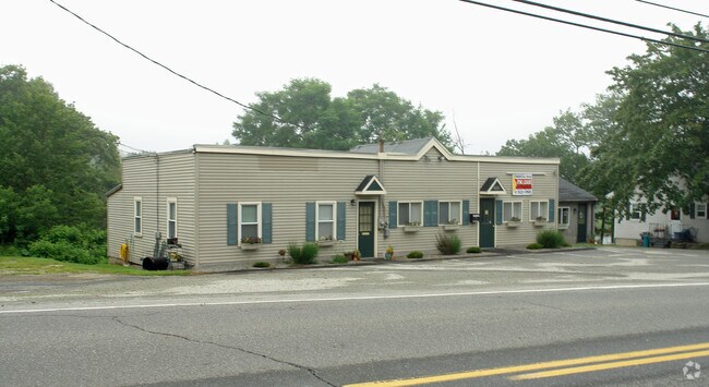
433 Bath Rd, Brunswick, ME 04011

Property Detail
433 Bath Rd
BRUN-000046-000000-000031A
Cumberland
Departmentstore
Maine
RP1
31-a
AE The base floodplain where base flood elevations are provided. AE Zones are now used on new format FIRMs instead of A1-A30 Zones.
0.44 AC
2025
NE Cumberland County
2025
Portland/South Portland
011100
Portland-South Portland, ME
2,524 SF
NEARBY LISTINGS FOR SALE OR LEASE
DEMOGRAPHICS near 433 Bath Rd
1 mile
3 mile
5 mile
2025 Total Population
637
13,892
33,222
2030 Population
657
14,139
34,308
Pop Growth 2025-2030
+ 3.14%
+ 1.78%
+ 3.27%
Average Age
47
43
43
2025 Total Households
283
6,289
14,374
HH Growth 2025-2030
+ 3.18%
+ 1.83%
+ 3.28%
Median Household Inc
$93,091
$63,425
$74,384
Avg Household Size
2.20
2.10
2.10
2025 Avg HH Vehicles
2.00
2.00
2.00
Median Home Value
$360,908
$311,142
$369,325
Median Year Built
1985
1971
1974
Nearby Places
Map Layers
Map Styles
 Street
 Aerial
Layers
 Traffic
 Biking
Places
Listings with unknown addresses are not visible on the map
- Restaurants
- Banks
- Shops
- Fitness
- Groceries
PUBLIC TRANSPORTATION
COMMUTER RAIL
Drive
Walk
Distance
8 min
4.7 mi
AIRPORT
Portland International Jetport
Drive
Walk
Distance
Portland International Jetport
51 min
36.8 mi
Freight Ports
Portland, ME
Drive
Walk
Distance
Portland, ME
44 min
33.8 mi
Nearby Properties
Address
Land Use
TOTAL SIZE
Lot Size
Zoning
Address
Land Use
TOTAL SIZE
Lot Size
Zoning
180,000 SF
26.95 AC
S
Address
Land Use
TOTAL SIZE
Lot Size
Zoning
16 AC
I
Address
Land Use
TOTAL SIZE
Lot Size
Zoning
132,504 SF
113.20 AC
GM8
Address
Land Use
TOTAL SIZE
Lot Size
Zoning
43,434 SF
127 AC
R1
Address
Land Use
TOTAL SIZE
Lot Size
Zoning
252,409 SF
24.20 AC
GM4
Address
Land Use
TOTAL SIZE
Lot Size
Zoning
116,612 SF
2.53 AC
R1
Address
Land Use
TOTAL SIZE
Lot Size
Zoning
158,044 SF
29.13 AC
GM4
Address
Land Use
TOTAL SIZE
Lot Size
Zoning
203,981 SF
28.41 AC
GM4
Address
Land Use
TOTAL SIZE
Lot Size
Zoning
11,760 SF
5.68 AC
GM7
Address
Land Use
TOTAL SIZE
Lot Size
Zoning
8,432 SF
8.80 AC
GM7
Address
Land Use
TOTAL SIZE
Lot Size
Zoning
160,000 SF
49.64 AC
GI
Address
Land Use
TOTAL SIZE
Lot Size
Zoning
900 SF
100.78 AC
RR
Address
Land Use
TOTAL SIZE
Lot Size
Zoning
61,453 SF
2.90 AC
C4
Address
Land Use
TOTAL SIZE
Lot Size
Zoning
67.39 AC
Address
Land Use
TOTAL SIZE
Lot Size
Zoning
49,175 SF
6.70 AC
GM7
Address
Land Use
TOTAL SIZE
Lot Size
Zoning
84,327 SF
5.48 AC
S
Address
Land Use
TOTAL SIZE
Lot Size
Zoning
206,533 SF
28 AC
GI
Address
Land Use
TOTAL SIZE
Lot Size
Zoning
56,594 SF
C4
Address
Land Use
TOTAL SIZE
Lot Size
Zoning
137,400 SF
34.70 AC
GM4
Address
Land Use
TOTAL SIZE
Lot Size
Zoning
75,860 SF
0.72 AC
GM8
Address
Land Use
TOTAL SIZE
Lot Size
Zoning
1,946 SF
2.46 AC
GM7
Address
Land Use
TOTAL SIZE
Lot Size
Zoning
8,340 SF
4.66 AC
GM7
Address
Land Use
TOTAL SIZE
Lot Size
Zoning
56,848 SF
1.91 AC
C1
Address
Land Use
TOTAL SIZE
Lot Size
Zoning
3.52 AC
GM7
Address
Land Use
TOTAL SIZE
Lot Size
Zoning
73,164 SF
5.94 AC
GI
Address
Land Use
TOTAL SIZE
Lot Size
Zoning
168,560 SF
11.61 AC
GA
Address
Land Use
TOTAL SIZE
Lot Size
Zoning
3,370 SF
10.94 AC
GR1
Address
Land Use
TOTAL SIZE
Lot Size
Zoning
53,478 SF
6.08 AC
C2
Address
Land Use
TOTAL SIZE
Lot Size
Zoning
47,305 SF
9.30 AC
GM7
Address
Land Use
TOTAL SIZE
Lot Size
Zoning
62,082 SF
5.68 AC
GM7
The World's #1 Commercial Real Estate Marketplace
Connect with us
© 2026 CoStar Group
The information above has been obtained from sources believed reliable. While we do not doubt its accuracy we have not verified it and make no guarantee, warranty or representation about it. It is your responsibility to independently confirm its accuracy and completeness. Any projections, opinions, assumptions, or estimates used are for example only and do not represent the current or future performance of the property. The value of this transaction to you depends on tax and other factors which should be evaluated by your tax, financial, and legal advisors. You and your advisors should conduct a careful, independent investigation of the property to determine to your satisfaction the suitability of the property for your needs.